2020s Maps of Safford, Arizona
Explore 2 historic maps of Safford from the 2020s. These maps offer a rare glimpse into what life looked like during the 2020s — showing old roads, neighborhoods, homes, and landmarks that have changed or disappeared over time.
Whether you're researching your family's past, planning a metal detecting trip, or studying how Safford's landscape evolved across the 2020s, these high-resolution maps are a powerful tool for exploring the history of this region.
- Focus on a specific era: All maps on this page are from the 2020s, giving you a focused view of this time period.
- See what’s changed: Compare century-old streets, trails, and buildings to today's modern landscape using overlays and satellite layers.
- Research with precision: Use these maps for genealogy, historical research, land use analysis, or educational projects.
- View, download, or print: Maps are fully viewable online in high resolution, and can be downloaded or printed for your own records.
Start exploring Safford's history through authentic maps from the 2020s. This is your window into the past.
Safford, AZ maps
(2)- 2021 Map of Weber Peak, 2021 Print
 2021 Weber Peak2021 Print · USGSThe high-desert foothills of Graham County appear here in the modern era as the Gila Mountains rise toward the summit of Weber Peak. Genealogists and local historians can locate the Graham Cem and trace industrial access routes like San Juan Mine Rd or find isolated water sources such as Talley Spring.
 - 2021 Map of Safford, 2021 Print
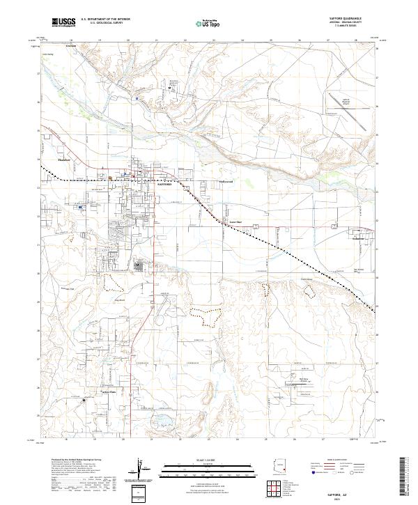 2021 Safford2021 Print · USGSThe agricultural and civic heart of the Gila Valley comes to life in this detailed survey of Safford and its surroundings. Researchers can trace the essential irrigation networks of the Montezuma Canal, locate the Graham County Courthouse, and find family sites at Safford Union Cemetery or Roper Lake.
End of results
Showing maps 1-2 of 2
Top cities near Safford
- Thatcher historical maps
- Pima historical maps
- Swift Trail Junction historical maps
- Cactus Flat historical maps
- Central historical maps
- Solomon historical maps
Frequently asked questions
- What are the different types of historical maps available for Safford?
- What is the oldest map of Safford?
- Where can I purchase historical maps of Safford for my home or office?
- Where can I download high-res historical maps of Safford?
- Are there historical topographic maps available for Safford?
- Is there historical aerial imagery available for Safford?
- Where are historical maps of Safford sourced from?