Old Maps of Safford, Arizona for Academic Research
Study the evolution of Safford with 16 high-resolution historic maps. Whether you're teaching, researching, or modeling changes in land use, these maps provide essential visual documentation of urban, environmental, and geographic change.
- Analyze long-term change: Track patterns in development, transportation, and natural features.
- Ideal for environmental or urban studies: Support academic projects with primary historical map data.
- Use in the classroom or lab: Educators and researchers rely on these maps to bring historical context to life.
These maps are a powerful tool for teaching, research, and visualizing how Safford has changed over the decades.
Safford, AZ maps
(16)- 1954 Map of Silver City, 1967 Print
 1954 Silver City1967 Print · USGSSoutheast Arizona and southwest New Mexico meet in this mid-century survey of the high desert and mountain mining districts. Local researchers can trace the rail lines through Lordsburg, the silver operations at Ash Peak Mines, and the limits of Fort Bayard Military Reservation.4 unique versions available
 - 1958 Map of Silver City
 1958 Silver City1958 Print · USGSSouthwestern New Mexico and eastern Arizona appear here in the mid-1950s, a period of intensive mining and rail activity. Trace the routes of the Southern Pacific RR through Lordsburg or locate historic operations at the Chino Mine and Santa Rita.
 - 1960 Map of Safford, 1961 Print
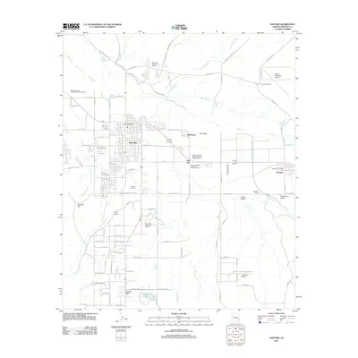
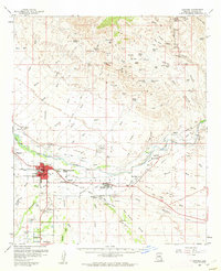 1960 Safford1961 Print · USGSThe Gila River valley is captured here during a period of steady growth in the early sixties, showing the vital irrigation network that sustained the local economy. Researchers can trace the path of the Southern Pacific railroad and locate landmarks like the Solomonsville Cemetery and Lafe Nelson School.3 unique versions available
 - 1962 Map of Silver City
 1962 Silver City1962 Print · USGSThe high desert borderlands of New Mexico and Arizona come alive in this early sixties survey. Genealogists and historians can trace the mining economy through the Chino Mine, follow the rail routes of the Southern Pacific, or locate settlements like Virden and Bayard.
 - 1985 Map of Safford, 1986 Print
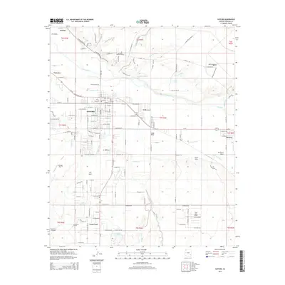
 1985 Safford1986 Print · USGSThe Gila Valley in the mid-eighties was a thriving agricultural corridor defined by an intricate network of irrigation and rail. Researchers can trace the path of the Southern Pacific and explore early water systems like the Montezuma Canal and Roper Lake State Park.2 unique versions available
 - 1985 Map of Weber Peak, 1986 Print
 1985 Weber Peak1986 Print · USGSThe Gila Mountains in Graham County were a hub of mineral exploration and rugged travel during the mid-1980s. Historians and genealogists can trace the landscape of old mining claims near Weber Peak and locate desert landmarks like Bear Spring and the southern Cem.
 - 1994 Map of Safford
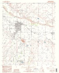
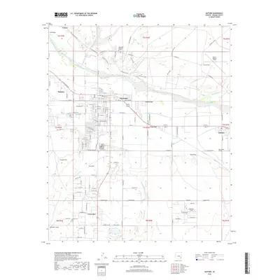
 1994 Safford1994 Print · USGSSoutheastern Arizona and the New Mexico borderlands come into focus in the mid-1990s, highlighting the irrigation-fed life of the Gila Valley. Genealogists and researchers can trace local landmarks like Eastern Arizona College, the Southern Pacific RR, and settlements from Artesia to Virden.2 unique versions available
 - 1998 Map of Safford, 2002 Print
 1998 Safford2002 Print · USGSSafford and Thatcher thrived along the Gila River in the late nineties, anchored by a massive network of desert irrigation. Local historians can trace the exact paths of the Union Canal and Highline Canal or locate landmarks like the Fairground and Solomon.
 - 2011 Map of Safford, 2011 Print
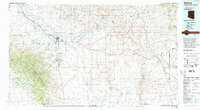
 2011 Safford2011 Print · USGSCovers Safford, including Thatcher, Cactus Flat, and other nearby areas
 - 2011 Map of Weber Peak, 2011 Print
 2011 Weber Peak2011 Print · USGSCovers Safford, including Graham, Graham County, and other nearby areas
 - 2014 Map of Weber Peak, 2014 Print
 2014 Weber Peak2014 Print · USGSCovers Safford, including Graham, Graham County, and other nearby areas
 - 2014 Map of Safford, 2014 Print
 2014 Safford2014 Print · USGSCovers Safford, including Thatcher, Cactus Flat, and other nearby areas
 - 2018 Map of Weber Peak, 2018 Print
 2018 Weber Peak2018 Print · USGSCovers Safford, including Graham, Graham County, and other nearby areas
 - 2018 Map of Safford, 2018 Print
 2018 Safford2018 Print · USGSCovers Safford, including Thatcher, Cactus Flat, and other nearby areas
 - 2021 Map of Weber Peak, 2021 Print
 2021 Weber Peak2021 Print · USGSThe high-desert foothills of Graham County appear here in the modern era as the Gila Mountains rise toward the summit of Weber Peak. Genealogists and local historians can locate the Graham Cem and trace industrial access routes like San Juan Mine Rd or find isolated water sources such as Talley Spring.
 - 2021 Map of Safford, 2021 Print
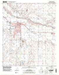
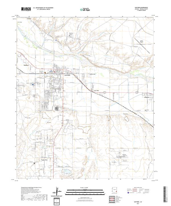 2021 Safford2021 Print · USGSThe agricultural and civic heart of the Gila Valley comes to life in this detailed survey of Safford and its surroundings. Researchers can trace the essential irrigation networks of the Montezuma Canal, locate the Graham County Courthouse, and find family sites at Safford Union Cemetery or Roper Lake.
End of results
Showing maps 1-16 of 16
Top cities near Safford
- Thatcher historical maps
- Pima historical maps
- Swift Trail Junction historical maps
- Cactus Flat historical maps
- Central historical maps
- Solomon historical maps
Frequently asked questions
- What are the different types of historical maps available for Safford?
- What is the oldest map of Safford?
- Where can I purchase historical maps of Safford for my home or office?
- Where can I download high-res historical maps of Safford?
- Are there historical topographic maps available for Safford?
- Is there historical aerial imagery available for Safford?
- Where are historical maps of Safford sourced from?