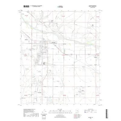
2018 Map of Safford
USGS Topo · Published 2018About this map
The Gila River corridor defines the geography of the Gila Valley, where a sophisticated network of irrigation systems like the Montezuma Canal, Highline Canal, and Sunflower Canal support the agricultural heart of Graham County. This desert landscape is anchored by the hub of Safford and the neighboring community of Thatcher, showing the transition from urban streets to the expansive San Simon Valley.
Find a feature on this map
99 named features on this map. Tap any name to fly to it.
Don’t see what you’re looking for? This feature index may not catch every label — zoom into the map to look around manually.
Map Details
Editions of this 2018 Safford Map
This is the sole edition of this map. No revisions or reprints were ever made.
Other maps of this area

1942 · Mt. Graham
USGS Topo · 1:62,500

1945 · Mt. Graham
USGS Topo · 1:62,500

1954 · Silver City
USGS Topo · 1:250,000

1958 · Silver City
USGS Topo · 1:250,000

1960 · Thatcher
USGS Topo · 1:62,500

1960 · Safford
USGS Topo · 1:62,500

1962 · Silver City
USGS Topo · 1:250,000
1966 · Artesia NE
USGS Topo · 1:24,000

1966 · Artesia
USGS Topo · 1:24,000
1972 · Mt. Graham
USGS Topo · 1:24,000