
1960 Map of Thatcher
USGS Topo · Published 1960About this map
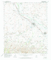
The Gila River valley serves as a corridor of irrigation and settlement on this 1960 survey, dominated by a sequence of agricultural towns including Pima, Central, and Thatcher. The landscape is defined by the hydraulic engineering of the day, with numerous canals, a Pumping Station, and several reservoirs such as Cluff Res No 1 and Riggs Reservoir supporting the arid region's farm economy. Traces of early 20th-century life are visible in landmarks like the Cotton Gin and the Lamb Hotel (Ruins), while the Southern Pacific railroad provides the vital transportation link through the valley. To the south, the terrain rises sharply into the Coronado National Forest and the northern slopes of the Pinaleno Mountains, where high-elevation features like Shingle Mill Mountain and Frye Mesa contrast with the cultivated river flats. The presence of the Eastern Arizona Jr College in Thatcher marks the area's development as a regional educational hub.
Find a feature on this map
129 named features on this map. Tap any name to fly to it.
Don’t see what you’re looking for? This feature index may not catch every label — zoom into the map to look around manually.
Map Details
Editions of this 1960 Thatcher Map
2 editions found
Other maps of this area

1940 · Sierra Bonita Ranch
USGS Topo · 1:62,500

1942 · Sierra Bonita Ranch
USGS Topo · 1:62,500

1942 · Mt. Graham
USGS Topo · 1:62,500

1943 · Sierra Bonita Ranch
USGS Topo · 1:62,500

1944 · Jackson Mtn.
USGS Topo · 1:62,500

1945 · Mt. Graham
USGS Topo · 1:62,500

1946 · Jackson Mtn.
USGS Topo · 1:62,500

1954 · Silver City
USGS Topo · 1:250,000

1954 · Clifton
USGS Topo · 1:250,000

1954 · Mesa
USGS Topo · 1:250,000