
1954 Map of Mesa
USGS Topo · Published 1968About this map
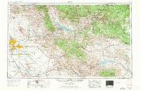
Arizona State University and the emerging suburbs of Tempe, Mesa, and Scottsdale anchor the western edge of this mid-century landscape, just as the postwar boom began transforming the Salt River Valley. While the grid of Phoenix expands toward Chandler and Williams AF Base, the map's eastern half remains dominated by industrial and indigenous land use. Heavy mining activity is centered around the Inspiration Mine near Miami and Globe, alongside the Magma Mine at Superior, marking the copper-driven economy of the era. The vast hydro-social engineering of the Salt River and Gila River is evident in the series of reservoirs, including Theodore Roosevelt Lake and San Carlos Reservoir, which supported both desert agriculture and the rising urban centers. This survey captures the region at a pivotal moment, balancing historical mining towns with the massive expansion of the Phoenix metropolitan area.
Find a feature on this map
58 named features on this map. Tap any name to fly to it.
Don’t see what you’re looking for? This feature index may not catch every label — zoom into the map to look around manually.
Map Details
Editions of this 1954 Mesa Map
4 editions found
Other maps of this area

1886 · St Johns
USGS Topo · 1:250,000

1886 · Holbrook
USGS Topo · 1:250,000

1887 · Verde
USGS Topo · 1:250,000

1887 · Prescott
USGS Topo · 1:250,000

1892 · Verde
USGS Topo · 1:250,000

1892 · St Johns
USGS Topo · 1:250,000

1892 · Prescott
USGS Topo · 1:250,000

1893 · Holbrook
USGS Topo · 1:250,000

1900 · Florence
USGS Topo · 1:125,000

1901 · Globe
USGS Topo · 1:62,500