Old Maps of Trilogy at Power Ranch, Gilbert for Hiking & Exploration
Hike through history with 21 historic maps of Trilogy at Power Ranch. Explore old trails, ghost towns, and forgotten backroads — perfect for outdoor adventurers and local explorers.
- Rediscover forgotten places: Map out old mining camps, roads, and footpaths that no longer exist on modern maps.
- Layer with modern tools: Combine with LiDAR or satellite views to plan hikes through historical terrain.
- Made for exploration: Popular among hikers, overlanders, and local history lovers.
Use these maps to find adventure and explore the hidden past of Trilogy at Power Ranch.
Trilogy at Power Ranch, Gilbert maps
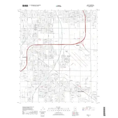
(21)- 1904 Map of Desert Well, 1958 Print
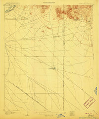
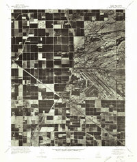
 1904 Desert Well1958 Print · USGSArizona's Salt River Valley comes to life in the early 1900s as a landscape of irrigation canals and desert outposts. Local historians can trace the early footprint of Higley, locate the specific Desert Well, and follow the path of the Santa Fe Prescott and Phoenix RR.
 - 1906 Map of Desert Well
 1906 Desert Well1906 Print · USGSArizona's Salt River valley was transitioning from open range to an irrigated landscape in the years after the turn of the century. Trace the early routes of the Santa Fe Prescott and Phoenix RR and locate pioneer outposts like Buchanan's Ranch and the Desert Well.3 unique versions available
 - 1907 Map of Sacaton
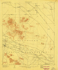 1907 Sacaton1907 Print · USGSThe Gila River Valley comes alive in this survey from the early 1900s, showing the early infrastructure of the Gila River Indian Reservation. Trace the legacy of desert ranching at Andrada's Ranch or find the early site of Blackwater Chapel.4 unique versions available
 - 1954 Map of Mesa, 1968 Print
 1954 Mesa1968 Print · USGSCentral Arizona in the mid-fifties reveals the rapid growth of the Valley of the Sun alongside the deep-rooted mining districts of the eastern mountains. Genealogists and researchers can trace the expansion of Mesa and Chandler or locate legacy operations at Inspiration Mine and the Magma Arizona railroad.4 unique versions available
 - 1956 Map of Chandler Heights, 1959 Print
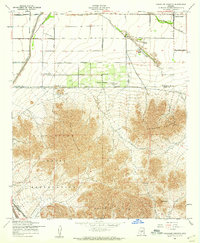 1956 Chandler Heights1959 Print · USGSThe Pinal and Maricopa County borderlands come into focus in the mid-1950s as agriculture and industry reach into the desert. Genealogists and historians can trace the early development of Chandler Heights and locate remote mining shafts near the Goldmine Mountains.4 unique versions available
 - 1956 Map of Higley, 1959 Print
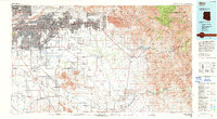
 1956 Higley1959 Print · USGSSoutheastern Maricopa County is captured during its mid-century transition from a desert railroad corridor to a significant military and agricultural hub. Researchers can trace the layout of Williams Air Force Base and the rural origins of Higley and Queen Creek.5 unique versions available
 - 1957 Map of Mesa
 1957 Mesa1957 Print · USGSCentral Arizona's desert valleys and high-mountain mining districts come alive in the mid-fifties. Researchers can trace the early layout of Mesa and Phoenix or locate remote sites like Inspiration Mine and Arizona State College.
 - 1958 Map of Mesa
 1958 Mesa1958 Print · USGSMid-century Arizona comes alive in this survey of the valley and high desert, where urban growth begins to transform the landscape. Genealogists and researchers can trace the rail-and-mine economy through Inspiration Mine and old stops like Rittenhouse and Magma.
 - 1960 Map of Mesa
 1960 Mesa1960 Print · USGSThe Salt River Valley and Superstition wilderness are captured here during a era of rapid post-war growth. Researchers can trace the mid-century footprints of Williams AF Base and Arizona State College or locate the deep-rock shafts of the Old Dominion Mine and Magma Mine.
 - 1964 Map of Mesa
 1964 Mesa1964 Print · USGSCentral Arizona in the mid-1960s reveals a landscape defined by rapid desert urbanization and a massive copper mining industry. Genealogists and historians can trace the growth of Phoenix or explore the mining camps and operations at Miami Mine and Magma Mine.
 - 1971 Map of Higley, 1972 Print
 1971 Higley1972 Print · USGSMaricopa County agriculture and military aviation are captured in detail during the early seventies. Genealogists and historians can trace the footprint of Higley and the sprawling layout of Williams Air Force Base at the height of its activity.
 - 1971 Map of Chandler Heights, 1972 Print
 1971 Chandler Heights1972 Print · USGSThe agricultural grid and desert foothills of Pinal and Maricopa counties are seen in detail in the early 1970s. Researchers can trace the layout of citrus groves in Chandler Heights and the drainage patterns of Queen Creek below the Goldmine Mountains.
 - 1994 Map of Mesa
 1994 Mesa1994 Print · USGSThe Phoenix and Mesa metropolitan area meets the desert wilderness in the 1990s as urban growth pushes toward the Superstition Mountains. Researchers can trace the path of the Southern Pacific railroad or locate heritage sites like Casa Grande Ruins Nat Mon and Williams Air Force Base.2 unique versions available
 - 2011 Map of Chandler Heights, 2011 Print
 2011 Chandler Heights2011 Print · USGSCovers Trilogy at Power Ranch, including Gilbert, Queen Creek, and other nearby areas
 - 2011 Map of Higley, 2011 Print
 2011 Higley2011 Print · USGSCovers Trilogy at Power Ranch, including Mesa, Gilbert, and other nearby areas
 - 2014 Map of Chandler Heights, 2014 Print
 2014 Chandler Heights2014 Print · USGSCovers Trilogy at Power Ranch, including Gilbert, Queen Creek, and other nearby areas
 - 2014 Map of Higley, 2014 Print
 2014 Higley2014 Print · USGSCovers Trilogy at Power Ranch, including Mesa, Gilbert, and other nearby areas
 - 2018 Map of Higley, 2018 Print
 2018 Higley2018 Print · USGSCovers Trilogy at Power Ranch, including Mesa, Gilbert, and other nearby areas
 - 2018 Map of Chandler Heights, 2018 Print
 2018 Chandler Heights2018 Print · USGSCovers Trilogy at Power Ranch, including Gilbert, Queen Creek, and other nearby areas
 - 2021 Map of Higley, 2021 Print
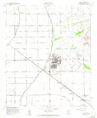
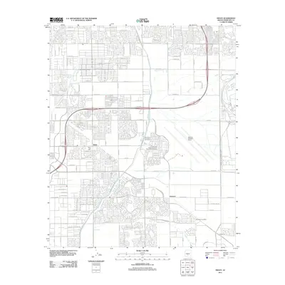
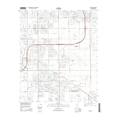
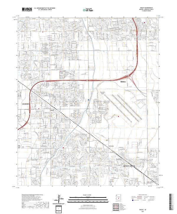 2021 Higley2021 Print · USGSThe East Valley of the Phoenix metro area undergoes significant suburban development in the early 2020s. Genealogists and local historians can trace the growth of Higley and Queen Creek while locating landmarks like the Phoenix-Mesa Gateway Airport.
 - 2021 Map of Chandler Heights, 2021 Print
 2021 Chandler Heights2021 Print · USGSThe transition from the agricultural and suburban outskirts of Phoenix to the Santan Mountains is captured in this 2021 record. Researchers can trace the development of Chandler Heights and Queen Creek alongside the rugged terrain of Goldmine Mtn and The Gap.
End of results
Showing maps 1-21 of 21
Frequently asked questions
- What are the different types of historical maps available for Trilogy at Power Ranch?
- What is the oldest map of Trilogy at Power Ranch?
- Where can I purchase historical maps of Trilogy at Power Ranch for my home or office?
- Where can I download high-res historical maps of Trilogy at Power Ranch?
- Are there historical topographic maps available for Trilogy at Power Ranch?
- Is there historical aerial imagery available for Trilogy at Power Ranch?
- Where are historical maps of Trilogy at Power Ranch sourced from?