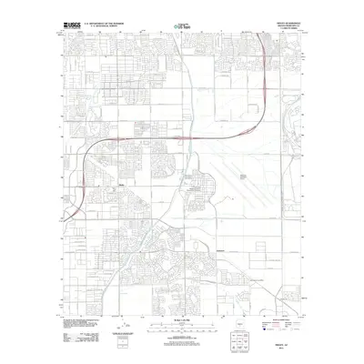
2011 Map of Higley
USGS Topo · Published 2011About this map
The town of Higley and its surrounding communities in Maricopa County appear here during a period of significant suburban expansion in the early twenty-first century. The landscape is defined by a rigid grid of residential developments and agricultural infrastructure, most notably the Roosevelt Water Canal Rd which speaks to the critical irrigation history of the Salt River Valley. Institutional and industrial landmarks occupy large footprints, including the Arizona State University Polytechnic Campus and the Williams Gateway Airport, reflecting the repurposing of former military land. Smaller settlements like Germann, Queen Creek, and Rittenhouse are visible along the southern and eastern margins. The transition from rural desert to high-density housing is evident, punctuated by specialized sites such as the General Motors Proving Grnds and local landmarks like the Higley Post Office and the Boys Ranch Post Office.
Find a feature on this map
83 named features on this map. Tap any name to fly to it.
Don’t see what you’re looking for? This feature index may not catch every label — zoom into the map to look around manually.
Map Details
Editions of this 2011 Higley Map
This is the sole edition of this map. No revisions or reprints were ever made.
Other maps of this area

1904 · Desert Well
USGS Topo · 1:62,500

1906 · Desert Well
USGS Topo · 1:62,500

1907 · Sacaton
USGS Topo · 1:62,500

1913 · Mesa
USGS Topo · 1:62,500

1914 · Gila Butte
USGS Topo · 1:62,500

1915 · Mesa
USGS Topo · 1:62,500

1917 · Gila Butte
USGS Topo · 1:62,500

1952 · Chandler
USGS Topo · 1:24,000
1952 · Mesa
USGS Topo · 1:24,000

1952 · Gila Butte
USGS Topo · 1:24,000