
1917 Map of Gila Butte
USGS Topo · Published 1917About this map
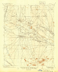
Gila River Indian Reservation lands dominate this central Arizona landscape, where the Gila River and Little Gila River weave through a network of early irrigation infrastructure and indigenous settlements. Surveyed by the U.S. Reclamation Service, the map highlights the critical role of water management in the desert, featuring the Consolidated Canal, the Santan Ditch, and numerous U.S.R.S. Pump stations. The presence of the Sweetwater Store Indian Trading Post and North Line Trading Post underscores the regional commerce of the early twentieth century. Educational and community hubs like Snaketown, the Casa Blanca Indian School, and Tyler School are recorded alongside various cemeteries. Rail connectivity is provided by the Arizona Eastern (Phoenix Division) and the Southern Pacific, while the Santan Mountains and volcanic forms like Gila Butte and Sacaton Butte anchor the topography.
Find a feature on this map
28 named features on this map. Tap any name to fly to it.
Don’t see what you’re looking for? This feature index may not catch every label — zoom into the map to look around manually.
Map Details
Editions of this 1917 Gila Butte Map
2 editions found
Other maps of this area

1904 · Desert Well
USGS Topo · 1:62,500

1906 · Desert Well
USGS Topo · 1:62,500

1907 · Sacaton
USGS Topo · 1:62,500

1912 · Phoenix
USGS Topo · 1:62,500

1913 · Mesa
USGS Topo · 1:62,500

1913 · Maricopa
USGS Topo · 1:62,500

1914 · Gila Butte
USGS Topo · 1:62,500

1914 · Phoenix
USGS Topo · 1:62,500

1915 · Mesa
USGS Topo · 1:62,500

1915 · Maricopa
USGS Topo · 1:62,500