
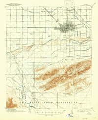
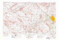
1912 Map of Phoenix
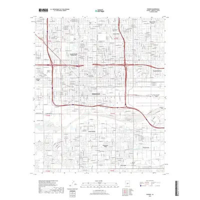
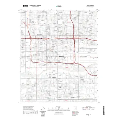
USGS Topo · Published 1955About this map
The Salt River and its complex network of irrigation ditches define this early 20th-century landscape, illustrating the vital infrastructure required to sustain growth in the desert. From the Grand Canal to the Wormser Canal, the map reveals how water engineering shaped the development of Phoenix and outlying settlements like Alhambra. To the south, the Salt River Mountains provide a natural barrier between the city and the Gila River Indian Reservation, where the Gila River meets the Santa Cruz River. This period shows a community established through institutional and social markers, including the Indian School, State Hospital, and several rural schoolhouses like Fowler School and Isaac School. The presence of the Gold Coin Mine and the Prescott and Phoenix RR highlights the era's reliance on both extraction and rail transport to connect the valley to broader markets.
Find a feature on this map
42 named features on this map. Tap any name to fly to it.
Don’t see what you’re looking for? This feature index may not catch every label — zoom into the map to look around manually.
Map Details
Editions of this 1912 Phoenix Map
This is the sole edition of this map. No revisions or reprints were ever made.
Historical Maps of Phoenix Through Time
16 maps found
1912 Phoenix
Maricopa County, AZ
1914 Phoenix
Maricopa County, AZ
1952 Phoenix
Maricopa County, AZ
1952 Phoenix
Maricopa County, AZ
1954 Phoenix
Maricopa County, AZ

1957 Phoenix
Maricopa County, AZ

1958 Phoenix
Maricopa County, AZ

1960 Phoenix
Maricopa County, AZ
1969 Phoenix
Maricopa County, AZ

1971 Phoenix
Maricopa County, AZ
1971 Phoenix
Maricopa County, AZ
2011 Phoenix
Maricopa County, AZ
2014 Phoenix
Maricopa County, AZ
2018 Phoenix
Maricopa County, AZ
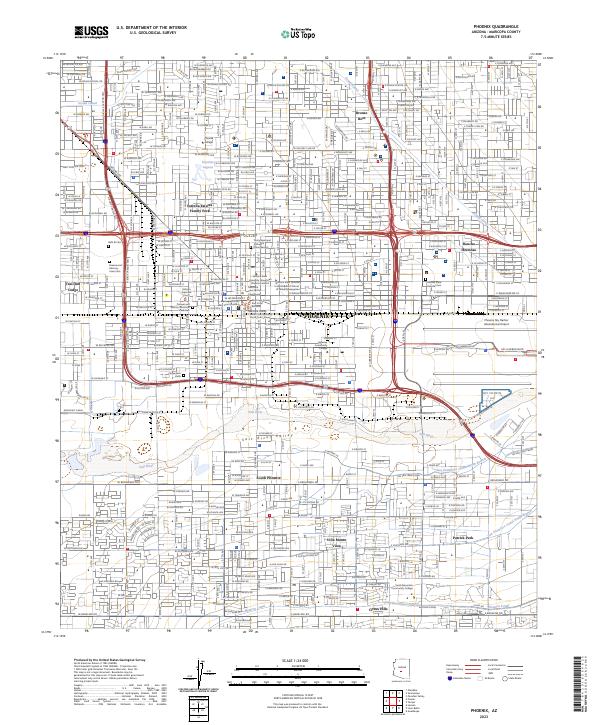
2021 Phoenix
Maricopa County, AZ
2023 Phoenix
Maricopa County, AZ