Old Maps of Quail Valley, Phoenix for Metal Detecting
Plan your next treasure hunt with 16 historic maps of Quail Valley. Find old homesites, ghost towns, trails, and gathering spots that may be lost to time — perfect for identifying promising metal detecting locations.
- Locate forgotten sites: Uncover places like long-lost settlements, abandoned rail lines, or gathering spots.
- Plan better hunts: Use map overlays combined with LiDAR or satellite views to narrow in on historically rich areas.
- Made for detectorists: Thousands of hobbyists use these maps to discover relics, coins, and hidden history.
Use these historic maps to boost your research and find new opportunities beneath the surface of Quail Valley.
Quail Valley, Phoenix maps
(16)- 1904 Map of Camelback
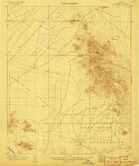
 1904 Camelback1904 Print · USGSMaricopa County is captured at the dawn of the twentieth century, showing a desert landscape before the rise of the Phoenix suburbs. Researchers can trace the foundational Arizona Canal and early landmarks like Camelback Mtn and Thompson Pk.
 - 1906 Map of Camelsback
 1906 Camelsback1906 Print · USGSArizona's high desert near Phoenix is captured here at the turn of the century, when the landscape was defined by mountain ranges and early water infrastructure. Genealogists and historians can trace the paths of the Old Verde Canal and the Arizona Canal or locate landmarks like Thompson Pk and Mountain Spring.3 unique versions available
 - 1930 Map of Cave Creek, 1959 Print
 1930 Cave Creek1959 Print · USGSThe Cave Creek and Verde River backcountry comes alive in this survey from the era of guest ranches and remote outposts. Researchers can locate early family homesteads like Lewis Ranch, trace the route to the Mormon Girl Mine, or find the original Spur Cross Dude Ranch.2 unique versions available
 - 1939 Map of Cave Creek
 1939 Cave Creek1939 Print · USGSThe Cave Creek area in the late thirties is a landscape of working cattle ranches and early desert tourism. Genealogists and historians can trace family-named outposts like Sears Kay Ranch and Browns Ranch or the historic Mormon Girl Mine.3 unique versions available
 - 1954 Map of Mesa, 1968 Print
 1954 Mesa1968 Print · USGSCentral Arizona in the mid-fifties reveals the rapid growth of the Valley of the Sun alongside the deep-rooted mining districts of the eastern mountains. Genealogists and researchers can trace the expansion of Mesa and Chandler or locate legacy operations at Inspiration Mine and the Magma Arizona railroad.4 unique versions available
 - 1957 Map of Mesa
 1957 Mesa1957 Print · USGSCentral Arizona's desert valleys and high-mountain mining districts come alive in the mid-fifties. Researchers can trace the early layout of Mesa and Phoenix or locate remote sites like Inspiration Mine and Arizona State College.
 - 1958 Map of Mesa
 1958 Mesa1958 Print · USGSMid-century Arizona comes alive in this survey of the valley and high desert, where urban growth begins to transform the landscape. Genealogists and researchers can trace the rail-and-mine economy through Inspiration Mine and old stops like Rittenhouse and Magma.
 - 1960 Map of Mesa
 1960 Mesa1960 Print · USGSThe Salt River Valley and Superstition wilderness are captured here during a era of rapid post-war growth. Researchers can trace the mid-century footprints of Williams AF Base and Arizona State College or locate the deep-rock shafts of the Old Dominion Mine and Magma Mine.
 - 1964 Map of Mesa
 1964 Mesa1964 Print · USGSCentral Arizona in the mid-1960s reveals a landscape defined by rapid desert urbanization and a massive copper mining industry. Genealogists and historians can trace the growth of Phoenix or explore the mining camps and operations at Miami Mine and Magma Mine.
 - 1964 Map of Currys Corner, 1965 Print
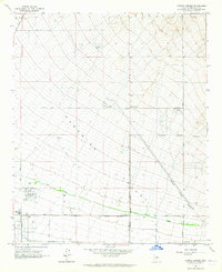 1964 Currys Corner1965 Print · USGSMaricopa County's northern desert reaches were still largely open range in the mid-sixties, punctuated by local landmarks like Currys Corner. You can trace the path of the Old Verde Canal or locate early community hubs like Paradise Valley High Sch.5 unique versions available
 - 1971 Map of Currys Corner, 1972 Print
 1971 Currys Corner1972 Print · USGSMaricopa County's arid landscape is captured in the early 1970s, revealing the desert prior to extensive modern development. Genealogists and local historians can trace the footprint of Currys Corner and the path of the Old Verde Canal across the desert floor.
 - 1994 Map of Theodore Roosevelt Lake, 1995 Print
 1994 Theodore Roosevelt Lake1995 Print · USGSCentral Arizona in the early nineties reveals the sprawling growth of the Valley of the Sun against the high desert wilderness. Researchers can trace the development of Scottsdale and Carefree or locate remote outposts like Sunflower and Punkin Center near the Mazatzal Wilderness.3 unique versions available
 - 2011 Map of Currys Corner, 2011 Print
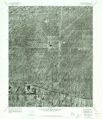
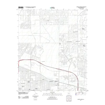 2011 Currys Corner2011 Print · USGSCovers Quail Valley, including Phoenix, Scottsdale, and other nearby areas
 - 2014 Map of Currys Corner, 2014 Print
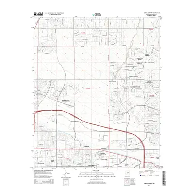 2014 Currys Corner2014 Print · USGSCovers Quail Valley, including Phoenix, Scottsdale, and other nearby areas
 - 2018 Map of Currys Corner, 2018 Print
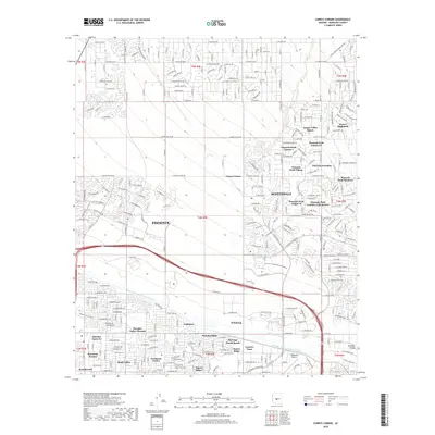 2018 Currys Corner2018 Print · USGSCovers Quail Valley, including Phoenix, Scottsdale, and other nearby areas
 - 2021 Map of Currys Corner, 2021 Print
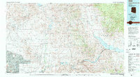
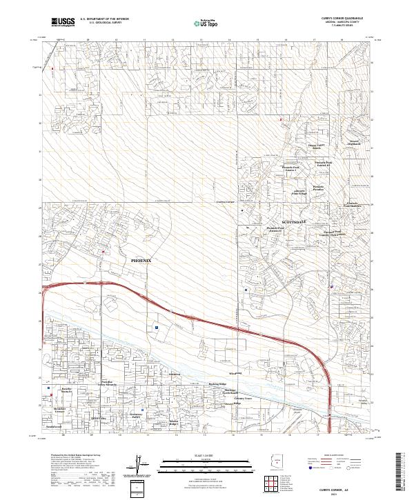 2021 Currys Corner2021 Print · USGSNorth Phoenix and Scottsdale are seen here during a phase of rapid desert development in the early 2020s. Researchers can trace modern community layouts from Pinnacle Peak Village to Oakhurst and the vital Central Arizona Project Aqueduct.
End of results
Showing maps 1-16 of 16
Frequently asked questions
- What are the different types of historical maps available for Quail Valley?
- What is the oldest map of Quail Valley?
- Where can I purchase historical maps of Quail Valley for my home or office?
- Where can I download high-res historical maps of Quail Valley?
- Are there historical topographic maps available for Quail Valley?
- Is there historical aerial imagery available for Quail Valley?
- Where are historical maps of Quail Valley sourced from?