1980s Maps of Cyclopic, Arizona
Explore 2 historic maps of Cyclopic from the 1980s. These maps offer a rare glimpse into what life looked like during the 1980s — showing old roads, neighborhoods, homes, and landmarks that have changed or disappeared over time.
Whether you're researching your family's past, planning a metal detecting trip, or studying how Cyclopic's landscape evolved across the 1980s, these high-resolution maps are a powerful tool for exploring the history of this region.
- Focus on a specific era: All maps on this page are from the 1980s, giving you a focused view of this time period.
- See what’s changed: Compare century-old streets, trails, and buildings to today's modern landscape using overlays and satellite layers.
- Research with precision: Use these maps for genealogy, historical research, land use analysis, or educational projects.
- View, download, or print: Maps are fully viewable online in high resolution, and can be downloaded or printed for your own records.
Start exploring Cyclopic's history through authentic maps from the 1980s. This is your window into the past.
Cyclopic, AZ maps
(2)- 1983 Map of Boulder City
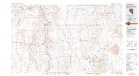 1983 Boulder City1983 Print · USGSThe Nevada-Arizona borderlands come alive in the early 1980s, centered on the Colorado River and the industrial activity of the surrounding ranges. Researchers can locate dozens of historic prospects such as the Klondyke Mine, Liberty Mine, and Dixie Queen Mine.2 unique versions available
 - 1989 Map of Gold Basin, 1990 Print
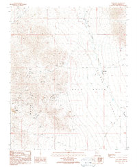 1989 Gold Basin1990 Print · USGSGold Basin and the White Hills were centers of desert mining activity in the late 1980s. Researchers can trace historic workings from the Excelsior Mine to the settlement at Cyclopic, alongside landmarks like the cemetery near Burnt Mill.2 unique versions available
End of results
Showing maps 1-2 of 2
Top cities near Cyclopic
Frequently asked questions
- What are the different types of historical maps available for Cyclopic?
- What is the oldest map of Cyclopic?
- Where can I purchase historical maps of Cyclopic for my home or office?
- Where can I download high-res historical maps of Cyclopic?
- Are there historical topographic maps available for Cyclopic?
- Is there historical aerial imagery available for Cyclopic?
- Where are historical maps of Cyclopic sourced from?