Old Maps of Lazy Y U, Arizona
Explore 14 old maps of Lazy Y U, spanning from 1886 to today. These high-resolution historic maps reveal how streets, neighborhoods, landmarks, and natural features evolved over time — perfect for genealogy, metal detecting, research, and local history exploration.
What you can do with these maps:
- See how Lazy Y U changed over time: Compare historical maps to modern-day views to trace roads, homesites, rail lines & more.
- View detailed metadata: Each map includes creators, publishers, year, scale, and archive source.
- Overlay maps with satellite & LiDAR: Visualize the past alongside modern tools to explore terrain & human change.
- Trusted historical sources: Maps sourced from the USGS, Library of Congress, and other archives.
- Access maps your way: View online, download high-res files, or order prints for personal or research use.
Start exploring old maps of Lazy Y U to uncover forgotten places, hidden landmarks, and the deep history beneath your feet.
Lazy Y U, AZ maps
(14)- 1886 Map of Diamond Creek
 1886 Diamond Creek1886 Print · USGSMohave County was a land of expanding rails and rugged canyon rims in the mid-1880s. Genealogists and historians can trace the early path of the Atlantic and Pacific Railroad and locate frontier sites like Old Hackberry, American Flag Mine, and Camp Willow Grove.
 - 1892 Map of Diamond Creek
 1892 Diamond Creek1892 Print · USGSNorthwestern Arizona comes alive in this late nineteenth-century survey during the height of the steam rail era. Genealogists and historians can trace the early path of the Atlantic and Pacific Railroad and locate vanished outposts like Camp Willow Grove, Cottonwood Station, and Old Hackberry.6 unique versions available
 - 1948 Map of Williams
 1948 Williams1948 Print · USGSNorthern Arizona is captured here during the post-war era of roadside travel and heavy rail transport along the Santa Fe line. Researchers can trace the path of Route 66 through settlements like Seligman, Valentine, and Hackberry while exploring the vast terrain of the Hualpai Indian Reservation.2 unique versions available
 - 1954 Map of Williams, 1972 Print
 1954 Williams1972 Print · USGSThe high plateau of Northern Arizona is captured here during the mid-fifties, showing the rail-and-road corridor before the interstate era. You can trace family roots through remote railroad stops like Audley and Pica or locate early landmarks such as Grand Canyon Caverns and Frazier Wells.
 - 1956 Map of Williams, 1963 Print
 1956 Williams1963 Print · USGSNorthern Arizona in the mid-fifties reveals a landscape shaped by the Atchison Topeka and Santa Fe railroad and the iconic Highway 66. Trace the route of early travelers through Peach Springs, Seligman, and Ash Fork, or find remote sites like the Music Mountain Mine (Gold).3 unique versions available
 - 1960 Map of Williams
 1960 Williams1960 Print · USGSNorthern Arizona in the mid-twentieth century was defined by its massive canyons and the vital rail line connecting its remote ranches. Genealogists and historians can trace the development of Peach Springs, the high-altitude Bill Williams Mountain, and isolated outposts like Diamond Bar Ranch.
 - 1961 Map of Williams
 1961 Williams1961 Print · USGSNorthern Arizona in the mid-fifties reveals a high-desert landscape of rail towns and deep canyons along the Atchison Topeka and Santa Fe. Researchers can trace old Route 66 through Peach Springs, Seligman, and Ash Fork, or find remote sites like Music Mountain Mine.
 - 1968 Map of Rattlesnake Hill, 1971 Print
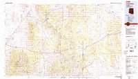
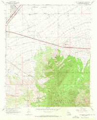 1968 Rattlesnake Hill1971 Print · USGSArizona's high desert meets the mountains in the late 1960s, showing the vital corridors of the Hualapai Valley. Genealogists and historians can locate remote ranch sites like the Lazy Yu Ranch and D-W Ranch alongside the landmark Rattlesnake Hill.3 unique versions available
 - 1984 Map of Valentine
 1984 Valentine1984 Print · USGSNorthern Arizona's high desert comes into focus in the mid-1980s as the rail and road network connects remote outposts. Trace the path of the Atchison Topeka and Santa Fe through Valentine and locate mining sites like the Sunshine Mine.2 unique versions available
 - 2011 Map of Rattlesnake Hill, 2011 Print
 2011 Rattlesnake Hill2011 Print · USGSCovers Lazy Y U, including Kingman, Pinion Pines, and other nearby areas
 - 2014 Map of Rattlesnake Hill, 2014 Print
 2014 Rattlesnake Hill2014 Print · USGSCovers Lazy Y U, including Kingman, Pinion Pines, and other nearby areas
 - 2018 Map of Rattlesnake Hill, 2018 Print
 2018 Rattlesnake Hill2018 Print · USGSCovers Lazy Y U, including Kingman, Pinion Pines, and other nearby areas
 - 2021 Map of Rattlesnake Hill, 2021 Print
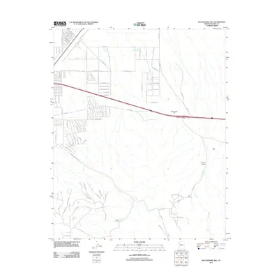
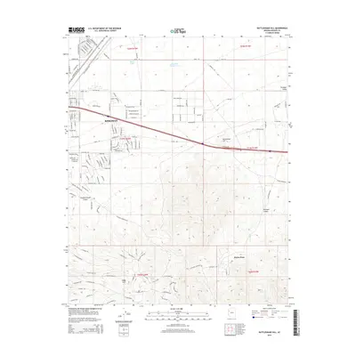
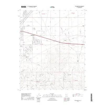
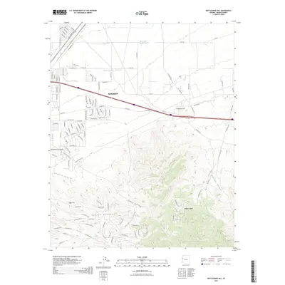
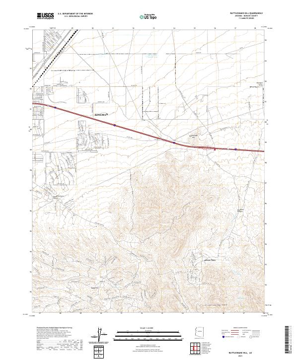 2021 Rattlesnake Hill2021 Print · USGSNear Kingman in the early 2020s, the desert landscape shows a distinct mix of growing suburban street grids and remote canyon settlements. Researchers can trace the development of Kingman and Pinion Pines or locate local landmarks like Rattlesnake Hill and Shack Spring.
 - 2026 Map of Rattlesnake Hill, 2026 Print
 2026 Rattlesnake Hill2026 Print · USGSCovers Lazy Y U, including Kingman, Pinion Pines, and other nearby areas
End of results
Showing maps 1-14 of 14
Top cities near Lazy Y U
- Kingman historical maps
- New Kingman-Butler historical maps
- Walnut Creek historical maps
- So-Hi historical maps
- Clacks Canyon historical maps
- Pinion Pines historical maps
See more
Frequently asked questions
- What are the different types of historical maps available for Lazy Y U?
- What is the oldest map of Lazy Y U?
- Where can I purchase historical maps of Lazy Y U for my home or office?
- Where can I download high-res historical maps of Lazy Y U?
- Are there historical topographic maps available for Lazy Y U?
- Is there historical aerial imagery available for Lazy Y U?
- Where are historical maps of Lazy Y U sourced from?