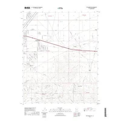
2018 Map of Rattlesnake Hill
USGS Topo · Published 2018About this map
Kingman expands into the desert foothills in this 2018 survey, where the urban grid of neighborhoods like those along Beverly Ave and Pacific Ave meets the rising elevations of the Hualapai Mountains. The landscape transitions from the developed flats of the Hualapai Valley to the southwest, into the sharp relief of Rattlesnake Hill and the deep cuts of Slaughterhouse Canyon. Outside the city center, smaller residential enclaves such as Pinion Pines and Lazy Y U are mapped alongside essential water sources like Shuck Spring and Falls Spring. This record captures the precise extent of local road development, from the interstate corridor of Cty Hwy 245 to the winding recreational access of Hualapai Mtn Rd, illustrating how modern infrastructure navigates this arid terrain.
Find a feature on this map
80 named features on this map. Tap any name to fly to it.
Don’t see what you’re looking for? This feature index may not catch every label — zoom into the map to look around manually.
Map Details
Editions of this 2018 Rattlesnake Hill Map
This is the sole edition of this map. No revisions or reprints were ever made.
Other maps of this area

1886 · Diamond Creek
USGS Topo · 1:250,000

1886 · Camp Mohave
USGS Topo · 1:250,000

1892 · Diamond Creek
USGS Topo · 1:250,000

1892 · Camp Mohave
USGS Topo · 1:250,000

1939 · Chloride
USGS Topo · 1:48,000

1942 · Camp Mohave
USGS Topo · 1:250,000

1944 · Chloride
USGS Topo · 1:62,500

1947 · Kingman
USGS Topo · 1:250,000

1948 · Kingman
USGS Topo · 1:250,000

1948 · Williams
USGS Topo · 1:250,000