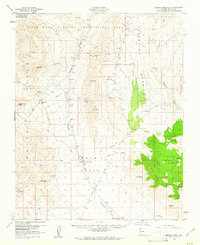
1960s Maps of Ray Place, Arizona
Explore 2 historic maps of Ray Place from the 1960s. These maps offer a rare glimpse into what life looked like during the 1960s — showing old roads, neighborhoods, homes, and landmarks that have changed or disappeared over time.
Whether you're researching your family's past, planning a metal detecting trip, or studying how Ray Place's landscape evolved across the 1960s, these high-resolution maps are a powerful tool for exploring the history of this region.
- Focus on a specific era: All maps on this page are from the 1960s, giving you a focused view of this time period.
- See what’s changed: Compare century-old streets, trails, and buildings to today's modern landscape using overlays and satellite layers.
- Research with precision: Use these maps for genealogy, historical research, land use analysis, or educational projects.
- View, download, or print: Maps are fully viewable online in high resolution, and can be downloaded or printed for your own records.
Start exploring Ray Place's history through authentic maps from the 1960s. This is your window into the past.
Ray Place, AZ maps
(2)- 1960 Map of Kingman
 1960 Kingman1960 Print · USGSThe high desert landscape of the Arizona-Nevada border comes alive in the mid-twentieth century, showcasing the rise of recreation alongside deep-rooted mining history. Genealogists and historians can trace the roots of towns like Kingman and Oatman, or locate remote sites like the Lucky Dutchman Mine and Santa Claus.3 unique versions available
 - 1960 Map of Garnet Mtn., 1961 Print
 1960 Garnet Mtn.1961 Print · USGSThe mining camps and remote ranchlands of Mohave County come into focus in this early 1960s survey of the Gold Basin area. Researchers can trace the desert's industrial and agricultural history through labels like the King Tut Placer Mine, Burnt Mill Ranch, and Patterson Well.3 unique versions available
End of results
Showing maps 1-2 of 2
Frequently asked questions
- What are the different types of historical maps available for Ray Place?
- What is the oldest map of Ray Place?
- Where can I purchase historical maps of Ray Place for my home or office?
- Where can I download high-res historical maps of Ray Place?
- Are there historical topographic maps available for Ray Place?
- Is there historical aerial imagery available for Ray Place?
- Where are historical maps of Ray Place sourced from?