1990s Maps of Wahak Hotrontk, Pisinemo District
Explore 2 historic maps of Wahak Hotrontk from the 1990s. These maps offer a rare glimpse into what life looked like during the 1990s — showing old roads, neighborhoods, homes, and landmarks that have changed or disappeared over time.
Whether you're researching your family's past, planning a metal detecting trip, or studying how Wahak Hotrontk's landscape evolved across the 1990s, these high-resolution maps are a powerful tool for exploring the history of this region.
- Focus on a specific era: All maps on this page are from the 1990s, giving you a focused view of this time period.
- See what’s changed: Compare century-old streets, trails, and buildings to today's modern landscape using overlays and satellite layers.
- Research with precision: Use these maps for genealogy, historical research, land use analysis, or educational projects.
- View, download, or print: Maps are fully viewable online in high resolution, and can be downloaded or printed for your own records.
Start exploring Wahak Hotrontk's history through authentic maps from the 1990s. This is your window into the past.
Wahak Hotrontk, Pisinemo District maps
(2)- 1990 Map of Wahak Hotrontk
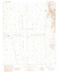 1990 Wahak Hotrontk1990 Print · USGSThe Papago Indian Reservation in the early nineties is documented here as a landscape of desert survival and ancient sites. Researchers can trace the layout of Wahak Hotrontk or locate the historic footprints of Stotonyak (Site) and Ahan Owuch (Site).
 - 1996 Map of Wahak Hotrontk, 2001 Print
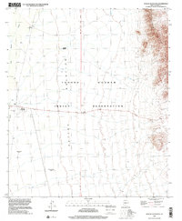 1996 Wahak Hotrontk2001 Print · USGSThe Tohono O'odham Nation in the 1990s is captured here as a landscape of desert valleys and isolated wells. Genealogists and historians can trace the locations of Wahak Hotrontk, San Simon Well, and historical locations like Stotonyak (Site).
End of results
Showing maps 1-2 of 2
Frequently asked questions
- What are the different types of historical maps available for Wahak Hotrontk?
- What is the oldest map of Wahak Hotrontk?
- Where can I purchase historical maps of Wahak Hotrontk for my home or office?
- Where can I download high-res historical maps of Wahak Hotrontk?
- Are there historical topographic maps available for Wahak Hotrontk?
- Is there historical aerial imagery available for Wahak Hotrontk?
- Where are historical maps of Wahak Hotrontk sourced from?