2020s Maps of San Xavier District, Arizona
Explore 5 historic maps of San Xavier District from the 2020s. These maps offer a rare glimpse into what life looked like during the 2020s — showing old roads, neighborhoods, homes, and landmarks that have changed or disappeared over time.
Whether you're researching your family's past, planning a metal detecting trip, or studying how San Xavier District's landscape evolved across the 2020s, these high-resolution maps are a powerful tool for exploring the history of this region.
- Focus on a specific era: All maps on this page are from the 2020s, giving you a focused view of this time period.
- See what’s changed: Compare century-old streets, trails, and buildings to today's modern landscape using overlays and satellite layers.
- Research with precision: Use these maps for genealogy, historical research, land use analysis, or educational projects.
- View, download, or print: Maps are fully viewable online in high resolution, and can be downloaded or printed for your own records.
Start exploring San Xavier District's history through authentic maps from the 2020s. This is your window into the past.
San Xavier District, AZ maps
(5)- 2021 Map of Cat Mountain, 2021 Print
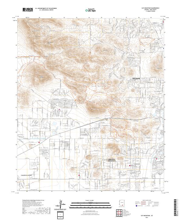 2021 Cat Mountain2021 Print · USGSThe western edge of Tucson at the start of the 2020s shows a landscape where mountain wilderness meets desert suburbs. Researchers can trace the modern paths of the Central Arizona Project Aqueduct near local landmarks like Saginaw Hill and Snyder Hill.
 - 2021 Map of San Xavier Mission, 2021 Print
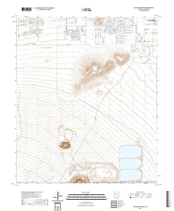 2021 San Xavier Mission2021 Print · USGSThe desert valleys south of Tucson are captured here in the early twenty-first century as urban expansion meets the traditional landscape. Genealogists and local historians can locate San Xavier Cem, Monte Calvario Cem, and the massive Central Arizona Project Aqueduct.
 - 2021 Map of San Xavier Mission SW, 2021 Print
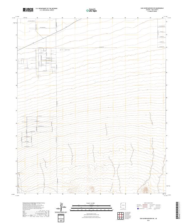 2021 San Xavier Mission SW2021 Print · USGSThe high desert of Pima County is captured in this recent survey of the Avra Valley as modern residential tracts expand. Researchers can trace the layout of local corridors such as S Sandario Rd, W Hermans Rd, and W Los Reales Rd.
 - 2021 Map of Tucson SW, 2021 Print
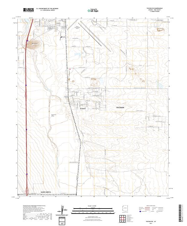 2021 Tucson SW2021 Print · USGSThe Santa Cruz Valley south of Tucson comes into sharp focus during this period of suburban and industrial expansion. Genealogists and local historians can trace modern property lines and infrastructure near Summit, the Tucson International Airport, and Martinez Hill.
 - 2026 Map of Tucson SW, 2026 Print
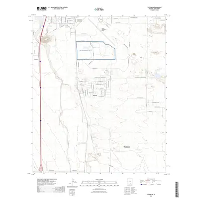 2026 Tucson SW2026 Print · USGSCovers San Xavier District, including Tucson, Sahuarita, and other nearby areas
End of results
Showing maps 1-5 of 5
Top cities near San Xavier District
Top neighborhoods of San Xavier District
Frequently asked questions
- What are the different types of historical maps available for San Xavier District?
- What is the oldest map of San Xavier District?
- Where can I purchase historical maps of San Xavier District for my home or office?
- Where can I download high-res historical maps of San Xavier District?
- Are there historical topographic maps available for San Xavier District?
- Is there historical aerial imagery available for San Xavier District?
- Where are historical maps of San Xavier District sourced from?