Old Maps of Pan Tak, Schuk Toak District for Academic Research
Study the evolution of Pan Tak with 18 high-resolution historic maps. Whether you're teaching, researching, or modeling changes in land use, these maps provide essential visual documentation of urban, environmental, and geographic change.
- Analyze long-term change: Track patterns in development, transportation, and natural features.
- Ideal for environmental or urban studies: Support academic projects with primary historical map data.
- Use in the classroom or lab: Educators and researchers rely on these maps to bring historical context to life.
These maps are a powerful tool for teaching, research, and visualizing how Pan Tak has changed over the decades.
Pan Tak, Schuk Toak District maps
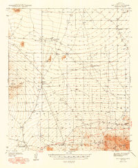
(18)- 1934 Map of Silver Bell
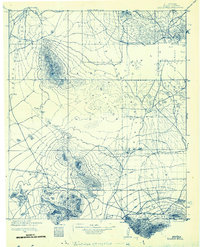 1934 Silver Bell1934 Print · USGSPima County at the height of the New Deal era reveals a sparse network of desert settlements and remote mines. Genealogists and historians can trace the footprint of the Papago Indian Reservation through its small villages like Santa Cruz and industrial sites like the Roadside Mine.
 - 1938 Map of San Vicente, 1967 Print
 1938 San Vicente1967 Print · USGSThe high desert of Pima County comes into focus during the late 1930s, showcasing a network of remote ranching outposts and indigenous settlements. Researchers can trace the early Ajo-Tucson Highway to sites like Schuchk and the Roadside Mine.
 - 1941 Map of San Vicente
 1941 San Vicente1941 Print · USGSPima County ranching and tribal lands are captured in the late 1930s before modern development altered this desert landscape. Genealogists and historians can trace family-named sites like San Ignacio Ranch and settlements including San Vicente and Haivana Nakya.
 - 1942 Map of San Vicente
 1942 San Vicente1942 Print · USGSThe Sonoran desert landscape of Pima County is captured here in the late 1930s, showing the early ranching and mining infrastructure of the Papago Indian Reservation. Genealogists and historians can locate remote outposts like San Ignacio Ranch, Wattle Hut, and the Roadside Mine.
 - 1948 Map of San Vicente
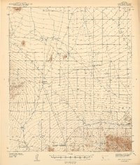
 1948 San Vicente1948 Print · USGSWithin the Papago Indian Reservation in the late thirties, this survey shows a resilient desert landscape of cattle tanks and remote ranching outposts. Trace the locations of Havana Nakya, the Roadside Mine, and the Ajo-Tucson Highway as they appeared before mid-century growth.2 unique versions available
 - 1956 Map of Tucson, 1967 Print
 1956 Tucson1967 Print · USGSPost-war Southern Arizona comes into focus as the copper and aviation industries expand around Tucson. Trace family roots in South Tucson or locate early mining sites like the San Manuel Mine and Silver Bell Mine near the Santa Cruz River.3 unique versions available
 - 1958 Map of Tucson
 1958 Tucson1958 Print · USGSSouthern Arizona in the late fifties reveals a landscape of desert agriculture and rising military aviation. Trace the rail lines of the Southern Pacific or locate the historic San Xavier Del Bac Mission and the Casa Grande Natl Mon.
 - 1959 Map of Tucson
 1959 Tucson1959 Print · USGSSouthern Arizona in the late fifties shows a landscape of military growth and desert industry. Genealogists and historians can trace the footprint of Davis-Monthan Air Force Base and old mining sites like the San Manuel Mine near Mammoth.2 unique versions available
 - 1962 Map of Tucson
 1962 Tucson1962 Print · USGSSouthern Arizona in the early sixties showcases a landscape defined by burgeoning desert cities and massive military installations. Researchers can trace tribal settlements like Schuchk, legacy mining sites at Silver Bell Mine, and the early footprint of Davis-Monthan Air Force Base.
 - 1964 Map of Tucson
 1964 Tucson1964 Print · USGSSouthern Arizona in the mid-1960s shows a landscape of burgeoning desert cities and industrial-scale copper mining. Researchers can trace the development of Tucson and its outlying mining districts, including the Silver Bell Mine and San Manuel Mine.
 - 1979 Map of Pan Tak
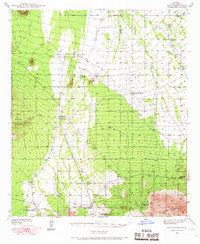
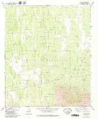 1979 Pan Tak1979 Print · USGSMid-century desert life in Pima County is centered here on the Papago Indian Reservation during the late seventies. Genealogists and historians can trace the settlement of Pan Tak, locate isolated water sources like Dobbs Well, and identify mining sites such as the Roadside Mine.2 unique versions available
 - 1994 Map of Silver Bell Mountains
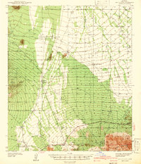
 1994 Silver Bell Mountains1994 Print · USGSSouthern Arizona in the mid-nineties shows a land of transition between desert wilderness, tribal lands, and the growing Tucson suburbs. Genealogists and historians can trace settlements like San Luis and Ko Vaya, or follow the industrial legacy of the Silver Bell Mine.2 unique versions available
 - 1996 Map of Pan Tak, 2002 Print
 1996 Pan Tak2002 Print · USGSThe Tohono O'odham landscape in the late nineties showcases a remote desert environment structured by ancient washes and modern mining interests. Researchers can trace the water-dependent settlement patterns at Pan Tak and find resource sites like the Roadside Mine and Dobbs Well.
 - 2011 Map of Pan Tak, 2011 Print
 2011 Pan Tak2011 Print · USGSCovers Pan Tak, including Schuk Toak District, Pima County, and other nearby areas
 - 2014 Map of Pan Tak, 2014 Print
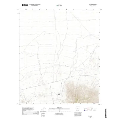
 2014 Pan Tak2014 Print · USGSCovers Pan Tak, including Schuk Toak District, Pima County, and other nearby areas
 - 2018 Map of Pan Tak, 2018 Print
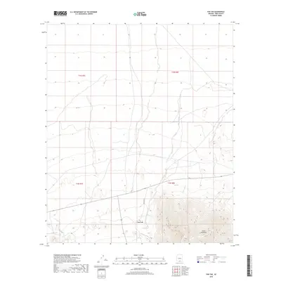 2018 Pan Tak2018 Print · USGSCovers Pan Tak, including Schuk Toak District, Pima County, and other nearby areas
 - 2021 Map of Pan Tak, 2021 Print
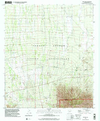
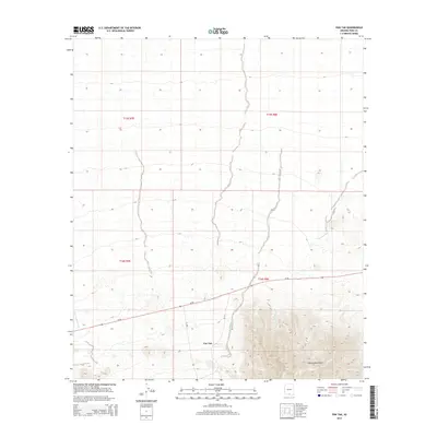
 2021 Pan Tak2021 Print · USGSThe desert plains of Pima County meet the high peaks of the Tohono O'odham Nation in the early twenty-first century. Researchers can trace the path of Indian Rte 39 near the settlement of Pan Tak and follow the seasonal Pan Tak Wash.
 - 2026 Map of Pan Tak, 2026 Print
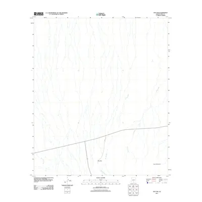
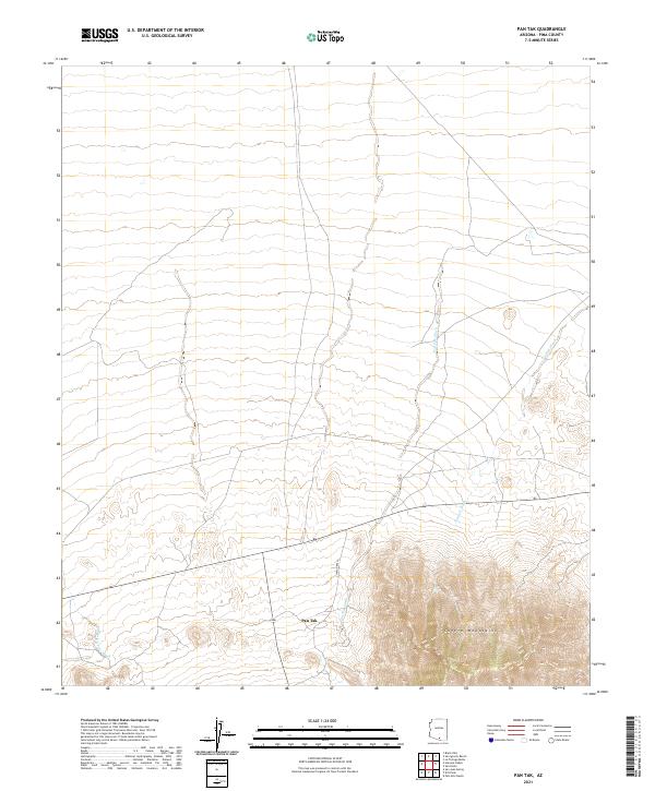
 2026 Pan Tak2026 Print · USGSCovers Pan Tak, including Schuk Toak District, Pima County, and other nearby areas
End of results
Showing maps 1-18 of 18
Frequently asked questions
- What are the different types of historical maps available for Pan Tak?
- What is the oldest map of Pan Tak?
- Where can I purchase historical maps of Pan Tak for my home or office?
- Where can I download high-res historical maps of Pan Tak?
- Are there historical topographic maps available for Pan Tak?
- Is there historical aerial imagery available for Pan Tak?
- Where are historical maps of Pan Tak sourced from?