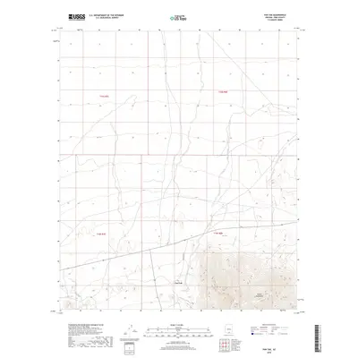
2018 Map of Pan Tak
USGS Topo · Published 2018About this map
Pan Tak sits at the base of the dramatic Coyote Mountains in the Schuk Toak District, serving as a primary focal point for this survey of the Sonoran desert landscape. The terrain is defined by its drainage patterns, with the Pan Tak Wash and Viipuli Wash carving paths through the alluvial fans south of the peaks. Significant transportation routes like Indian Rte 39 provide access through this arid region, linking the mountain foothills to the flatter desert plains to the north. These drainage systems, including San Vicente Wash, illustrate the hydrological lifeblood of the area, where seasonal water flow has historically shaped movement and settlement patterns. The map highlights the intersection of traditional land use and modern infrastructure within the Tohono O'odham Nation.
Find a feature on this map
10 named features on this map. Tap any name to fly to it.
Don’t see what you’re looking for? This feature index may not catch every label — zoom into the map to look around manually.
Map Details
Editions of this 2018 Pan Tak Map
This is the sole edition of this map. No revisions or reprints were ever made.
Other maps of this area

1920 · Arivaca
USGS Topo · 1:125,000

1934 · Tucson Mountains
USGS Topo · 1:125,000

1934 · Silver Bell
USGS Topo · 1:125,000

1938 · San Vicente
USGS Topo · 1:62,500

1940 · Palo Alto Ranch
USGS Topo · 1:62,500

1941 · San Vicente
USGS Topo · 1:62,500

1941 · Cocoraque Butte
USGS Topo · 1:62,500

1941 · Baboquivari Peak
USGS Topo · 1:62,500

1942 · San Vicente
USGS Topo · 1:62,500

1943 · Cocoraque Butte
USGS Topo · 1:62,500