
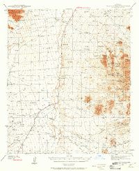
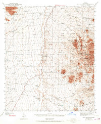
1940 Map of Palo Alto Ranch
USGS Topo · Published 1956About this map
Working cattle ranches and legacy mining claims define this corner of the Sonoran Desert in the early 1940s. The landscape is dominated by the Coyote Mountains in the northwest and the Sierrita Mountains to the east, with the broad Altar Wash valley serving as a primary drainage corridor between them. Small-scale settlement is concentrated at family-held outposts like Anvil Ranch and the Palo Alto Ranch, which are connected by a network of unimproved desert tracks such as the Batamote Road.
Find a feature on this map
54 named features on this map. Tap any name to fly to it.
Don’t see what you’re looking for? This feature index may not catch every label — zoom into the map to look around manually.
Map Details
Editions of this 1940 Palo Alto Ranch Map
3 editions found
Other maps of this area

1920 · Arivaca
USGS Topo · 1:125,000

1925 · Samaniego Peak
USGS Topo · 1:62,500

1925 · San Xavier
USGS Topo · 1:62,500

1934 · Tucson Mountains
USGS Topo · 1:125,000

1934 · Silver Bell
USGS Topo · 1:125,000

1938 · San Vicente
USGS Topo · 1:62,500

1939 · Twin Buttes
USGS Topo · 1:62,500

1939 · Tubac
USGS Topo · 1:62,500

1941 · Presumido Peak
USGS Topo · 1:62,500

1941 · Twin Buttes
USGS Topo · 1:62,500