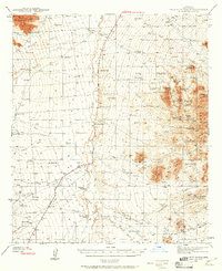
1940 Map of Palo Alto Ranch
USGS Topo · Published 1961About this map
Anvil Ranch and Palo Alto Ranch anchor a landscape defined by an extensive network of ephemeral drainage systems and early mid-century ranching operations. The terrain is marked by prominent desert elevations such as the Coyote Mountains and Stevens Mtn, which overlook numerous mining sites that had already ceased operations by the time of the 1940 survey. These include the Aguinaldo Mine (abandoned) and Yellow Bird Mine (abandoned), reflecting the shift from mineral extraction to a cattle-and-water economy.
Find a feature on this map
69 named features on this map. Tap any name to fly to it.
Don’t see what you’re looking for? This feature index may not catch every label — zoom into the map to look around manually.
Map Details
Editions of this 1940 Palo Alto Ranch Map
3 editions found
Other maps of this area

1920 · Arivaca
USGS Topo · 1:125,000

1925 · Samaniego Peak
USGS Topo · 1:62,500

1925 · San Xavier
USGS Topo · 1:62,500

1934 · Tucson Mountains
USGS Topo · 1:125,000

1934 · Silver Bell
USGS Topo · 1:125,000

1938 · San Vicente
USGS Topo · 1:62,500

1939 · Twin Buttes
USGS Topo · 1:62,500

1939 · Tubac
USGS Topo · 1:62,500

1940 · Palo Alto Ranch
USGS Topo · 1:62,500

1941 · Presumido Peak
USGS Topo · 1:62,500