1900s (20th Century) Maps of Queens Well, Schuk Toak District
Explore 10 historic maps of Queens Well from the 1900s (20th Century). These maps offer a rare glimpse into what life looked like during the 1900s — showing old roads, neighborhoods, homes, and landmarks that have changed or disappeared over time.
Whether you're researching your family's past, planning a metal detecting trip, or studying how Queens Well's landscape evolved across the 1900s, these high-resolution maps are a powerful tool for exploring the history of this region.
- Focus on a specific era: All maps on this page are from the 1900s, giving you a focused view of this time period.
- See what’s changed: Compare century-old streets, trails, and buildings to today's modern landscape using overlays and satellite layers.
- Research with precision: Use these maps for genealogy, historical research, land use analysis, or educational projects.
- View, download, or print: Maps are fully viewable online in high resolution, and can be downloaded or printed for your own records.
Start exploring Queens Well's history through authentic maps from the 1900s. This is your window into the past.
Queens Well, Schuk Toak District maps
(10)- 1934 Map of Silver Bell
 1934 Silver Bell1934 Print · USGSPima County at the height of the New Deal era reveals a sparse network of desert settlements and remote mines. Genealogists and historians can trace the footprint of the Papago Indian Reservation through its small villages like Santa Cruz and industrial sites like the Roadside Mine.
 - 1956 Map of Tucson, 1967 Print
 1956 Tucson1967 Print · USGSPost-war Southern Arizona comes into focus as the copper and aviation industries expand around Tucson. Trace family roots in South Tucson or locate early mining sites like the San Manuel Mine and Silver Bell Mine near the Santa Cruz River.3 unique versions available
 - 1958 Map of Tucson
 1958 Tucson1958 Print · USGSSouthern Arizona in the late fifties reveals a landscape of desert agriculture and rising military aviation. Trace the rail lines of the Southern Pacific or locate the historic San Xavier Del Bac Mission and the Casa Grande Natl Mon.
 - 1959 Map of Tucson
 1959 Tucson1959 Print · USGSSouthern Arizona in the late fifties shows a landscape of military growth and desert industry. Genealogists and historians can trace the footprint of Davis-Monthan Air Force Base and old mining sites like the San Manuel Mine near Mammoth.2 unique versions available
 - 1959 Map of Vaca Hills, 1961 Print
 1959 Vaca Hills1961 Print · USGSArizona's copper country comes into focus in the late 1950s as massive open-pit operations reshape the West Silver Bell Mountains. Genealogists and industrial historians can trace the Silver Bell (Site), the Daisy Shaft, and an Old Railroad Grade used for hauling ore.2 unique versions available
 - 1962 Map of Tucson
 1962 Tucson1962 Print · USGSSouthern Arizona in the early sixties showcases a landscape defined by burgeoning desert cities and massive military installations. Researchers can trace tribal settlements like Schuchk, legacy mining sites at Silver Bell Mine, and the early footprint of Davis-Monthan Air Force Base.
 - 1964 Map of Tucson
 1964 Tucson1964 Print · USGSSouthern Arizona in the mid-1960s shows a landscape of burgeoning desert cities and industrial-scale copper mining. Researchers can trace the development of Tucson and its outlying mining districts, including the Silver Bell Mine and San Manuel Mine.
 - 1989 Map of Queens Well
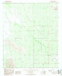 1989 Queens Well1989 Print · USGSThe Papago Indian Reservation comes into focus in the late 1980s, showcasing a landscape of desert ranching and seasonal water management. Trace the infrastructure of the Aguirre Valley through features like Queens Well and numerous Check Dams.
 - 1994 Map of Silver Bell Mountains
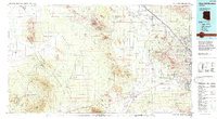 1994 Silver Bell Mountains1994 Print · USGSSouthern Arizona in the mid-nineties shows a land of transition between desert wilderness, tribal lands, and the growing Tucson suburbs. Genealogists and historians can trace settlements like San Luis and Ko Vaya, or follow the industrial legacy of the Silver Bell Mine.2 unique versions available
 - 1996 Map of Queens Well, 2003 Print
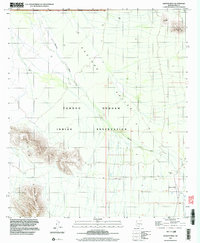 1996 Queens Well2003 Print · USGSThe Tohono O'odham nation and the arid Aguirre Valley dominate this desert landscape during the late twentieth century. Researchers can trace remote desert water points and tracks like Queens Well, San Ignacio Ranch, and the winding Aguirre Wash.
End of results
Showing maps 1-10 of 10
Frequently asked questions
- What are the different types of historical maps available for Queens Well?
- What is the oldest map of Queens Well?
- Where can I purchase historical maps of Queens Well for my home or office?
- Where can I download high-res historical maps of Queens Well?
- Are there historical topographic maps available for Queens Well?
- Is there historical aerial imagery available for Queens Well?
- Where are historical maps of Queens Well sourced from?