2000s (21st Century) Maps of Palm Springs, Apache Junction
Explore 5 historic maps of Palm Springs from the 2000s (21st Century). These maps offer a rare glimpse into what life looked like during the 2000s — showing old roads, neighborhoods, homes, and landmarks that have changed or disappeared over time.
Whether you're researching your family's past, planning a metal detecting trip, or studying how Palm Springs's landscape evolved across the 2000s, these high-resolution maps are a powerful tool for exploring the history of this region.
- Focus on a specific era: All maps on this page are from the 2000s, giving you a focused view of this time period.
- See what’s changed: Compare century-old streets, trails, and buildings to today's modern landscape using overlays and satellite layers.
- Research with precision: Use these maps for genealogy, historical research, land use analysis, or educational projects.
- View, download, or print: Maps are fully viewable online in high resolution, and can be downloaded or printed for your own records.
Start exploring Palm Springs's history through authentic maps from the 2000s. This is your window into the past.
Palm Springs, Apache Junction maps
(5)- 2004 Map of Apache Junction, 2007 Print
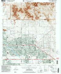 2004 Apache Junction2007 Print · USGSApache Junction sits at the desert edge in the early 2000s, where suburban expansion meets the forest boundary. Trace local growth through schools and museums like Superstition Mtn School and the Superstition Mountain Museum.
 - 2011 Map of Apache Junction, 2011 Print
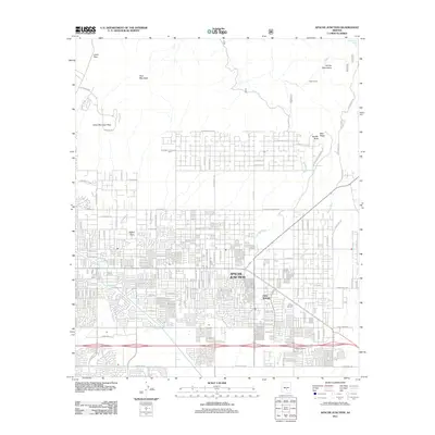 2011 Apache Junction2011 Print · USGSCovers Palm Springs, including Mesa, Apache Junction, and other nearby areas
 - 2014 Map of Apache Junction, 2014 Print
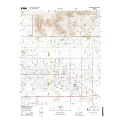 2014 Apache Junction2014 Print · USGSCovers Palm Springs, including Mesa, Apache Junction, and other nearby areas
 - 2018 Map of Apache Junction, 2018 Print
 2018 Apache Junction2018 Print · USGSCovers Palm Springs, including Mesa, Apache Junction, and other nearby areas
 - 2021 Map of Apache Junction, 2021 Print
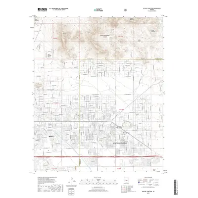
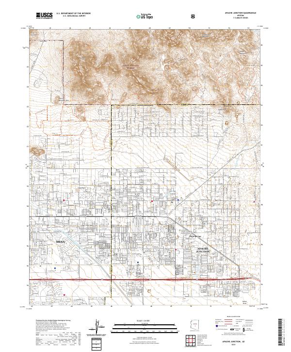 2021 Apache Junction2021 Print · USGSApache Junction and Mesa meet the mountain wilderness in this contemporary survey of the East Valley. Local researchers can trace the path of the Central Arizona Project Aqueduct or locate specific neighborhood landmarks like Palm Springs and the Central Arizona College - Superstition Mountain Campus.
End of results
Showing maps 1-5 of 5
Frequently asked questions
- What are the different types of historical maps available for Palm Springs?
- What is the oldest map of Palm Springs?
- Where can I purchase historical maps of Palm Springs for my home or office?
- Where can I download high-res historical maps of Palm Springs?
- Are there historical topographic maps available for Palm Springs?
- Is there historical aerial imagery available for Palm Springs?
- Where are historical maps of Palm Springs sourced from?