1960s Maps of Hagler, Arkansas
Explore 3 historic maps of Hagler from the 1960s. These maps offer a rare glimpse into what life looked like during the 1960s — showing old roads, neighborhoods, homes, and landmarks that have changed or disappeared over time.
Whether you're researching your family's past, planning a metal detecting trip, or studying how Hagler's landscape evolved across the 1960s, these high-resolution maps are a powerful tool for exploring the history of this region.
- Focus on a specific era: All maps on this page are from the 1960s, giving you a focused view of this time period.
- See what’s changed: Compare century-old streets, trails, and buildings to today's modern landscape using overlays and satellite layers.
- Research with precision: Use these maps for genealogy, historical research, land use analysis, or educational projects.
- View, download, or print: Maps are fully viewable online in high resolution, and can be downloaded or printed for your own records.
Start exploring Hagler's history through authentic maps from the 1960s. This is your window into the past.
Hagler, AR maps
(3)- 1960 Map of Helena
 1960 Helena1960 Print · USGSThe Arkansas and Mississippi Delta regions meet along the great river bends during a period of significant agricultural and rail expansion. Genealogists and historians can trace the paths of the Missouri Pacific railroad through Clarendon or locate landings along the Mississippi River and White River.
 - 1968 Map of Lodge Corner, 1969 Print
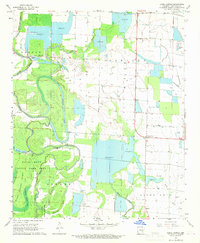 1968 Lodge Corner1969 Print · USGSArkansas County during the late sixties showcases a landscape of rice reservoirs and bayou drainage systems. Researchers can locate remote rural landmarks like Youngblood Bridge, Bayless Cem, and the small settlement at Lodge Corner.3 unique versions available
 - 1969 Map of Humphrey
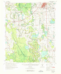 1969 Humphrey1969 Print · USGSSoutheast Arkansas in the late sixties reveals a landscape of rice farming and rail commerce centered on Stuttgart. Trace the routes of the Southwestern Railway or locate rural landmarks like Lodge Corner, Argo Chapel, and Sunshine Cem.
End of results
Showing maps 1-3 of 3
Top cities near Hagler
- Stuttgart historical maps
- DeWitt historical maps
- De Witt historical maps
- Gillett historical maps
- Humphrey historical maps
- Grady historical maps
See more
Frequently asked questions
- What are the different types of historical maps available for Hagler?
- What is the oldest map of Hagler?
- Where can I purchase historical maps of Hagler for my home or office?
- Where can I download high-res historical maps of Hagler?
- Are there historical topographic maps available for Hagler?
- Is there historical aerial imagery available for Hagler?
- Where are historical maps of Hagler sourced from?