
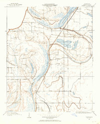
1960 Map of Helena
USGS Topo · Published 1960About this map
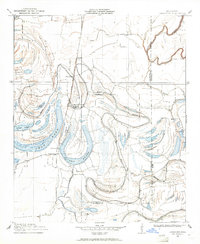
The Mississippi River meanders through the heart of this mid-century survey, defining the boundary between Arkansas and Mississippi. Along its western banks, the confluence of the White River and the Arkansas River creates a massive alluvial landscape protected by the White River National Wildlife Refuge and Bayou Meto State Wildlife Refuge. The terrain is famously interrupted by Crowleys Ridge, a prominent geological formation rising above the Delta floor near Forrest City and Marianna.
Find a feature on this map
50 named features on this map. Tap any name to fly to it.
Don’t see what you’re looking for? This feature index may not catch every label — zoom into the map to look around manually.
Map Details
Editions of this 1960 Helena Map
This is the sole edition of this map. No revisions or reprints were ever made.
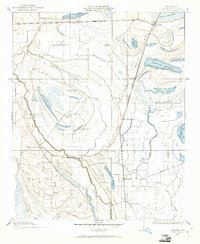
Other maps of this area

1891 · Little Rock
USGS Topo · 1:125,000

1893 · Little Rock
USGS Topo · 1:125,000

1908 · Lula
USGS Topo · 1:24,000
1908 · Dundee
USGS Topo · 1:24,000

1908 · Hollywood
USGS Topo · 1:24,000
1908 · Coahoma
USGS Topo · 1:24,000

1908 · Moon Lake
USGS Topo · 1:24,000
1908 · Jonestown
USGS Topo · 1:24,000

1908 · Walnut Lake
USGS Topo · 1:24,000

1908 · Lake Cormorant
USGS Topo · 1:24,000