Old Maps of Okolona, Arkansas
Explore 25 old maps of Okolona, spanning from 1901 to today. These high-resolution historic maps reveal how streets, neighborhoods, landmarks, and natural features evolved over time — perfect for genealogy, metal detecting, research, and local history exploration.
What you can do with these maps:
- See how Okolona changed over time: Compare historical maps to modern-day views to trace roads, homesites, rail lines & more.
- View detailed metadata: Each map includes creators, publishers, year, scale, and archive source.
- Overlay maps with satellite & LiDAR: Visualize the past alongside modern tools to explore terrain & human change.
- Trusted historical sources: Maps sourced from the USGS, Library of Congress, and other archives.
- Access maps your way: View online, download high-res files, or order prints for personal or research use.
Start exploring old maps of Okolona to uncover forgotten places, hidden landmarks, and the deep history beneath your feet.
Okolona, AR maps
(25)- 1901 Map of Gurdon
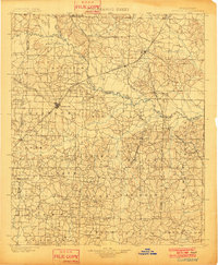 1901 Gurdon1901 Print · USGSSouthwest Arkansas at the dawn of the twentieth century was a landscape defined by the arrival of the rails and the timber industry. Researchers can trace the development of early rail towns like Gurdon, Prescott, and Whelen Springs along the St. Louis Iron Mountain and Southern R. R.3 unique versions available
 - 1943 Map of Antoine
 1943 Antoine1943 Print · USGSPike and Clark counties come into focus during the early 1940s, highlighting a landscape of river-bottom settlements and upland timber tracts. Researchers can trace family roots at Meeks Settlement or locate remote rural landmarks like Rosewall Sch and Nutts.3 unique versions available
 - 1953 Map of El Dorado, 1967 Print
 1953 El Dorado1967 Print · USGSSouth Arkansas in the mid-1960s was a landscape of industrial growth and river-fed commerce. Researchers can trace the extensive Oil and Gas Fields around Magnolia, the expansive U S Naval Ammunition Depot, and the busy rail lines of the Missouri Pacific.3 unique versions available
 - 1955 Map of Little Rock, 1978 Print
 1955 Little Rock1978 Print · USGSCentral Arkansas in the mid-fifties exhibits a landscape of growing cities, massive military installations, and mountain reservoirs. Genealogists and historians can trace the industrial Bauxite Mines, regional rail lines, and local landmarks like Antioch Church.
 - 1956 Map of Little Rock
 1956 Little Rock1956 Print · USGSCentral Arkansas in the mid-fifties shows a landscape defined by burgeoning military bases and the timber-and-mineral wealth of the Ouachitas. Genealogists and researchers can trace old rail lines like the Missouri Pacific and find established communities such as Bauxite, Sheridan, and Mabelvale.
 - 1957 Map of El Dorado
 1957 El Dorado1957 Print · USGSSouth Arkansas in the mid-1950s was a critical hub of military logistics and rail-river commerce. Genealogists and historians can trace family land across the Arkansas Louisiana border and locate sites like the U.S. Naval Ammunition Depot or the rail junctions at Magnolia and Camden.
 - 1958 Map of El Dorado
 1958 El Dorado1958 Print · USGSSouthern Arkansas and the Louisiana borderlands are shown during a period of heavy rail traffic and defense industry activity. Researchers can trace the legacy of the U. S. Naval Ammunition Depot or locate family roots in Smackover, Huttig, and Nashville.3 unique versions available
 - 1960 Map of El Dorado
 1960 El Dorado1960 Print · USGSSouth Central Arkansas in the late fifties was a hub of energy production and defense industry. Researchers can trace the extensive Oil and Gas Fields around El Dorado or locate family landmarks like Old Park Cem and New Hope Church.
 - 1960 Map of Little Rock
 1960 Little Rock1960 Print · USGSCentral Arkansas in the late fifties shows a landscape of growing military bases and massive new reservoirs. Local historians can trace the mid-century expansion of Little Rock and Hot Springs alongside the industrial works at Bauxite and the Pine Bluff Arsenal.
 - 1964 Map of Little Rock
 1964 Little Rock1964 Print · USGSCentral Arkansas in the mid-sixties is a landscape of mountain ridges, industrial rail lines, and growing military hubs. Researchers can trace the development of Bauxite and Hot Springs or locate rural landmarks like Sparkman and the Pine Bluff Arsenal.
 - 1970 Map of Okolona South, 1972 Print
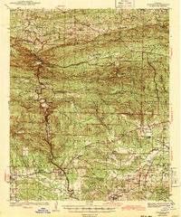
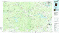
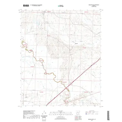
 1970 Okolona South1972 Print · USGSSouthwestern Arkansas near the Clark and Nevada county line is captured here in the early 1970s. Researchers can trace the MISSOURI PACIFIC rail line between Okolona and Burtsell, or locate family sites at Rome Cem and St Clair Ch.
 - 1975 Map of Okolona North, 1978 Print
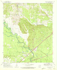
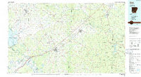
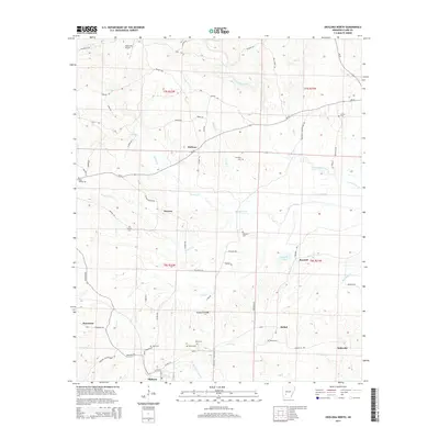
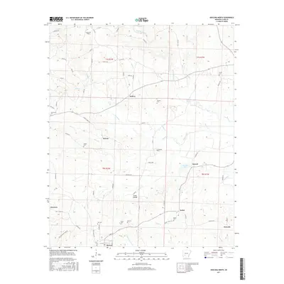
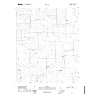
 1975 Okolona North1978 Print · USGSClark County, Arkansas, appears here in the mid-seventies, a landscape of timbered hills and bottomlands along the Terre Noire Creek. Researchers can trace old family burial grounds at Peeples Cemetery and Wier Cemetery or locate the Kathleen Siding on the Missouri Pacific rail line.
 - 1986 Map of Arkadelphia
 1986 Arkadelphia1986 Print · USGSSouthwest Arkansas in the mid-eighties shows a landscape of timbered ridges and significant new reservoirs. Researchers can trace rural schoolhouses and churches like Sunshine Sch and Hempwallace Ch alongside the famous Crater of Diamonds State Park.2 unique versions available
 - 1986 Map of Hope
 1986 Hope1986 Print · USGSSouthwest Arkansas in the mid-eighties was a landscape of rail-connected towns and timbered ridges. Researchers can trace the Missouri Pacific Railroad corridor through Hope or locate local landmarks like De Ann Cem and Poison Springs State Forest.2 unique versions available
 - 1989 Map of El Dorado, 1990 Print
 1989 El Dorado1990 Print · USGSThe Arkansas-Louisiana borderlands in the late eighties show a landscape of heavy industry and wildlife conservation centered on the Ouachita River. Researchers can trace the legacy of timber and transport via the Missouri Pacific RR, Poison Springs State Forest, and the vast Felsenthal Pool.
 - 2011 Map of Okolona South, 2011 Print
 2011 Okolona South2011 Print · USGSCovers Okolona, including Burtsell, Clark County, and other nearby areas
 - 2011 Map of Okolona North, 2011 Print
 2011 Okolona North2011 Print · USGSCovers Okolona, including Bethel, Love Creek, and other nearby areas
 - 2014 Map of Okolona North, 2014 Print
 2014 Okolona North2014 Print · USGSCovers Okolona, including Bethel, Love Creek, and other nearby areas
 - 2014 Map of Okolona South, 2014 Print
 2014 Okolona South2014 Print · USGSCovers Okolona, including Burtsell, Clark County, and other nearby areas
 - 2017 Map of Okolona South, 2017 Print
 2017 Okolona South2017 Print · USGSCovers Okolona, including Burtsell, Clark County, and other nearby areas
 - 2017 Map of Okolona North, 2017 Print
 2017 Okolona North2017 Print · USGSCovers Okolona, including Bethel, Love Creek, and other nearby areas
 - 2020 Map of Okolona South, 2020 Print
 2020 Okolona South2020 Print · USGSCovers Okolona, including Burtsell, Clark County, and other nearby areas
 - 2020 Map of Okolona North, 2020 Print
 2020 Okolona North2020 Print · USGSCovers Okolona, including Bethel, Love Creek, and other nearby areas
 - 2024 Map of Okolona South, 2024 Print
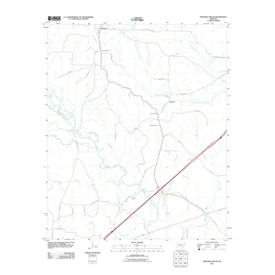
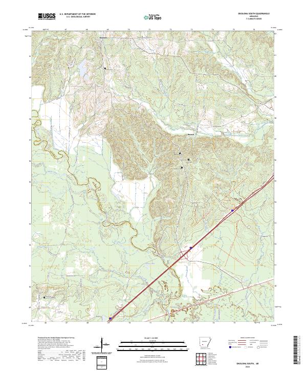 2024 Okolona South2024 Print · USGSThe Clark County countryside southwest of Arkadelphia comes to life in this modern topographic view of rural Arkansas. Researchers can trace the heritage of vanished communities through sites like Old Rome Cem, Burtsell, and the Missionary Grove Church Cem.
 - 2024 Map of Okolona North, 2024 Print
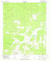
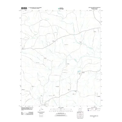
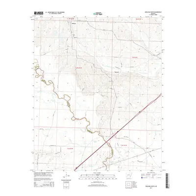
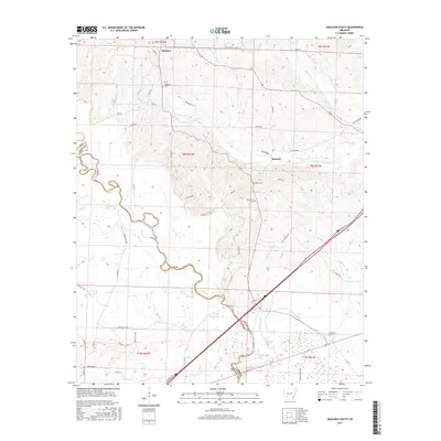
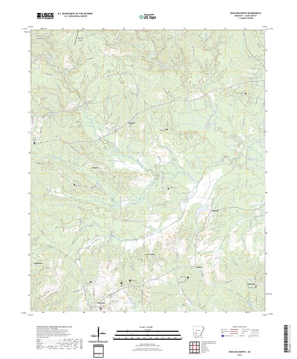 2024 Okolona North2024 Print · USGSClark County, Arkansas, maintains a traditional rural character in these modern surveys, centered on the historic town of Okolona. Genealogists and historians can trace numerous family burial sites like Pettus Cem and Ross Cem alongside the waters of Terre Noire Creek.
End of results
Showing maps 1-25 of 25
Top cities near Okolona
- Prescott historical maps
- Gurdon historical maps
- Delight historical maps
- Antoine historical maps
- Whelen Springs historical maps
Frequently asked questions
- What are the different types of historical maps available for Okolona?
- What is the oldest map of Okolona?
- Where can I purchase historical maps of Okolona for my home or office?
- Where can I download high-res historical maps of Okolona?
- Are there historical topographic maps available for Okolona?
- Is there historical aerial imagery available for Okolona?
- Where are historical maps of Okolona sourced from?