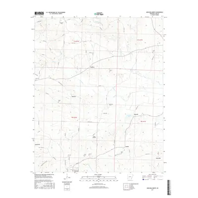
2017 Map of Okolona North
USGS Topo · Published 2017About this map
Okolona anchors the southern edge of this Clark County landscape, where the S Fork Terre Noire Cr flows through a region defined by its rural settlements and scattered family cemeteries. Significant for genealogists and local historians, the area is dotted with burial sites such as Pettus Cem, Ross Cem, and Wier Cem, reflecting the ancestral footprints of the local community. The terrain is a network of small watercourses including Moores Creek, Pruitt Cr, and Love Creek that drain the timbered and agricultural lands between Smyrna and Dobyville. Small communities like Bethel and Halfway are connected by a system of country roads like Smyrna Rd and Ruggles Rd. Near the northern border, Ashworth Airport and the winding Terre Noire Creek highlight the mix of modern utility and the persistent natural drainage patterns of this Arkansas interior.
Find a feature on this map
76 named features on this map. Tap any name to fly to it.
Don’t see what you’re looking for? This feature index may not catch every label — zoom into the map to look around manually.
Map Details
Editions of this 2017 Okolona North Map
This is the sole edition of this map. No revisions or reprints were ever made.
Other maps of this area

1901 · Gurdon
USGS Topo · 1:125,000

1943 · Antoine
USGS Topo · 1:62,500

1953 · El Dorado
USGS Topo · 1:250,000

1955 · Little Rock
USGS Topo · 1:250,000

1956 · Little Rock
USGS Topo · 1:250,000

1957 · El Dorado
USGS Topo · 1:250,000

1958 · El Dorado
USGS Topo · 1:250,000

1960 · El Dorado
USGS Topo · 1:250,000

1960 · Little Rock
USGS Topo · 1:250,000

1964 · Little Rock
USGS Topo · 1:250,000