
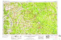
1958 Map of El Dorado
USGS Topo · Published 1958About this map
The Ouachita and Saline river valleys dominate this mid-century look at Southern Arkansas and the Louisiana borderlands. This period saw the landscape defined by a mix of heavy timber industry, active rail corridors, and a massive defense presence at the U. S. Naval Ammunition Depot near Camden. Significant oil and gas development is reflected in the dense network of settlements like Smackover, Norphlet, and Louann, which grew during the regional petroleum booms.
Find a feature on this map
78 named features on this map. Tap any name to fly to it.
Don’t see what you’re looking for? This feature index may not catch every label — zoom into the map to look around manually.
Map Details
Editions of this 1958 El Dorado Map
3 editions found
Other maps of this area

1901 · Gurdon
USGS Topo · 1:125,000

1903 · Camden
USGS Topo · 1:125,000

1906 · Caddo Gap
USGS Topo · 1:125,000

1907 · Atlanta
USGS Topo · 1:62,500

1909 · Texarkana
USGS Topo · 1:62,500

1910 · Atlanta
USGS Topo · 1:62,500

1913 · De Queen
USGS Topo · 1:125,000

1922 · Sarepta
USGS Topo · 1:62,500

1924 · Sarepta
USGS Topo · 1:62,500

1927 · El Dorado
USGS Topo · 1:62,500