
Loading...
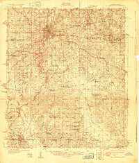
Loading map...1927 Map of El Dorado
USGS Topo · Published 1927About this map
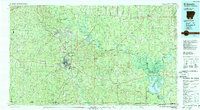
El Dorado serves as the focal point of this 1927 survey, radiating a dense grid of streets and industry at the height of the South Arkansas oil boom era. The landscape is heavily marked by the infrastructure of the Missouri Pacific Railroad and the Rock Island and Pacific Railway, which facilitated the rapid growth of the region. Moving south toward the state line, the terrain transitions into a dense network of rural landmarks, including Old Parker Chapel and Jones High School.
Find a feature on this map
72 named features on this map. Tap any name to fly to it.
Don’t see what you’re looking for? This feature index may not catch every label — zoom into the map to look around manually.
Map Details
Date Portrayed1927
Date Published1927
PublisherU.S. Geological Survey
Map TypeTopographic
Scale1:62,500
Physical Dimensions16.5 x 19.8 inches
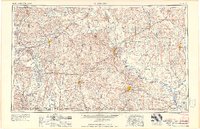
Editions of this 1927 El Dorado Map
2 editions found
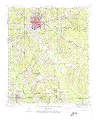
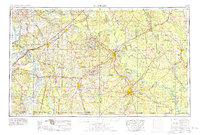
Historical Maps of El Dorado Through Time
9 maps found


Featured Locations
Source Details
SourceU.S. Geological Survey
CopyrightPublic Domain