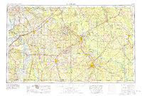
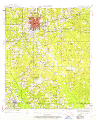
1951 Map of El Dorado
USGS Topo · Published 1953About this map
El Dorado serves as the focal point of this 1950s survey, showing a dense urban grid expanding into the timber and oil lands of southern Arkansas. The landscape is defined by the winding course of Bayou de Loutre and a dense network of country churches and schoolhouses that anchored rural life between the wars. Transport routes like the Missouri Pacific and the Chicago Rock Island and Pacific railroads intersect the region, facilitating the movement of local resources. To the south, the map documents the state line at Junction City, where the community straddles the border between Arkansas and Louisiana. Significant local landmarks include Parkers Chapel Sch, Wingfield Lake, and several family and community burial grounds such as Mc Gee Cemetery and Craig Cem, providing essential data for those researching the genealogy of Union County.
Find a feature on this map
65 named features on this map. Tap any name to fly to it.
Don’t see what you’re looking for? This feature index may not catch every label — zoom into the map to look around manually.
Map Details
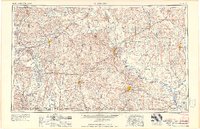
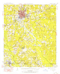
Editions of this 1951 El Dorado Map
3 editions found
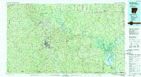
Historical Maps of El Dorado Through Time
9 maps found