
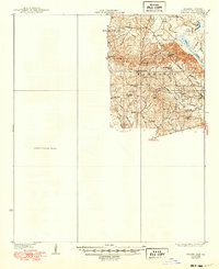
1937 Map of Strong
USGS Topo · Published 1937About this map
Wilmington and New London anchor this 1930s landscape in southern Union County, an area defined by its intricate network of bayous and creeks. The terrain is characterized by the meandering Bayou de Loutre and the low-lying Pine Island, while the presence of the Strong Pumping Station and a Sawmill indicate the infrastructure supporting the local economy. For those tracing community history, the map preserves the locations of vital institutions such as Ward Chapel, North Chapel, and the Union School, alongside family-named landmarks like the McClendon Mill. The inclusion of the Fire Tower and the Wallace Cem offers specific points of reference for genealogists and researchers looking to locate vanished homesteads or burial sites in this heavily wooded river-bottom country.
Find a feature on this map
31 named features on this map. Tap any name to fly to it.
Don’t see what you’re looking for? This feature index may not catch every label — zoom into the map to look around manually.
Map Details
Editions of this 1937 Strong Map
2 editions found
Other maps of this area

1927 · El Dorado
USGS Topo · 1:62,500

1930 · El Dorado
USGS Topo · 1:62,500

1933 · Strong
USGS Topo · 1:62,500

1934 · Ingalls
USGS Topo · 1:48,000

1934 · Felsenthal
USGS Topo · 1:62,500

1934 · Moro Bay
USGS Topo · 1:62,500

1935 · Haile
USGS Topo · 1:62,500

1937 · Felsenthal
USGS Topo · 1:62,500

1937 · Ingalls
USGS Topo · 1:62,500

1938 · Felsenthal
USGS Topo · 1:62,500