
1951 Map of Bernice
USGS Topo · Published 1952About this map
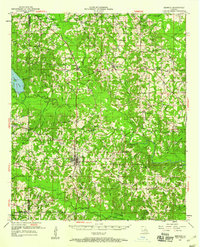
Bernice stands as a central rail hub in northern Louisiana, where the Chicago Rock Island and Pacific RR cuts a straight line through the heart of town. This mid-century survey reveals a landscape defined by small rural settlements and a high density of country churches and schools that once anchored local life. To the north, the small communities of Randolph, Taylorville, and Spearsville are linked by a network of winding roads and numerous creeks, such as Little Corney Bayou and Cheney Creek.
Find a feature on this map
59 named features on this map. Tap any name to fly to it.
Don’t see what you’re looking for? This feature index may not catch every label — zoom into the map to look around manually.
Map Details
Editions of this 1951 Bernice Map
4 editions found
Other maps of this area

1927 · El Dorado
USGS Topo · 1:62,500

1930 · El Dorado
USGS Topo · 1:62,500

1933 · Strong
USGS Topo · 1:62,500

1937 · Strong
USGS Topo · 1:62,500

1939 · Strong
USGS Topo · 1:62,500

1950 · Ruston
USGS Topo · 1:62,500

1950 · Arcadia
USGS Topo · 1:62,500

1951 · Arcadia
USGS Topo · 1:62,500

1951 · Ruston
USGS Topo · 1:62,500

1951 · Summerfield
USGS Topo · 1:62,500