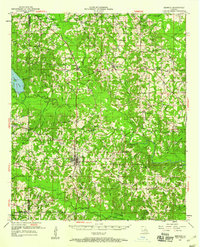
1951 Map of Bernice
USGS Topo · Published 1960About this map
Bernice serves as the central hub for this portion of Union Parish at the mid-century, where the Chicago Rock Island and Pacific railroad creates a clear north-south axis through the piney woods. The landscape is defined by an intricate network of watercourses, including the Middle Fork Bayou D'Arbonne and Corney Creek, which dictate the placement of smaller settlements like Lillie and Randolph. This era of the 1950s shows a high density of rural institutions that anchored these dispersed communities, from the Mt Tabor Sch to numerous country churches like Evergreen Ch and Canaan Ch. Genealogists will find significant value in the documentation of family-named landmarks and resting places, such as Taylor Cem and Hard Shell Cem, which reflect the localized history of North Louisiana before modern consolidation changed the rural social structure.
Find a feature on this map
61 named features on this map. Tap any name to fly to it.
Don’t see what you’re looking for? This feature index may not catch every label — zoom into the map to look around manually.
Map Details
Editions of this 1951 Bernice Map
4 editions found

Other maps of this area

1927 · El Dorado
USGS Topo · 1:62,500

1930 · El Dorado
USGS Topo · 1:62,500

1933 · Strong
USGS Topo · 1:62,500

1937 · Strong
USGS Topo · 1:62,500

1939 · Strong
USGS Topo · 1:62,500

1950 · Ruston
USGS Topo · 1:62,500

1950 · Arcadia
USGS Topo · 1:62,500

1951 · Arcadia
USGS Topo · 1:62,500

1951 · Ruston
USGS Topo · 1:62,500

1951 · Summerfield
USGS Topo · 1:62,500