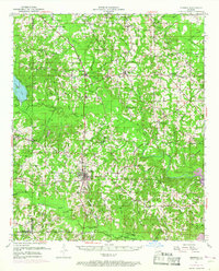
1951 Map of Bernice
USGS Topo · Published 1969About this map
Bernice serves as the central hub of this North Louisiana landscape, situated at the crossroads of local highways and the Chicago Rock Island and Pacific railroad. The topography is defined by the complex drainage systems of the Middle Fork Bayou D'Arbonne and Corney Creek, which feed into the large expanse of Bayou D'Arbonne Lake in the southeast. This survey captures a dense network of rural community centers and family-named landmarks established along the ridges and creek bottoms.
Find a feature on this map
73 named features on this map. Tap any name to fly to it.
Don’t see what you’re looking for? This feature index may not catch every label — zoom into the map to look around manually.
Map Details
Editions of this 1951 Bernice Map
4 editions found

Other maps of this area

1927 · El Dorado
USGS Topo · 1:62,500

1930 · El Dorado
USGS Topo · 1:62,500

1933 · Strong
USGS Topo · 1:62,500

1937 · Strong
USGS Topo · 1:62,500

1939 · Strong
USGS Topo · 1:62,500

1950 · Ruston
USGS Topo · 1:62,500

1950 · Arcadia
USGS Topo · 1:62,500

1951 · Arcadia
USGS Topo · 1:62,500

1951 · Ruston
USGS Topo · 1:62,500

1951 · Summerfield
USGS Topo · 1:62,500