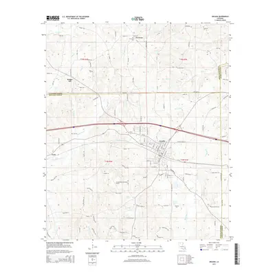
1951 Map of Arcadia
USGS Topo · Published 1951About this map
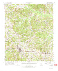
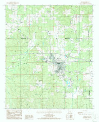
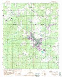
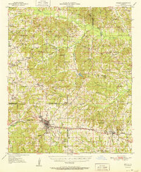
Arcadia and Simsboro anchor this 1951 study of the North Louisiana landscape, where the Illinois Central railroad cuts a straight line through the rolling piney woods. The map reveals a densely settled rural society organized around community centers like Macedonia Ch, Alabama Ch, and Saint Rest Ch. Evidence of the mid-century energy economy is visible in the sprawling Gas Field and localized Oil infrastructure north of Hurricane. Family history is deeply etched into the land through numerous small burial grounds and educational landmarks, including the Givens McGuire Cem, Trussell Cem, and Hurricane Sch. The terrain is defined by the drainage of the D'Arbonne Bayou and Dugdemona River, which flow through the three intersecting parishes of Claiborne, Lincoln, and Bienville.
Find a feature on this map
90 named features on this map. Tap any name to fly to it.
Don’t see what you’re looking for? This feature index may not catch every label — zoom into the map to look around manually.
Map Details
Editions of this 1951 Arcadia Map
This is the sole edition of this map. No revisions or reprints were ever made.
Historical Maps of Arcadia Through Time
9 maps found