
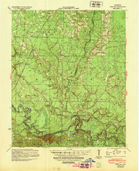
1939 Map of Moro Bay
USGS Topo · Published 1941About this map
The Ouachita River meanders through a dense network of sloughs and brakes along the borders of Calhoun, Bradley, and Union Counties. This 1930s survey captures a landscape defined by its waterways, featuring complex drainage patterns like Pacific Slough and Cane Hill Spring Slough, alongside landforms such as Harvin Ridge. Life in the Arkansas timberlands during this era centered around river access points like Wilmington Landing and Stow Landing, as well as small rural communities such as Artesian and Jersey.
Find a feature on this map
90 named features on this map. Tap any name to fly to it.
Don’t see what you’re looking for? This feature index may not catch every label — zoom into the map to look around manually.
Map Details
Editions of this 1939 Moro Bay Map
2 editions found
Other maps of this area

1903 · Camden
USGS Topo · 1:125,000

1927 · El Dorado
USGS Topo · 1:62,500

1930 · El Dorado
USGS Topo · 1:62,500

1933 · Strong
USGS Topo · 1:62,500

1934 · Ingalls
USGS Topo · 1:48,000

1934 · Felsenthal
USGS Topo · 1:62,500

1934 · Moro Bay
USGS Topo · 1:62,500

1937 · Strong
USGS Topo · 1:62,500

1937 · Felsenthal
USGS Topo · 1:62,500

1937 · Ingalls
USGS Topo · 1:62,500