
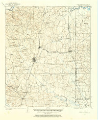
1907 Map of Atlanta
USGS Topo · Published 1954About this map
Atlanta serves as a major railroad hub on the Texas and Pacific line, anchoring a landscape defined by the timber and cotton industries at the start of the twentieth century. The map reveals an intricate network of industrial sites, from the Cass Lumber Co Sawmill in the north to numerous family-operated operations like Pritchard's Gin, Richards Sawmill, and Huffine's Sawmill. These facilities are connected by a web of railways, including the Kansas City Southern and several specialized timber lines like the Black Bayou Lumber Co RR.
Find a feature on this map
74 named features on this map. Tap any name to fly to it.
Don’t see what you’re looking for? This feature index may not catch every label — zoom into the map to look around manually.
Map Details
Editions of this 1907 Atlanta Map
2 editions found
Other maps of this area

1909 · New Boston
USGS Topo · 1:62,500

1909 · Texarkana
USGS Topo · 1:62,500

1910 · Linden
USGS Topo · 1:62,500

1910 · Atlanta
USGS Topo · 1:62,500

1932 · Hosston NW
USGS Topo · 1:31,680

1944 · Kildare
USGS Topo · 1:62,500

1948 · Kildare
USGS Topo · 1:62,500

1948 · Vivian
USGS Topo · 1:62,500

1952 · Doddridge NW
USGS Topo · 1:24,000

1952 · Doddridge
USGS Topo · 1:24,000