1948 Map of Vivian
USGS Topo · Published 1948About this map
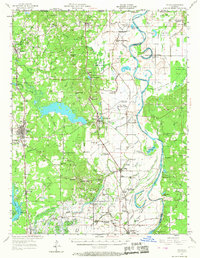
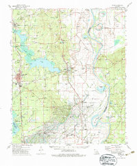
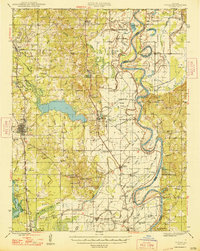
The Red River meanders through the eastern portion of this Caddo Parish survey, defining a landscape of complex oxbow lakes and sloughs such as Silver Lake and Old River. Industry and transport are central to the region's character, with the Kansas City Southern and Texas and Pacific railroads serving established settlements like Vivian, Hosston, and Gilliam. A notable Oil Refinery near Lewis highlights the importance of energy extraction in the 1940s, while the Miller Bluff Ferry and Cedar Bluff Ferry indicate where traditional river crossings still operated before modern bridges became universal.
Find a feature on this map
135 named features on this map. Tap any name to fly to it.
Don’t see what you’re looking for? This feature index may not catch every label — zoom into the map to look around manually.
Map Details
Editions of this 1948 Vivian Map
This is the sole edition of this map. No revisions or reprints were ever made.