
1952 Map of Doddridge NW
USGS Topo · Published 1953About this map
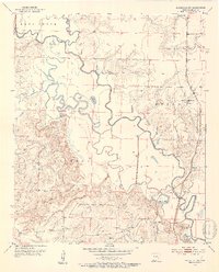
Sulphur River meanders through the heart of this Miller County landscape, creating a complex network of wetlands and oxbows like Mercer Bayou and Little Pond. In the early 1950s, this area maintained a rural, river-dependent character where the Texas and Pacific railroad provided the primary industrial link, passing through the settlement at Ft Lynn along the eastern edge of the river valley. The topography reveals a distinct transition from the flat bottomlands of the river basin to the rising elevations of the Sulphur and Beech districts. Local community life is anchored by dispersed rural landmarks such as Antioch Ch, Springhill Ch, and Olive Branch Ch. Industrial activity is represented by scattered Oil Wells and a Gravel Pit, while the Sulphur River Lookout Tower stands as a sentinel over the heavily wooded terrain of southwestern Arkansas.
Find a feature on this map
25 named features on this map. Tap any name to fly to it.
Don’t see what you’re looking for? This feature index may not catch every label — zoom into the map to look around manually.
Map Details
Editions of this 1952 Doddridge NW Map
4 editions found
Other maps of this area

1907 · Atlanta
USGS Topo · 1:62,500

1909 · Texarkana
USGS Topo · 1:62,500

1910 · Atlanta
USGS Topo · 1:62,500

1952 · Doddridge SE
USGS Topo · 1:24,000

1952 · Doddridge
USGS Topo · 1:24,000

1952 · Fouke SE
USGS Topo · 1:24,000

1952 · Doddridge NE
USGS Topo · 1:24,000

1952 · Fouke
USGS Topo · 1:24,000

1953 · Texarkana
USGS Topo · 1:250,000

1953 · El Dorado
USGS Topo · 1:250,000