Old Maps of Cass County, Texas
Explore 162 old maps of Cass County, spanning from 1907 to today. These high-resolution historic maps reveal how streets, neighborhoods, landmarks, and natural features evolved over time — perfect for genealogy, metal detecting, research, and local history exploration.
What you can do with these maps:
- See how Cass County changed over time: Compare historical maps to modern-day views to trace roads, homesites, rail lines & more.
- View detailed metadata: Each map includes creators, publishers, year, scale, and archive source.
- Overlay maps with satellite & LiDAR: Visualize the past alongside modern tools to explore terrain & human change.
- Trusted historical sources: Maps sourced from the USGS, Library of Congress, and other archives.
- Access maps your way: View online, download high-res files, or order prints for personal or research use.
Start exploring old maps of Cass County to uncover forgotten places, hidden landmarks, and the deep history beneath your feet.
Cass County, TX maps
(162)- 1907 Map of Atlanta, 1954 Print
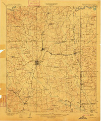
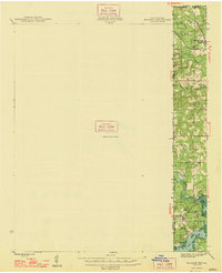
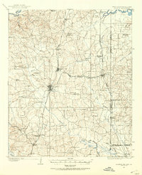 1907 Atlanta1954 Print · USGSNorthwest Louisiana and Northeast Texas meet in this early century survey of the rail-and-timber corridor surrounding Atlanta. Researchers can trace the heritage of rural communities through dozens of local landmarks like Laws Chapel, Pritchard's Gin, and the Cass Lumber Co Sawmill.2 unique versions available
 - 1909 Map of New Boston
 1909 New Boston1909 Print · USGSBowie County at the dawn of the twentieth century was a landscape shaped by competing railroads and the winding Sulphur River. Genealogists and local historians can locate early landmarks like Boston, Chalybeate School, and the historic Bigham Ferry crossing.2 unique versions available
 - 1909 Map of Texarkana
 1909 Texarkana1909 Print · USGSTexarkana emerged as a bustling tri-state rail center at the dawn of the twentieth century, defined by its complex web of iron roads and river commerce. Genealogists and local historians can trace family roots at White Chapel, the Stateline Ferry, and rural sites like Alamo Mills.5 unique versions available
 - 1910 Map of Linden
 1910 Linden1910 Print · USGSNortheast Texas at the dawn of the century reveals a landscape defined by the timber industry and small rural hubs. You can trace the development of Cass County through landmarks like the T.P. Sawmill, Bryans Mill, and dozens of family-named sites like Harbucks Store.2 unique versions available
 - 1910 Map of Atlanta
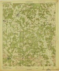
 1910 Atlanta1910 Print · USGSNortheast Texas at the height of the timber boom is captured here, showing the intricate network of sawmills and rail lines crossing into Arkansas and Louisiana. Genealogists can locate family landmarks like Laws Chapel, Hosey's Store, and the Henderson Hill School among the many rural settlements.2 unique versions available
 - 1914 Map of Daingerfield
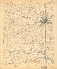
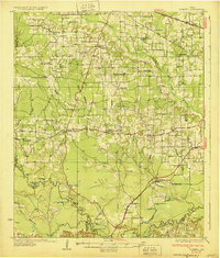
 1914 Daingerfield1914 Print · USGSNortheast Texas before the Great War is captured here through its bustling rail towns and timber-rich creek bottoms. Genealogists can trace hundreds of family sites, from Walkers Chapel and Boon Hall to the busy Jennings Lake Switch.2 unique versions available
 - 1930 Map of Bassett
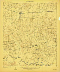
 1930 Bassett1930 Print · USGSBowie and Cass Counties are captured here as the traditional rural landscape met the expanding reach of the railroad and early oil exploration. Genealogists can locate many namesake schools and churches like Big Woods Sch, Mt Zion Ch, and the settlement of White Cotton.2 unique versions available
 - 1944 Map of Kildare, 1954 Print
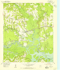
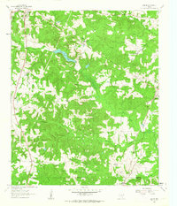
 1944 Kildare1954 Print · USGSThe tri-state border region of Texas, Louisiana, and Arkansas comes alive in this mid-century survey of the bayou country. Genealogists and researchers can trace local landmarks like Mission Chapel, the settlement of Trees, and the rail stops of the Kansas City Southern.
 - 1948 Map of Kildare
 1948 Kildare1948 Print · USGSThe Texas-Louisiana borderlands in the late 1940s reveal a landscape of rail-driven settlements and bayou wetlands. Genealogists and historians can trace old landmarks such as Bonham Landing, the village of Trees, and the Mission Chapel near the Caddo Parish line.
 - 1953 Map of Texarkana, 1964 Print
 1953 Texarkana1964 Print · USGSThe Texas-Arkansas borderlands are captured here in the mid-fifties, during a decade of massive military and hydraulic engineering projects. Genealogists and researchers can locate family landmarks like Old Boston Cem, Siloam Ch, and the vast Red River Arsenal.4 unique versions available
 - 1954 Map of Domino, 1955 Print
 1954 Domino1955 Print · USGSCrossing the Texas and Arkansas border in the mid-fifties, this area shows a landscape defined by the winding Sulphur River and active gravel mining. Genealogists can locate rural landmarks like Buchanan Cem, Bright Star Ch, and the settlement of Domino.5 unique versions available
 - 1954 Map of Lake Texarkana, 1955 Print
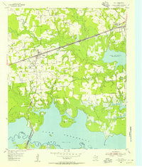
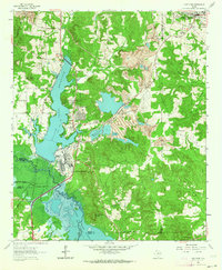
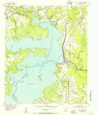 1954 Lake Texarkana1955 Print · USGSNortheast Texas is captured here in the mid-fifties during the transformation of the Sulphur River valley. Genealogists and historians can locate rural landmarks like Opossum Trot Church, the Holloway Cem, and the crossing at McCartney Bridge.6 unique versions available
 - 1954 Map of Texarkana, 1960 Print
 1954 Texarkana1960 Print · USGSTexarkana and its surrounding borderlands are captured at a mid-century peak of industrial and suburban growth. Genealogists and historians can trace the foundations of Wake Village, locate the Red River Arsenal, and find rural landmarks like Hampton Chapel and Red Springs Cem.2 unique versions available
 - 1955 Map of Corley
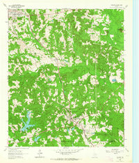
 1955 Corley1955 Print · USGSBowie County rural life in the mid-fifties is captured here as a new road network begins to take shape. Researchers can locate family landmarks such as Old Union Cem, Mount Obie Ch, and the small settlement of Carbondale.3 unique versions available
 - 1955 Map of Maud
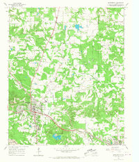
 1955 Maud1955 Print · USGSBowie County's rail-and-water landscape comes alive in the mid-fifties, centered on the growing town of Maud. Genealogists can trace family sites at Harris Cem and Oak Ridge Ch or explore the early shores of Lake Texarkana.3 unique versions available
 - 1955 Map of New Boston, 1960 Print
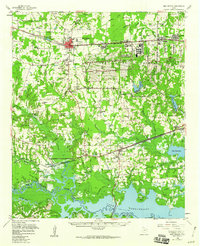 1955 New Boston1960 Print · USGSBowie County in the mid-1950s is defined by the massive footprint of the Red River Arsenal and the burgeoning waters of Lake Texarkana. Researchers can trace the migration of local centers from Old Boston to New Boston while locating family landmarks like Red Bayou Cem and Magnolia Ch.
 - 1956 Map of Texarkana
 1956 Texarkana1956 Print · USGSThe Ark-La-Tex borderlands come alive in the mid-fifties, showing the transition from a rail-dependent rural economy to a post-war industrial landscape. Researchers can trace the massive Red River Ordnance Depot and find towns like Talco, Bogata, and Naples.
 - 1956 Map of Tyler
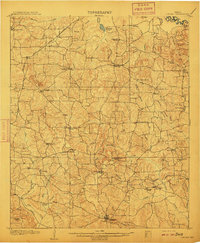
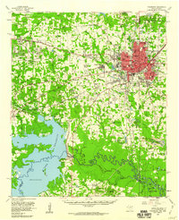
 1956 Tyler1956 Print · USGSEast Texas was a powerhouse of oil production and rail transport during the mid-fifties, centered on the sprawling East Texas Oil Field. Researchers can trace the heritage of industrial hubs like Kilgore, military sites such as the Longhorn Ordnance Works, and many rural landmarks like Mount Enterprise.5 unique versions available
 - 1961 Map of Cunningham Creek, 1963 Print
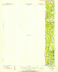
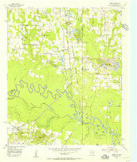
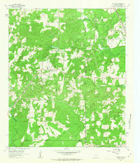
 1961 Cunningham Creek1963 Print · USGSCass County, Texas, is documented here in the early 1960s, showing a landscape of bayous and small rural settlements. Genealogists can locate family landmarks like the Bear Creek Cem and Caves Spring Ch or trace the winding course of Black Cypress Creek.
 - 1962 Map of McLeod, 1963 Print
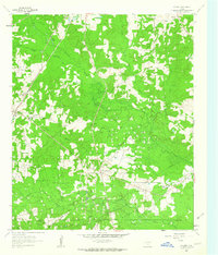
 1962 McLeod1963 Print · USGSThe Texas-Louisiana borderlands come into focus in the early sixties, showing a landscape defined by petroleum production and rural rail lines. Researchers can trace family sites and industry via the Kansas City Southern, Josey Cem, and the Refinery near North Rodessa.2 unique versions available
 - 1962 Map of Lanier, 1963 Print
 1962 Lanier1963 Print · USGSEast Texas at the start of the sixties reveals a landscape shaped by oil, iron ore, and rural settlement. Genealogists can trace family landmarks like Salem Cem and Zion Hill Cem alongside industrial features like the Strip Mines and the Texas and Pacific railroad.
 - 1962 Map of Kildare, 1963 Print
 1962 Kildare1963 Print · USGSEastern Texas oil and rail culture meet in the early sixties near the Marion County line. Genealogists and industrial historians can trace the Texas and Pacific rail line through Kildare and locate the Kildare Oil Field and Terrell Cem.2 unique versions available
 - 1962 Map of Avinger, 1964 Print
 1962 Avinger1964 Print · USGSEast Texas rail and timber lands are frozen in time during the early sixties, centered on the junction of Avinger and Hughes Springs. Genealogists and local historians can trace rural roots at Mt Moriah Ch, Traylor Sch, and family landmarks like Donaldson Mountain.2 unique versions available
 - 1962 Map of Lone Star, 1964 Print
 1962 Lone Star1964 Print · USGSMorris County in the early sixties was a hub of East Texas industry and rural life, from the growing town of Lone Star to the heavy iron works. Researchers can trace the massive Steel Plant, local landmarks like Hospital in the Pines, and old family burial grounds including South Union Cem.2 unique versions available
 - 1964 Map of Daingerfield, 1967 Print
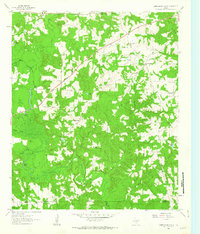
 1964 Daingerfield1967 Print · USGSMorris County was a hub of rail activity and iron-ore mining in the mid-sixties, centered on the growing town of Daingerfield. Genealogists and historians can trace the foundations of local life at Daingerfield State Park, the Black Mountain Mine, and several rural landmarks like Bradfield Ch.2 unique versions available
Showing maps 1-25 of 162
Top cities of Cass County
- Atlanta historical maps
- Linden historical maps
- Hughes Springs historical maps
- Queen City historical maps
- Avinger historical maps
- Bloomburg historical maps
See more
Frequently asked questions
- What are the different types of historical maps available for Cass County?
- What is the oldest map of Cass County?
- Where can I purchase historical maps of Cass County for my home or office?
- Where can I download high-res historical maps of Cass County?
- Are there historical topographic maps available for Cass County?
- Is there historical aerial imagery available for Cass County?
- Where are historical maps of Cass County sourced from?