Old Maps of Mulberry, Arkansas for Genealogy
Trace your family roots with 27 historic maps of Mulberry. These high-res maps reveal old neighborhoods, homesites, landmarks, and streets — helping you uncover where your ancestors lived and how the area evolved over time.
- Explore historic neighborhoods: Identify where your relatives may have lived in the 1800s or 1900s.
- Compare maps over time: Trace the changes in streets, buildings, and landmarks for multi-generational research.
- Perfect for genealogy & ancestry research: Used by family historians and researchers to map out lineage and migration.
These maps are an incredible resource for exploring your personal connection to Mulberry's past.
Mulberry, AR maps
(27)- 1890 Map of Fort Smith
 1890 Fort Smith1890 Print · USGSThe Arkansas-Indian Territory border was a landscape of rapid transition in the late nineteenth century. Genealogists and historians can trace early post offices like Jenny Lind P.O. and Oak Bower (Lavaca P.O.) or follow the path of the St. Louis and San Francisco Railroad.7 unique versions available
 - 1898 Map of Winslow #4
 1898 Winslow #41898 Print · USGSCrawford County, Arkansas, appears here during the late nineteenth century as a network of ridge-top settlements and winding creek beds. Researchers can trace the early footprints of Lancaster, Graphic, and Pleasant Hill along the banks of Mulberry Creek.
 - 1898 Map of Winslow, 1954 Print
 1898 Winslow1954 Print · USGSNorthwest Arkansas and the adjacent Indian Territory are captured here in the late nineteenth century as the railroad began to transform the high Ozarks. Genealogists can trace early homesteads and transport routes like the Quesenbury Road, Rheas Mill, and the mountain town of Winslow.
 - 1901 Map of Winslow
 1901 Winslow1901 Print · USGSThe Boston Mountains and the Arkansas border are captured here at the close of the nineteenth century, documenting the critical rail passage through the Ozarks. Genealogists and historians can trace the Frisco Line, the historic Old Wire Road, and early settlements like Cove City and Cane Hill.5 unique versions available
 - 1906 Map of Lavaca
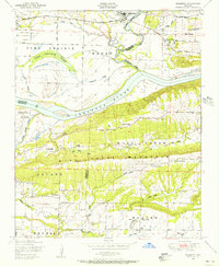
 1906 Lavaca1906 Print · USGSThe Arkansas River valley comes to life in the late nineteenth century as railroads and ridges define the growing settlements of Sebastian County. Researchers can trace the original locations of Lavaca, Alma, and Vesta, or locate family-named landmarks like Butler's Knob and Arbuckles Island.
 - 1943 Map of Fort Smith
 1943 Fort Smith1943 Print · USGSFort Smith and the Arkansas River valley are shown here during the height of the Second World War as the region became a major military hub. Genealogists and researchers can locate several rural schools and churches, such as St Marys School and Pleasant Ridge Church and Cem, alongside industrial sites like the Strip Mine and Smelter.
 - 1946 Map of Fort Smith
 1946 Fort Smith1946 Print · USGSThe Arkansas-Oklahoma borderlands appear here in the mid-forties, as new reservoirs began to transform the river valleys. Genealogists and historians can trace rail-served towns from Muskogee to Fort Smith and locate landmarks like Camp Chaffee.
 - 1947 Map of Lavaca, 1954 Print
 1947 Lavaca1954 Print · USGSThe Arkansas River valley in the late 1940s reveals a landscape of growing energy production and military expansion. Genealogists can trace family roots through Nixon Cem, Harmony Ch, and the streets of Charleston and Lavaca.
 - 1948 Map of Mulberry, 1956 Print
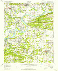
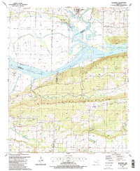
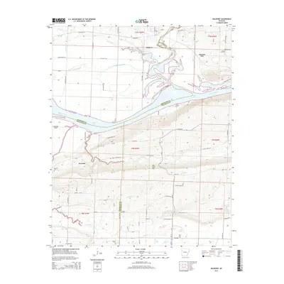
 1948 Mulberry1956 Print · USGSCrawford and Franklin counties are captured here in the late 1940s as the riverfront economy shifted between timber and transit. Genealogists can locate family landmarks like Harmony Church, Pleasant View Cemetery, and the Union School along the Arkansas River.4 unique versions available
 - 1951 Map of Mulberry
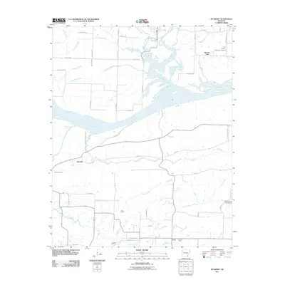
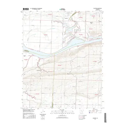
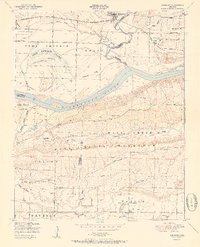 1951 Mulberry1951 Print · USGSThe Arkansas River valley near Mulberry comes alive in this mid-century survey, showcasing a landscape of fertile bottomlands and river islands. Researchers can trace rural genealogy through Pleasant View School, Bethel Church, and the winding Court House Slough.2 unique versions available
 - 1965 Map of Fort Smith
 1965 Fort Smith1965 Print · USGSEastern Oklahoma and Western Arkansas are captured here during a period of massive post-war change as new reservoirs reshaped the river valleys. Genealogists and historians can trace the rail networks of the Midland Valley RR and find established communities like Stilwell, Sallisaw, and Stigler.
 - 1967 Map of Fort Smith
 1967 Fort Smith1967 Print · USGSThe Arkansas River valley and the foothills of the Ozarks are captured here during a period of significant military and industrial activity. Researchers can trace the sprawling bounds of Camp Chaffee and Camp Gruber or locate vanished rail stops along the Midland Valley RR.
 - 1969 Map of Mountainburg SE, 1971 Print
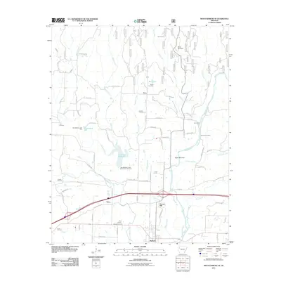
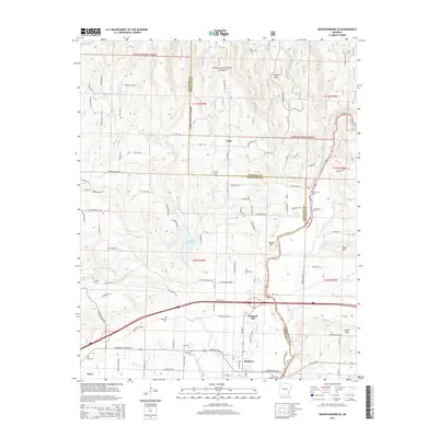
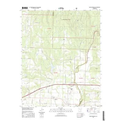
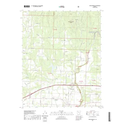
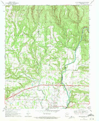 1969 Mountainburg SE1971 Print · USGSCrawford and Franklin counties are captured here in the late sixties as the modern interstate began to reshape the Ozark foothills. Genealogists and local historians can trace family locations through Concord Cem, Piney, and the Marvin Sch.3 unique versions available
 - 1978 Map of Fort Smith, 1979 Print
 1978 Fort Smith1979 Print · USGSThe Arkansas-Oklahoma borderlands in the late seventies show a landscape shaped by massive river reservoirs and sprawling military reservations. Trace the historic rail lines of the Missouri Pacific RR and locate regional landmarks like Fort Gibson, Tenkiller Ferry Lake, and Barling.2 unique versions available
 - 1978 Map of Fort Smith, 1979 Print
 1978 Fort Smith1979 Print · USGSThe Arkansas-Oklahoma borderlands in the late seventies show a region defined by river navigation, coal mining, and military expansion. You can trace industrial footprints like the Strip Mines and the vast Fort Chaffee Military Reservation.2 unique versions available
 - 1978 Map of Stilwell, 1979 Print
 1978 Stilwell1979 Print · USGSThe Oklahoma-Arkansas borderlands come alive in the late seventies, showing the transition from the Cherokee Nation hills to the Arkansas Ozarks. Researchers can trace the Kansas City Southern rail line through Stilwell, find Wrights Chapel, or locate the Northeastern State College campus in Tahlequah.
 - 1987 Map of Mulberry, 1988 Print
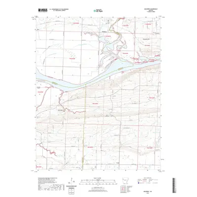
 1987 Mulberry1988 Print · USGSThe river valleys of Crawford and Franklin Counties come into focus in the late 1980s as gas extraction and rural life intersect. Researchers can locate family landmarks like Tate Cem, the Hall school, and community centers at Pleasant View and Vesta.2 unique versions available
 - 2011 Map of Mulberry, 2011 Print
 2011 Mulberry2011 Print · USGSCovers Mulberry, including Dyer, Pleasant View, and other nearby areas
 - 2011 Map of Mountainburg SE, 2011 Print
 2011 Mountainburg SE2011 Print · USGSCovers Mulberry, including Dyer, Piney, and other nearby areas
 - 2014 Map of Mountainburg SE, 2014 Print
 2014 Mountainburg SE2014 Print · USGSCovers Mulberry, including Dyer, Piney, and other nearby areas
 - 2014 Map of Mulberry, 2014 Print
 2014 Mulberry2014 Print · USGSCovers Mulberry, including Dyer, Pleasant View, and other nearby areas
 - 2017 Map of Mountainburg SE, 2017 Print
 2017 Mountainburg SE2017 Print · USGSCovers Mulberry, including Dyer, Piney, and other nearby areas
 - 2017 Map of Mulberry, 2017 Print
 2017 Mulberry2017 Print · USGSCovers Mulberry, including Dyer, Pleasant View, and other nearby areas
 - 2020 Map of Mulberry, 2020 Print
 2020 Mulberry2020 Print · USGSCovers Mulberry, including Dyer, Pleasant View, and other nearby areas
 - 2020 Map of Mountainburg SE, 2020 Print
 2020 Mountainburg SE2020 Print · USGSCovers Mulberry, including Dyer, Piney, and other nearby areas
Showing maps 1-25 of 27
Top cities near Mulberry
- Fort Smith historical maps
- Alma historical maps
- Barling historical maps
- Ozark historical maps
- Charleston historical maps
- Lavaca historical maps
See more
Top neighborhoods of Mulberry
Frequently asked questions
- What are the different types of historical maps available for Mulberry?
- What is the oldest map of Mulberry?
- Where can I purchase historical maps of Mulberry for my home or office?
- Where can I download high-res historical maps of Mulberry?
- Are there historical topographic maps available for Mulberry?
- Is there historical aerial imagery available for Mulberry?
- Where are historical maps of Mulberry sourced from?