Old Maps of Marion, Arkansas for Genealogy
Trace your family roots with 37 historic maps of Marion. These high-res maps reveal old neighborhoods, homesites, landmarks, and streets — helping you uncover where your ancestors lived and how the area evolved over time.
- Explore historic neighborhoods: Identify where your relatives may have lived in the 1800s or 1900s.
- Compare maps over time: Trace the changes in streets, buildings, and landmarks for multi-generational research.
- Perfect for genealogy & ancestry research: Used by family historians and researchers to map out lineage and migration.
These maps are an incredible resource for exploring your personal connection to Marion's past.
Marion, AR maps
(37)- 1916 Map of Memphis, 1954 Print
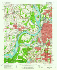
 1916 Memphis1954 Print · USGSMemphis and the Mississippi River bottomlands appear here in the early twentieth century, showing a landscape shaped by river transport and rail expansion. Genealogists and historians can locate rural landmarks like Barton Store, the Levi School, and the community of Mound City.
 - 1925 Map of Memphis
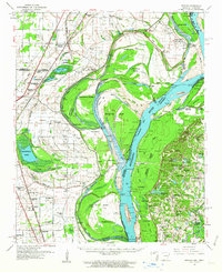
 1925 Memphis1925 Print · USGSThe Memphis riverfront and its Arkansas neighbors are shown here in the mid-1920s as modern highway projects began to parallel the extensive rail network. Genealogists can locate family-named features like Bertons Store, Mound City School, and Plunkett Chapel.
 - 1927 Map of Memphis
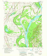
 1927 Memphis1927 Print · USGSMemphis and the Mississippi River bottomlands are captured here in the late twenties during a period of massive rail and river commerce. Genealogists can locate family landmarks like Plunkett Chapel, Levi School, and the Bunker Hill cemetery.2 unique versions available
 - 1931 Map of Jericho
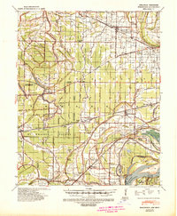
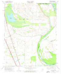
 1931 Jericho1931 Print · USGSThe Arkansas-Tennessee borderlands appear here in the early 1930s, defined by the winding Mississippi and its evolving islands. Genealogists and researchers can trace old river landings like Pecan Point, rail stops at Jericho, and the rural Mt Vernon Church.
 - 1939 Map of Jericho, 1941 Print
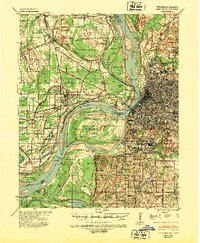
 1939 Jericho1941 Print · USGSThe shifting Mississippi River bottomlands come to life in this late 1930s survey of the Arkansas-Tennessee border. Researchers can trace historical river landings like Happy Valley Ldg, see the vanished tracks of the St Louis San Francisco RR, and locate rural landmarks such as Mt Olive Ch & Sch.
 - 1939 Map of Edmondson, 1942 Print
 1939 Edmondson1942 Print · USGSCrittenden and St. Francis Counties are shown in the late thirties as a landscape of rail-connected farming towns and bayous. Genealogists can locate family landmarks like Garrett Cem, Macedonia Ch, and the combined Bellmeade Sch & Ch.
 - 1939 Map of Memphis, 1944 Print
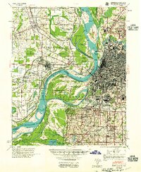
 1939 Memphis1944 Print · USGSThe Mississippi River corridor near Memphis and West Memphis is captured here just before mid-century. Researchers can trace the legacy of the riverfront through landmarks like Ensley Plantation, Bridge Junction, and historic grounds at Ross Hill Cem.
 - 1952 Map of Jericho
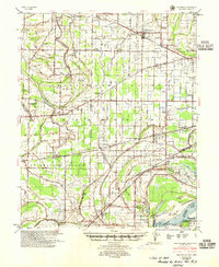
 1952 Jericho1952 Print · USGSThe Mississippi River's shifting course defines this borderland during the early 1950s, where Arkansas and Tennessee meet in a maze of chutes and islands. Researchers can trace rural lineages through numerous local sites like St Pauls Ch & Cem, Meneshea, and the Clarkedale Post Office.
 - 1953 Map of Memphis, 1966 Print
 1953 Memphis1966 Print · USGSEastern Arkansas and the Memphis riverfront are shown here during the mid-century period of regional growth and river management. Local historians can trace the paths of the Chicago Rock Island & Pacific RR through Forrest City or locate river landmarks like President's Island.3 unique versions available
 - 1954 Map of Edmondson, 1955 Print
 1954 Edmondson1955 Print · USGSCrittenden and St. Francis counties in the mid-fifties show a landscape of intricate Delta bayous and growing rural settlements. Genealogists can trace family roots through numerous local landmarks like Truevine Ch & Cem, Greasy Corner, and Crawfordsville.2 unique versions available
 - 1955 Map of Memphis
 1955 Memphis1955 Print · USGSMemphis and its Arkansas neighbors are shown here in the mid-fifties, during a time of major river engineering and rail expansion. Genealogists and historians can trace the foundations of local communities through landmarks like Ensley Plantation, Elmwood Cem, and the rural Riceville Sch.
 - 1956 Map of Memphis
 1956 Memphis1956 Print · USGSThe Mississippi Delta and the bluffs of West Tennessee meet in the mid-fifties, showing a landscape defined by massive river systems and rail hubs. Researchers can trace the path of Crowleys Ridge or locate vanished river landings near Centennial Island and Island No 35.
 - 1960 Map of Memphis, 1963 Print
 1960 Memphis1963 Print · USGSGreater Memphis and its Arkansas neighbors are shown at a peak of industrial and suburban growth. Trace family history through old landmarks like Locella Ch, the Marion Flying Service, and established cemeteries such as Forest Hill Cem.2 unique versions available
 - 1961 Map of Jericho, 1963 Print
 1961 Jericho1963 Print · USGSThe Mississippi River delta at the start of the 1960s reveals a world of island farming and rail-side settlements along the Arkansas-Tennessee border. Genealogists can trace family roots through numerous local landmarks, including Jericho, Clarkedale, and the St Paul School and Church.
 - 1962 Map of Jericho
 1962 Jericho1962 Print · USGSThe riverfront border of Arkansas and Tennessee is captured here in the early sixties, showing a landscape shaped by the Mississippi River. Genealogists and local historians can trace family roots through sites like Jericho, James Mill, and Lambethville, or locate rural landmarks such as Pecan Point Cem and the Shawnee Sch.
 - 1966 Map of West Memphis, 1967 Print
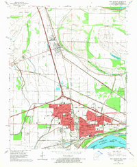 1966 West Memphis1967 Print · USGSMid-century West Memphis and the neighboring seat of Marion are shown during a period of rapid expansion near the Mississippi. Researchers can trace the mid-century rail networks and find local landmarks like the Southland Park Racetrack, Mound City, and the West Memphis Airport.3 unique versions available
 - 1970 Map of Jericho, 1974 Print
 1970 Jericho1974 Print · USGSCrittenden County, Arkansas, and the Mississippi riverfront appear in the 1970s as a managed landscape of agriculture and wildlife preservation. Family historians can trace small-town life in Jericho and Clarkedale, or locate rural markers like Malone Cem and New Mt Zion Ch.2 unique versions available
 - 1975 Map of Jericho
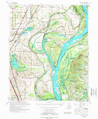 1975 Jericho1975 Print · USGSThe Mississippi River meanders through the Arkansas and Tennessee borderlands in the mid-seventies, documenting a landscape shaped by massive river bars and drainage ditches. Trace family sites at Jericho, Frenchmans Bayou, and small country landmarks like St Paul Cem or Paradise Ch.
 - 1975 Map of Edmondson NE, 1976 Print
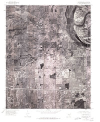 1975 Edmondson NE1976 Print · USGSCrittenden County's agricultural heartland is documented in the mid-1970s through this detailed aerial survey. Genealogists and local historians can trace exact farmstead locations and rural crossroads settlements like Crawfordsville, Vincent, and Lehi.
 - 1981 Map of Crawfordsville, 1982 Print
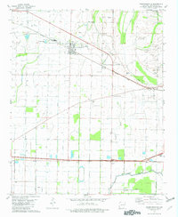 1981 Crawfordsville1982 Print · USGSCrittenden County's agricultural heartland is documented here in the early eighties, centered on the rail crossroads of Crawfordsville. Genealogists and local historians can locate numerous rural landmarks like St Stephens Cem, Corinthian Ch, and the small settlement of Julius.2 unique versions available
 - 1986 Map of Memphis West
 1986 Memphis West1986 Print · USGSThe Mississippi River delta and the rise of Crowleys Ridge define this mid-1980s look at the Mid-South. Researchers can trace the development of West Memphis and Marion or locate landmarks like Crittenden Mem Cem and Village Creek State Park.2 unique versions available
 - 1997 Map of West Memphis, 2001 Print
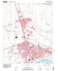 1997 West Memphis2001 Print · USGSCrittenden County at the close of the twentieth century shows the expanding urban footprints of West Memphis and Marion. Researchers can locate local landmarks like the Southland Park Racetrack, Mound City, and the Crittenden Memorial Park (Cem).
 - 2011 Map of Crawfordsville, 2011 Print
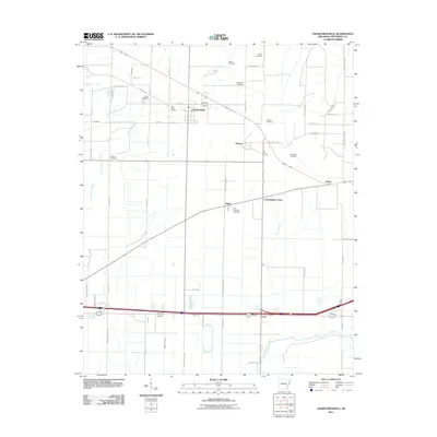 2011 Crawfordsville2011 Print · USGSCovers Marion, including West Memphis, Crawfordsville, and other nearby areas
 - 2011 Map of West Memphis, 2011 Print
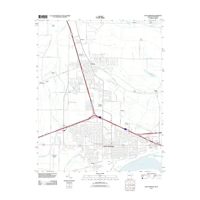 2011 West Memphis2011 Print · USGSCovers Marion, including Memphis, West Memphis, and other nearby areas
 - 2011 Map of Jericho, 2011 Print
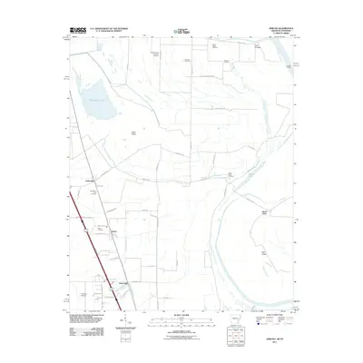 2011 Jericho2011 Print · USGSCovers Marion, including Clarkedale, Jericho, and other nearby areas
Showing maps 1-25 of 37
Top cities near Marion
- Memphis historical maps
- Southaven historical maps
- West Memphis historical maps
- Turrell historical maps
- Crawfordsville historical maps
- Clarkedale historical maps
See more
Top neighborhoods of Marion
Frequently asked questions
- What are the different types of historical maps available for Marion?
- What is the oldest map of Marion?
- Where can I purchase historical maps of Marion for my home or office?
- Where can I download high-res historical maps of Marion?
- Are there historical topographic maps available for Marion?
- Is there historical aerial imagery available for Marion?
- Where are historical maps of Marion sourced from?