Old Maps of Altus, Arkansas for Metal Detecting
Plan your next treasure hunt with 24 historic maps of Altus. Find old homesites, ghost towns, trails, and gathering spots that may be lost to time — perfect for identifying promising metal detecting locations.
- Locate forgotten sites: Uncover places like long-lost settlements, abandoned rail lines, or gathering spots.
- Plan better hunts: Use map overlays combined with LiDAR or satellite views to narrow in on historically rich areas.
- Made for detectorists: Thousands of hobbyists use these maps to discover relics, coins, and hidden history.
Use these historic maps to boost your research and find new opportunities beneath the surface of Altus.
Altus, AR maps
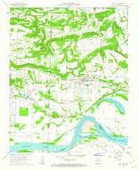
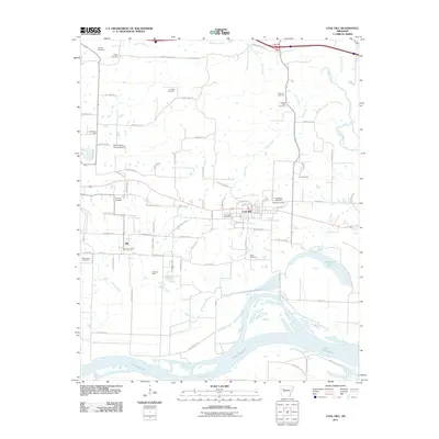
(24)- 1887 Map of Magazine Mountain #1
 1887 Magazine Mountain #11887 Print · USGSThe Arkansas River valley in the late 1880s is captured here just as the railroad began reshaping the local economy. Genealogists and researchers can trace early homesteads and rail stops through Paris, Coal Hill, and the river landings at Pattersons Bluff.
 - 1887 Map of Magazine Mountain #2
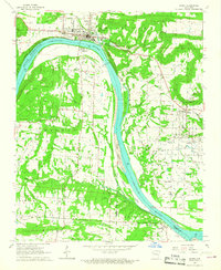
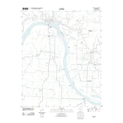
 1887 Magazine Mountain #21887 Print · USGSThe Arkansas River valley and its late-19th-century rail corridor are meticulously detailed in this survey of Franklin County. Genealogists can locate family names and vanished sites across Staked Prairie or explore old river and rail towns like Webb City and Altus.
 - 1887 Map of Magazine Mountain
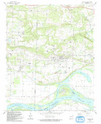
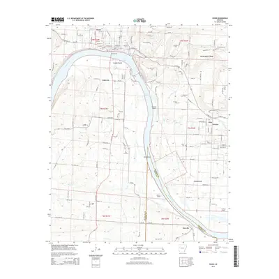
 1887 Magazine Mountain1887 Print · USGSNorthwest Arkansas in the 1880s is defined here by the river-and-rail economy along the Arkansas River valley. Genealogists and historians can trace long-forgotten post offices like Burnett Springs and early rail stops such as Coal Hill.
 - 1890 Map of Magazine Mountain
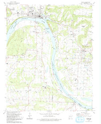
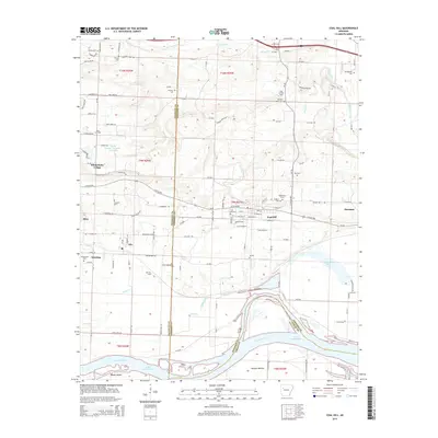
 1890 Magazine Mountain1890 Print · USGSThe Arkansas River Valley is captured here in the late nineteenth century as rail transport begins to eclipse river travel. Genealogists can trace early homesteads and community hubs like Paris, Booneville, and the remote Burnett Springs.6 unique versions available
 - 1956 Map of Russellville
 1956 Russellville1956 Print · USGSThe Arkansas River valley and the surrounding Boston Mountains are captured here in the mid-fifties, showing a landscape of small timber towns and new reservoirs. Genealogists can trace family roots through upland settlements like Pelsor and Witts Springs or locate the campus of Arkansas Polytechnic College.2 unique versions available
 - 1961 Map of Coal Hill, 1962 Print
 1961 Coal Hill1962 Print · USGSThe mining and rail corridor of Johnson County comes into focus in the early sixties, showing the industrial landscape before modern reclamation. Genealogists and researchers can trace family plots at Houston Cem or Hardgraves Cem and follow the old MISSOURI PACIFIC line through Coal Hill.2 unique versions available
 - 1964 Map of Russellville
 1964 Russellville1964 Print · USGSMid-century Central Arkansas is defined here by the river-valley towns and the surrounding mountain ranges before the full expansion of the interstate system. Genealogists and historians can trace rail-town development along the Missouri Pacific Railroad and locate landmarks like Arkansas Polytechnic College or Petit Jean State Park.
 - 1966 Map of Ozark, 1967 Print
 1966 Ozark1967 Print · USGSThe Arkansas River valley undergoes major changes in the 1960s as industrial progress meets traditional settlements. Genealogists and local historians can trace family roots through Highland Cemetery and St Marys Ch, or locate sites like Webb City Sch before the reservoir waters rose.2 unique versions available
 - 1977 Map of Russellville
 1977 Russellville1977 Print · USGSThe Arkansas River Valley and surrounding Ozark Mountains are documented here during a period of significant postwar growth and infrastructure development. Genealogists and researchers can locate family landmarks such as Mount Carmel Cem, St Josephs Church, and several remote Coal Mine sites along the Missouri Pacific RR line.
 - 1984 Map of Russellville
 1984 Russellville1984 Print · USGSThe Arkansas River valley in the mid-eighties shows a landscape defined by the rise of Lake Dardanelle and the enduring presence of the Ozark National Forest. Researchers can find historical institutions like Arkansas Tech Univ and Sacred Heart Church or trace the routes of the Missouri Pacific RR.2 unique versions available
 - 1984 Map of Russellville
 1984 Russellville1984 Print · USGSThe Arkansas River valley was undergoing significant change in the 1950s as transportation and water management reshaped the region from Russellville to Conway. Researchers can trace the era's rail networks like the Missouri Pacific RR and explore landmarks like Magazine Mountain and Petit Jean State Park.
 - 1992 Map of Russellville, 1993 Print
 1992 Russellville1993 Print · USGSCentral Arkansas in the early nineties shows a landscape defined by the Arkansas River valley and the surrounding national forests. Trace the development of river towns like Russellville and Dardanelle alongside landmarks such as Lake Dardanelle and Magazine Mtn.
 - 1993 Map of Coal Hill
 1993 Coal Hill1993 Print · USGSCoal Hill and the Arkansas River valley are shown in the early nineties as the region balanced its coal mining heritage with the waters of Lake Dardanelle. Genealogists can locate numerous family burial sites like Huddleston Cem and Burnett Cem near the Strip Mine workings.
 - 1993 Map of Ozark
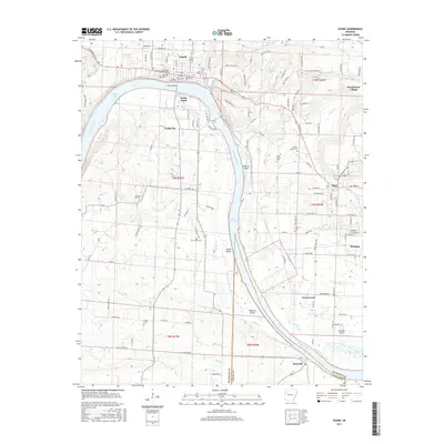
 1993 Ozark1993 Print · USGSThe riverfront town of Ozark and the surrounding Arkansas River valley are shown in the early nineties, centered on the engineering of the Ozark-Jeta Taylor Lock and Dam. Researchers can trace rural lineages through sites like Pilot Grove Cem, St Marys Ch, and the town of Denning.
 - 2011 Map of Coal Hill, 2011 Print
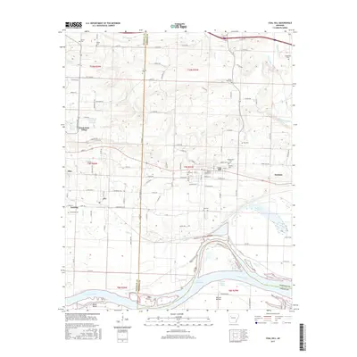
 2011 Coal Hill2011 Print · USGSCovers Altus, including Coal Hill, Hartman, and other nearby areas
 - 2011 Map of Ozark, 2011 Print
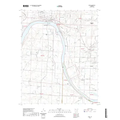
 2011 Ozark2011 Print · USGSCovers Altus, including Ozark, Denning, and other nearby areas
 - 2014 Map of Ozark, 2014 Print
 2014 Ozark2014 Print · USGSCovers Altus, including Ozark, Denning, and other nearby areas
 - 2014 Map of Coal Hill, 2014 Print
 2014 Coal Hill2014 Print · USGSCovers Altus, including Coal Hill, Hartman, and other nearby areas
 - 2017 Map of Coal Hill, 2017 Print
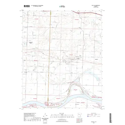
 2017 Coal Hill2017 Print · USGSCovers Altus, including Coal Hill, Hartman, and other nearby areas
 - 2017 Map of Ozark, 2017 Print
 2017 Ozark2017 Print · USGSCovers Altus, including Ozark, Denning, and other nearby areas
 - 2020 Map of Ozark, 2020 Print
 2020 Ozark2020 Print · USGSCovers Altus, including Ozark, Denning, and other nearby areas
 - 2020 Map of Coal Hill, 2020 Print
 2020 Coal Hill2020 Print · USGSCovers Altus, including Coal Hill, Hartman, and other nearby areas
 - 2024 Map of Ozark, 2024 Print
 2024 Ozark2024 Print · USGSThe riverfront and rolling hills of Franklin County come into focus in this contemporary survey of the Ozark region. Researchers can trace family history through numerous rural sites like Nickles Chapel Cem and Pond Creek Cem, or explore the limits of Wiederkehr Village and Altus.
 - 2024 Map of Coal Hill, 2024 Print
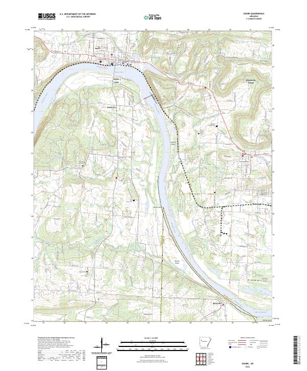
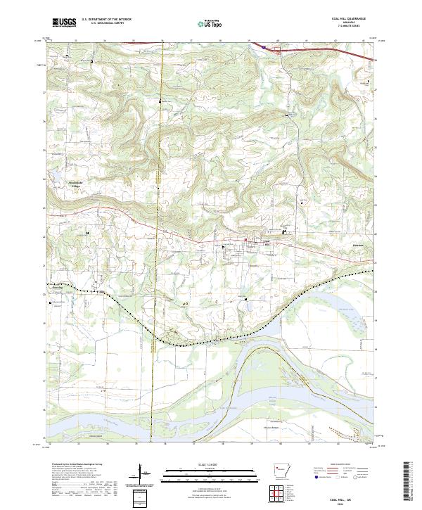 2024 Coal Hill2024 Print · USGSThe Arkansas River valley near Coal Hill comes into focus in this recent survey of Johnson and Franklin Counties. Family historians can locate numerous burial grounds like Hardgraves Cem and Possum Walk Cem, while following the river downstream past Okane Island and McLean Bottom.
End of results
Showing maps 1-24 of 24
Top cities near Altus
- Ozark historical maps
- Paris historical maps
- Coal Hill historical maps
- Hartman historical maps
- Subiaco historical maps
- Branch historical maps
See more
Frequently asked questions
- What are the different types of historical maps available for Altus?
- What is the oldest map of Altus?
- Where can I purchase historical maps of Altus for my home or office?
- Where can I download high-res historical maps of Altus?
- Are there historical topographic maps available for Altus?
- Is there historical aerial imagery available for Altus?
- Where are historical maps of Altus sourced from?