Old Maps of Cecil, Arkansas for Metal Detecting
Plan your next treasure hunt with 16 historic maps of Cecil. Find old homesites, ghost towns, trails, and gathering spots that may be lost to time — perfect for identifying promising metal detecting locations.
- Locate forgotten sites: Uncover places like long-lost settlements, abandoned rail lines, or gathering spots.
- Plan better hunts: Use map overlays combined with LiDAR or satellite views to narrow in on historically rich areas.
- Made for detectorists: Thousands of hobbyists use these maps to discover relics, coins, and hidden history.
Use these historic maps to boost your research and find new opportunities beneath the surface of Cecil.
Cecil, AR maps
(16)- 1887 Map of Magazine Mountain #2
 1887 Magazine Mountain #21887 Print · USGSThe Arkansas River valley and its late-19th-century rail corridor are meticulously detailed in this survey of Franklin County. Genealogists can locate family names and vanished sites across Staked Prairie or explore old river and rail towns like Webb City and Altus.
 - 1887 Map of Magazine Mountain
 1887 Magazine Mountain1887 Print · USGSNorthwest Arkansas in the 1880s is defined here by the river-and-rail economy along the Arkansas River valley. Genealogists and historians can trace long-forgotten post offices like Burnett Springs and early rail stops such as Coal Hill.
 - 1890 Map of Magazine Mountain
 1890 Magazine Mountain1890 Print · USGSThe Arkansas River Valley is captured here in the late nineteenth century as rail transport begins to eclipse river travel. Genealogists can trace early homesteads and community hubs like Paris, Booneville, and the remote Burnett Springs.6 unique versions available
 - 1956 Map of Russellville
 1956 Russellville1956 Print · USGSThe Arkansas River valley and the surrounding Boston Mountains are captured here in the mid-fifties, showing a landscape of small timber towns and new reservoirs. Genealogists can trace family roots through upland settlements like Pelsor and Witts Springs or locate the campus of Arkansas Polytechnic College.2 unique versions available
 - 1964 Map of Russellville
 1964 Russellville1964 Print · USGSMid-century Central Arkansas is defined here by the river-valley towns and the surrounding mountain ranges before the full expansion of the interstate system. Genealogists and historians can trace rail-town development along the Missouri Pacific Railroad and locate landmarks like Arkansas Polytechnic College or Petit Jean State Park.
 - 1965 Map of Cecil, 1967 Print
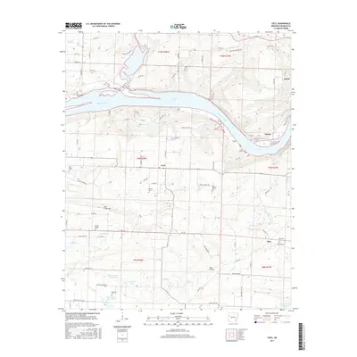
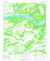 1965 Cecil1967 Print · USGSThe Arkansas River shoreline and energy landscape of the mid-1960s are captured here during a time of industrial development. Genealogists can trace family landmarks like Patterson Cem and Oak Bend Ch, or locate the Cecil Gas Field.2 unique versions available
 - 1977 Map of Russellville
 1977 Russellville1977 Print · USGSThe Arkansas River Valley and surrounding Ozark Mountains are documented here during a period of significant postwar growth and infrastructure development. Genealogists and researchers can locate family landmarks such as Mount Carmel Cem, St Josephs Church, and several remote Coal Mine sites along the Missouri Pacific RR line.
 - 1984 Map of Russellville
 1984 Russellville1984 Print · USGSThe Arkansas River valley in the mid-eighties shows a landscape defined by the rise of Lake Dardanelle and the enduring presence of the Ozark National Forest. Researchers can find historical institutions like Arkansas Tech Univ and Sacred Heart Church or trace the routes of the Missouri Pacific RR.2 unique versions available
 - 1984 Map of Russellville
 1984 Russellville1984 Print · USGSThe Arkansas River valley was undergoing significant change in the 1950s as transportation and water management reshaped the region from Russellville to Conway. Researchers can trace the era's rail networks like the Missouri Pacific RR and explore landmarks like Magazine Mountain and Petit Jean State Park.
 - 1992 Map of Russellville, 1993 Print
 1992 Russellville1993 Print · USGSCentral Arkansas in the early nineties shows a landscape defined by the Arkansas River valley and the surrounding national forests. Trace the development of river towns like Russellville and Dardanelle alongside landmarks such as Lake Dardanelle and Magazine Mtn.
 - 1993 Map of Cecil
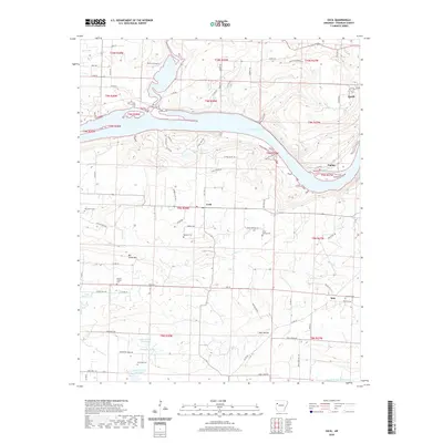
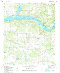 1993 Cecil1993 Print · USGSFranklin County's river bluffs and rural uplands are shown here in the early 1990s as the Arkansas River flows past Citadel Bluff. Researchers can locate family landmarks such as Berkley Cem, Oak Bend Ch, and the small community of Cecil.
 - 2011 Map of Cecil, 2011 Print
 2011 Cecil2011 Print · USGSCovers Cecil, including Meg, Poping, and other nearby areas
 - 2014 Map of Cecil, 2014 Print
 2014 Cecil2014 Print · USGSCovers Cecil, including Meg, Poping, and other nearby areas
 - 2017 Map of Cecil, 2017 Print
 2017 Cecil2017 Print · USGSCovers Cecil, including Meg, Poping, and other nearby areas
 - 2020 Map of Cecil, 2020 Print
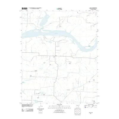
 2020 Cecil2020 Print · USGSCovers Cecil, including Meg, Poping, and other nearby areas
 - 2024 Map of Cecil, 2024 Print
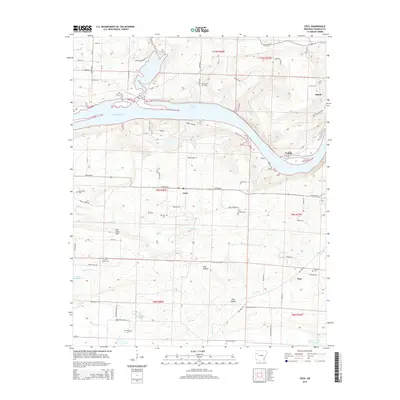
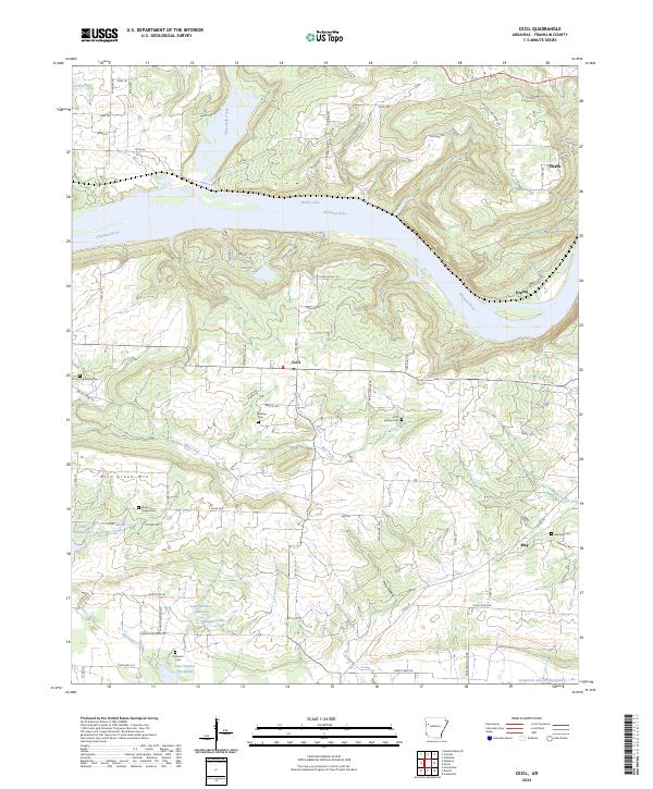 2024 Cecil2024 Print · USGSFranklin County's river valley and southern uplands are shown in detail during the early twenty-first century. Researchers can trace several rural burial grounds like Browns Chapel Cem and Patterson Cem alongside small communities such as Cecil and Meg.
End of results
Showing maps 1-16 of 16
Top cities near Cecil
- Alma historical maps
- Ozark historical maps
- Paris historical maps
- Charleston historical maps
- Lavaca historical maps
- Mulberry historical maps
See more
Frequently asked questions
- What are the different types of historical maps available for Cecil?
- What is the oldest map of Cecil?
- Where can I purchase historical maps of Cecil for my home or office?
- Where can I download high-res historical maps of Cecil?
- Are there historical topographic maps available for Cecil?
- Is there historical aerial imagery available for Cecil?
- Where are historical maps of Cecil sourced from?