1970s Maps of Saint Paul, Arkansas
Explore 2 historic maps of Saint Paul from the 1970s. These maps offer a rare glimpse into what life looked like during the 1970s — showing old roads, neighborhoods, homes, and landmarks that have changed or disappeared over time.
Whether you're researching your family's past, planning a metal detecting trip, or studying how Saint Paul's landscape evolved across the 1970s, these high-resolution maps are a powerful tool for exploring the history of this region.
- Focus on a specific era: All maps on this page are from the 1970s, giving you a focused view of this time period.
- See what’s changed: Compare century-old streets, trails, and buildings to today's modern landscape using overlays and satellite layers.
- Research with precision: Use these maps for genealogy, historical research, land use analysis, or educational projects.
- View, download, or print: Maps are fully viewable online in high resolution, and can be downloaded or printed for your own records.
Start exploring Saint Paul's history through authentic maps from the 1970s. This is your window into the past.
Saint Paul, AR maps
(2)- 1973 Map of St. Paul, 1976 Print
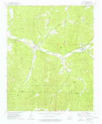 1973 St. Paul1976 Print · USGSThe mountain valleys of southern Madison County come into focus during the early 1970s, centered on the river settlements of St Paul and Combs. Researchers can locate several remote cemeteries including Riverside Cem and Cragar Cem, or trace landmarks like the Fly Gap Lookout Tower.4 unique versions available
 - 1977 Map of Russellville
 1977 Russellville1977 Print · USGSThe Arkansas River Valley and surrounding Ozark Mountains are documented here during a period of significant postwar growth and infrastructure development. Genealogists and researchers can locate family landmarks such as Mount Carmel Cem, St Josephs Church, and several remote Coal Mine sites along the Missouri Pacific RR line.
End of results
Showing maps 1-2 of 2
Frequently asked questions
- What are the different types of historical maps available for Saint Paul?
- What is the oldest map of Saint Paul?
- Where can I purchase historical maps of Saint Paul for my home or office?
- Where can I download high-res historical maps of Saint Paul?
- Are there historical topographic maps available for Saint Paul?
- Is there historical aerial imagery available for Saint Paul?
- Where are historical maps of Saint Paul sourced from?