Old Maps of Texarkana, Arkansas for Academic Research
Study the evolution of Texarkana with 53 high-resolution historic maps. Whether you're teaching, researching, or modeling changes in land use, these maps provide essential visual documentation of urban, environmental, and geographic change.
- Analyze long-term change: Track patterns in development, transportation, and natural features.
- Ideal for environmental or urban studies: Support academic projects with primary historical map data.
- Use in the classroom or lab: Educators and researchers rely on these maps to bring historical context to life.
These maps are a powerful tool for teaching, research, and visualizing how Texarkana has changed over the decades.
Texarkana, AR maps
(53)- 1909 Map of Texarkana
 1909 Texarkana1909 Print · USGSTexarkana emerged as a bustling tri-state rail center at the dawn of the twentieth century, defined by its complex web of iron roads and river commerce. Genealogists and local historians can trace family roots at White Chapel, the Stateline Ferry, and rural sites like Alamo Mills.5 unique versions available
 - 1950 Map of Ogden, 1966 Print
 1950 Ogden1966 Print · USGSThe riverlands of Southwest Arkansas are captured here in the mid-century, where the Red River meanders through a landscape of oxbow lakes and bayous. Researchers can trace the heritage of local communities through named schools and churches like Rosenwald Sch, Summer Hill Ch, and the settlement of Ogden.4 unique versions available
 - 1951 Map of Ogden
 1951 Ogden1951 Print · USGSThe Red River borderlands of Arkansas and Texas come alive in this mid-century survey, showcasing a landscape of shifting oxbows and rural crossings. Researchers can trace local heritage through the Rosenwald Sch, St Johns Ch, and the rail stop at Ogden.2 unique versions available
 - 1951 Map of Homan, 1952 Print
 1951 Homan1952 Print · USGSThe Red River lowlands of Miller County are captured here in the early fifties, showing a landscape shaped by water and rail. Genealogists and local historians can trace the community around Homan, Paup Cem, and the Missouri Pacific railroad corridor.6 unique versions available
 - 1952 Map of Mandeville, 1953 Print
 1952 Mandeville1953 Print · USGSMiller County, Arkansas, is captured here in the early fifties as the regional rail and aviation networks were firmly established. Genealogists can trace family names at Rondo Cem and Polk Cem, or locate landmarks like Harrison Chapel.4 unique versions available
 - 1952 Map of Fouke, 1953 Print
 1952 Fouke1953 Print · USGSMiller County's rural landscape is captured here in the early fifties, centered on the Texas and Pacific RR corridor. Genealogists can locate family landmarks like Gibson Cem and old congregation sites including Salem Ch and Boyd Ch.5 unique versions available
 - 1953 Map of Texarkana, 1964 Print
 1953 Texarkana1964 Print · USGSThe Texas-Arkansas borderlands are captured here in the mid-fifties, during a decade of massive military and hydraulic engineering projects. Genealogists and researchers can locate family landmarks like Old Boston Cem, Siloam Ch, and the vast Red River Arsenal.4 unique versions available
 - 1953 Map of El Dorado, 1967 Print
 1953 El Dorado1967 Print · USGSSouth Arkansas in the mid-1960s was a landscape of industrial growth and river-fed commerce. Researchers can trace the extensive Oil and Gas Fields around Magnolia, the expansive U S Naval Ammunition Depot, and the busy rail lines of the Missouri Pacific.3 unique versions available
 - 1954 Map of Texarkana, 1955 Print
 1954 Texarkana1955 Print · USGSTexarkana straddles the state line in the mid-fifties, serving as a primary crossroads for four major railroad lines. Genealogists and local historians can trace the foundations of the city through sites like the Railway Hospital, Holy Cross Cem, and Texarkana Junior College.6 unique versions available
 - 1954 Map of Domino, 1955 Print
 1954 Domino1955 Print · USGSCrossing the Texas and Arkansas border in the mid-fifties, this area shows a landscape defined by the winding Sulphur River and active gravel mining. Genealogists can locate rural landmarks like Buchanan Cem, Bright Star Ch, and the settlement of Domino.5 unique versions available
 - 1954 Map of Texarkana, 1960 Print
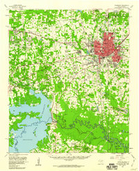 1954 Texarkana1960 Print · USGSTexarkana and its surrounding borderlands are captured at a mid-century peak of industrial and suburban growth. Genealogists and historians can trace the foundations of Wake Village, locate the Red River Arsenal, and find rural landmarks like Hampton Chapel and Red Springs Cem.2 unique versions available
 - 1956 Map of Texarkana
 1956 Texarkana1956 Print · USGSThe Ark-La-Tex borderlands come alive in the mid-fifties, showing the transition from a rail-dependent rural economy to a post-war industrial landscape. Researchers can trace the massive Red River Ordnance Depot and find towns like Talco, Bogata, and Naples.
 - 1957 Map of El Dorado
 1957 El Dorado1957 Print · USGSSouth Arkansas in the mid-1950s was a critical hub of military logistics and rail-river commerce. Genealogists and historians can trace family land across the Arkansas Louisiana border and locate sites like the U.S. Naval Ammunition Depot or the rail junctions at Magnolia and Camden.
 - 1958 Map of El Dorado
 1958 El Dorado1958 Print · USGSSouthern Arkansas and the Louisiana borderlands are shown during a period of heavy rail traffic and defense industry activity. Researchers can trace the legacy of the U. S. Naval Ammunition Depot or locate family roots in Smackover, Huttig, and Nashville.3 unique versions available
 - 1960 Map of El Dorado
 1960 El Dorado1960 Print · USGSSouth Central Arkansas in the late fifties was a hub of energy production and defense industry. Researchers can trace the extensive Oil and Gas Fields around El Dorado or locate family landmarks like Old Park Cem and New Hope Church.
 - 1986 Map of Hope
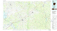 1986 Hope1986 Print · USGSSouthwest Arkansas in the mid-eighties was a landscape of rail-connected towns and timbered ridges. Researchers can trace the Missouri Pacific Railroad corridor through Hope or locate local landmarks like De Ann Cem and Poison Springs State Forest.2 unique versions available
 - 1986 Map of Texarkana
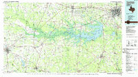 1986 Texarkana1986 Print · USGSThe Texas-Arkansas borderlands are captured here in the mid-eighties as a hub of military industry and river-basin geography. Genealogists and local historians can locate rural landmarks like Red Hill Cem, Coopers Chapel, and the Lone Star Army Ammunition Plant.
 - 1986 Map of Idabel
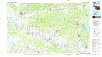 1986 Idabel1986 Print · USGSThe tri-state borderlands of Oklahoma, Arkansas, and Texas come alive in the 1980s, centered on the Red River and the timberlands of the Ouachita National Forest. Genealogists and historians can trace the paths of the Missouri Pacific railroad through towns like Bokhoma and Ashdown.
 - 1986 Map of Magnolia
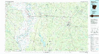 1986 Magnolia1986 Print · USGSThe Arkansas-Louisiana borderlands in the mid-1980s are defined by the river systems and the reach of the petroleum industry. Genealogists and historians can trace the St Louis Southwestern Railroad through Stamps or locate rural sites like Cleveland Cem and Brightstar.2 unique versions available
 - 1989 Map of El Dorado, 1990 Print
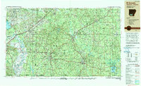 1989 El Dorado1990 Print · USGSThe Arkansas-Louisiana borderlands in the late eighties show a landscape of heavy industry and wildlife conservation centered on the Ouachita River. Researchers can trace the legacy of timber and transport via the Missouri Pacific RR, Poison Springs State Forest, and the vast Felsenthal Pool.
 - 1990 Map of Idabel
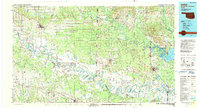 1990 Idabel1990 Print · USGSThe tri-state borderlands of Oklahoma, Arkansas, and Texas come alive in this late twentieth-century survey of the Red River valley. Researchers can trace the legacy of rail and river commerce through settlements like Bokhoma and Ashdown or find rural landmarks such as Hill Chapel.
 - 1992 Map of Texarkana
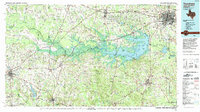 1992 Texarkana1992 Print · USGSThe Ark-La-Tex border region comes into focus in the early nineties, centered on the sprawling waters of Wright Patman Lake. Genealogists and historians can trace rail-town development and rural roots through Old Union Cem, the Red River Army Depot, and Dalby Springs Cem.
 - 2001 Map of Texarkana, 2004 Print
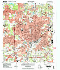 2001 Texarkana2004 Print · USGSTexarkana sits at a major crossroads of the South at the start of the new millennium, spanning the border between Texas and Arkansas. Researchers can trace the layout of civic landmarks and schools, from the Federal Correctional Institution to Texarkana Junior College and the Iron Mountain Tabernacle.
 - 2011 Map of Fouke, 2011 Print
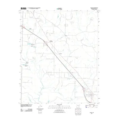 2011 Fouke2011 Print · USGSMiller County at the start of the 2010s reveals a landscape of rural junctions and managed waterways north of the Louisiana border. Genealogists and researchers can trace the roads connecting Fouke, Ferguson Crossroads, and the historic Gibson Cemetery.
 - 2011 Map of Ogden, 2011 Print
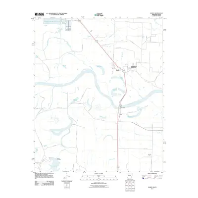 2011 Ogden2011 Print · USGSThe Red River floodplain along the Arkansas-Texas border comes to life in this early twenty-first-century survey. Genealogists and local historians can trace the roads around Ogden, locate the Flying W Airport, or study the river crossings at Index Bridge.
Showing maps 1-25 of 53
Top cities near Texarkana
- Texarkana historical maps
- Wake Village historical maps
- Ashdown historical maps
- Nash historical maps
- Red Lick historical maps
- Fouke historical maps
See more
Top neighborhoods of Texarkana
- South Texarkana historical maps
- Mount Pleasant historical maps
- Rondo historical maps
- Gertrude historical maps
- Lakewood Estates historical maps
- Ozan historical maps
See more
Frequently asked questions
- What are the different types of historical maps available for Texarkana?
- What is the oldest map of Texarkana?
- Where can I purchase historical maps of Texarkana for my home or office?
- Where can I download high-res historical maps of Texarkana?
- Are there historical topographic maps available for Texarkana?
- Is there historical aerial imagery available for Texarkana?
- Where are historical maps of Texarkana sourced from?