1900s (20th Century) Maps of Bayless, Arkansas
Explore 10 historic maps of Bayless from the 1900s (20th Century). These maps offer a rare glimpse into what life looked like during the 1900s — showing old roads, neighborhoods, homes, and landmarks that have changed or disappeared over time.
Whether you're researching your family's past, planning a metal detecting trip, or studying how Bayless's landscape evolved across the 1900s, these high-resolution maps are a powerful tool for exploring the history of this region.
- Focus on a specific era: All maps on this page are from the 1900s, giving you a focused view of this time period.
- See what’s changed: Compare century-old streets, trails, and buildings to today's modern landscape using overlays and satellite layers.
- Research with precision: Use these maps for genealogy, historical research, land use analysis, or educational projects.
- View, download, or print: Maps are fully viewable online in high resolution, and can be downloaded or printed for your own records.
Start exploring Bayless's history through authentic maps from the 1900s. This is your window into the past.
Bayless, AR maps
(10)- 1940 Map of Brinkley, 1942 Print
 1940 Brinkley1942 Print · USGSBrinkley and the surrounding Delta counties are shown in the 1940s as a bustling junction of three major railroads. Researchers can trace the legacy of local agriculture and community life through sites like Bemis Plantation, Lennon High School, and Garret Grove Ch Sch & Cem.3 unique versions available
 - 1948 Map of Helena
 1948 Helena1948 Print · USGSEastern Arkansas and the Mississippi Delta are captured here just after the war, showing a landscape defined by its great rivers and rail lines. Genealogists can trace family locations near Bemis Plantation, Helena, and smaller rail stops like Wheatley and Moro.
 - 1950 Map of Helena
 1950 Helena1950 Print · USGSMid-century Phillips County and the surrounding Delta region are shown at a peak of rail and river commerce. Genealogists and historians can trace family locations through numerous rural communities like Old Austin, Cotton Plant, and West Helena, or follow the routes of the Missouri Pacific RR across Grand Prairie.2 unique versions available
 - 1955 Map of Helena, 1967 Print
 1955 Helena1967 Print · USGSThe Arkansas Delta and Mississippi floodplains are captured here in the mid-fifties, during a period of expanding flood control and rail commerce. Researchers can trace the extensive Chicago Rock Island and Pacific RR lines and locate sites like the Arkansas State College Experimental Rice Farm or Friars Point.2 unique versions available
 - 1958 Map of Brinkley, 1959 Print
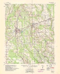 1958 Brinkley1959 Print · USGSMonroe and St. Francis counties are captured here in the late fifties, showing a landscape defined by the convergence of three major railroads. Genealogists can locate family landmarks like the Bemis Plantation and community hubs such as Beauty Spot Ch & Sch or Garrett Grove Cem.2 unique versions available
 - 1959 Map of Helena
 1959 Helena1959 Print · USGSThe Arkansas and Mississippi Delta regions are captured here in the late fifties, showing a landscape defined by the Mississippi River and the Grand Prairie. Genealogists and researchers can trace the rail networks of the Illinois Central RR and locate community landmarks like Helena and the White River National Wildlife Refuge.
 - 1960 Map of Helena
 1960 Helena1960 Print · USGSThe Arkansas and Mississippi Delta regions meet along the great river bends during a period of significant agricultural and rail expansion. Genealogists and historians can trace the paths of the Missouri Pacific railroad through Clarendon or locate landings along the Mississippi River and White River.
 - 1971 Map of Keevil, 1973 Print
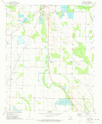 1971 Keevil1973 Print · USGSMonroe County was a hub of railroad activity and aquaculture in the early seventies, centered around the junction at Brinkley. Researchers can trace old family sites and rural landmarks like St John Ch, Riddell Landing Strip, and Jordan Cem.
 - 1986 Map of Brinkley
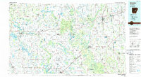 1986 Brinkley1986 Print · USGSThe Grand Prairie and White River basin come to life in the mid-1980s, showing the intersection of heavy rail and interstate travel through eastern Arkansas. Genealogists can locate family sites near Sylvania Cem, Oak Grove Ch, and the rural community of De Valls Bluff.
 - 1990 Map of Brinkley, 1991 Print
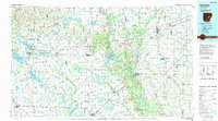 1990 Brinkley1991 Print · USGSEastern Arkansas at the start of the 1990s is defined by the agricultural rhythms of the Grand Prairie and the vital White River corridor. Genealogists and historians can trace the rail-linked growth of Brinkley and Des Arc alongside older landmarks like Peckerwood Lake.
End of results
Showing maps 1-10 of 10
Top cities near Bayless
- Brinkley historical maps
- Clarendon historical maps
- Cotton Plant historical maps
- Holly Grove historical maps
- Fredonia (Biscoe) historical maps
- Wheatley historical maps
See more
Frequently asked questions
- What are the different types of historical maps available for Bayless?
- What is the oldest map of Bayless?
- Where can I purchase historical maps of Bayless for my home or office?
- Where can I download high-res historical maps of Bayless?
- Are there historical topographic maps available for Bayless?
- Is there historical aerial imagery available for Bayless?
- Where are historical maps of Bayless sourced from?