Old Maps of Jasper, Arkansas for Hiking & Exploration
Hike through history with 15 historic maps of Jasper. Explore old trails, ghost towns, and forgotten backroads — perfect for outdoor adventurers and local explorers.
- Rediscover forgotten places: Map out old mining camps, roads, and footpaths that no longer exist on modern maps.
- Layer with modern tools: Combine with LiDAR or satellite views to plan hikes through historical terrain.
- Made for exploration: Popular among hikers, overlanders, and local history lovers.
Use these maps to find adventure and explore the hidden past of Jasper.
Jasper, AR maps
(15)- 1904 Map of Harrison, 1954 Print
 1904 Harrison1954 Print · USGSThe Ozark Mountains of Northwest Arkansas are documented here at the turn of the century, showing a landscape of pioneer settlements and new rail lines. Genealogists can trace early homesteads and commerce at Blantons Mill, the village of Carrollton, and the regional hub of Harrison.
 - 1905 Map of Harrison
 1905 Harrison1905 Print · USGSThe Ozark Plateau at the start of the century was a land of winding mountain railroads and isolated creek-side settlements. Genealogists can trace family footprints across the highlands from Lead Hill to Green Forest, finding early industrial landmarks like Blantons Mill and the Rock Quarry.3 unique versions available
 - 1945 Map of Harrison
 1945 Harrison1945 Print · USGSThe Ozark and Boston Mountains straddle the Missouri-Arkansas border during the mid-forties, showing a landscape of forest ridges and river valleys. Genealogists and historians can trace rail-connected towns like Monett and West Plains or early lake developments at Bull Shoals Res and Norfork Lake.
 - 1949 Map of Harrison
 1949 Harrison1949 Print · USGSThe Ozark highlands of northern Arkansas and southern Missouri are shown just after the war, when the White River still followed its original course. Genealogists and historians can trace rail lines like the Missouri & Arkansas RR and locate rural hubs like Harrison, Eureka Springs, and Mountain Home.
 - 1954 Map of Harrison
 1954 Harrison1954 Print · USGSThe Ozarks and Boston Mountains meet during a period of massive river engineering in the mid-fifties. Researchers can trace the early shorelines of Bull Shoals Lake and Table Rock Reservoir or locate inland towns like Berryville and Harrison.
 - 1958 Map of Harrison, 1973 Print
 1958 Harrison1973 Print · USGSThe Ozark and Boston Mountains appear in this mid-century survey as the great White River impoundments were reshaping the region. Researchers can trace the rail lines of the St Louis-San Francisco Ry and locate early settlements like Berryville and Gainesville.
 - 1964 Map of Harrison
 1964 Harrison1964 Print · USGSThe Ozark and Boston Mountains of Arkansas and Missouri are captured here in the mid-sixties, showing the rugged highlands before extensive modern development. Genealogists and historians can trace family-named peaks like Gaither Mountain and follow the St Louis-San Francisco RR through Monett and Purdy.
 - 1967 Map of Jasper, 1968 Print
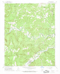 1967 Jasper1968 Print · USGSThe Newton County backcountry comes into focus during the late sixties, centered on the riverside town of Jasper. Genealogists and historians can trace family roots at Tom Thumb Cem or explore the landscape of Dogpatch and the Buffalo National River.2 unique versions available
 - 1985 Map of Harrison
 1985 Harrison1985 Print · USGSNorthwest Arkansas and southwest Missouri appear in the mid-eighties as a region of deep river valleys and high Ozark ridges. Researchers can trace rural life across several counties, locating the Bear Creek Springs Quarry, the winding Buffalo National River, and hilltop settlements like Alpena.
 - 1985 Map of Harrison
 1985 Harrison1985 Print · USGSThe Ozark highlands and the White River valley are seen here in the mid-1980s, showcasing a region defined by its massive reservoirs and protected wilderness. You can trace the rugged corridors of the Missouri & North Arkansas RR or locate historic settlements like Eureka Springs and Jasper.
 - 2011 Map of Jasper, 2011 Print
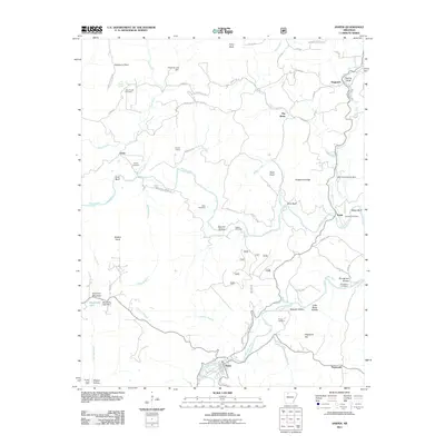 2011 Jasper2011 Print · USGSCovers Jasper, including Erbie, Pruitt, and other nearby areas
 - 2014 Map of Jasper, 2014 Print
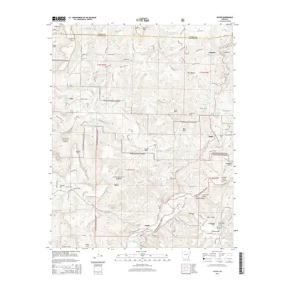 2014 Jasper2014 Print · USGSCovers Jasper, including Erbie, Pruitt, and other nearby areas
 - 2017 Map of Jasper, 2017 Print
 2017 Jasper2017 Print · USGSCovers Jasper, including Erbie, Pruitt, and other nearby areas
 - 2020 Map of Jasper, 2020 Print
 2020 Jasper2020 Print · USGSCovers Jasper, including Erbie, Pruitt, and other nearby areas
 - 2024 Map of Jasper, 2024 Print
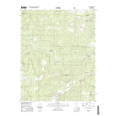
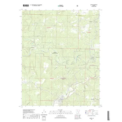
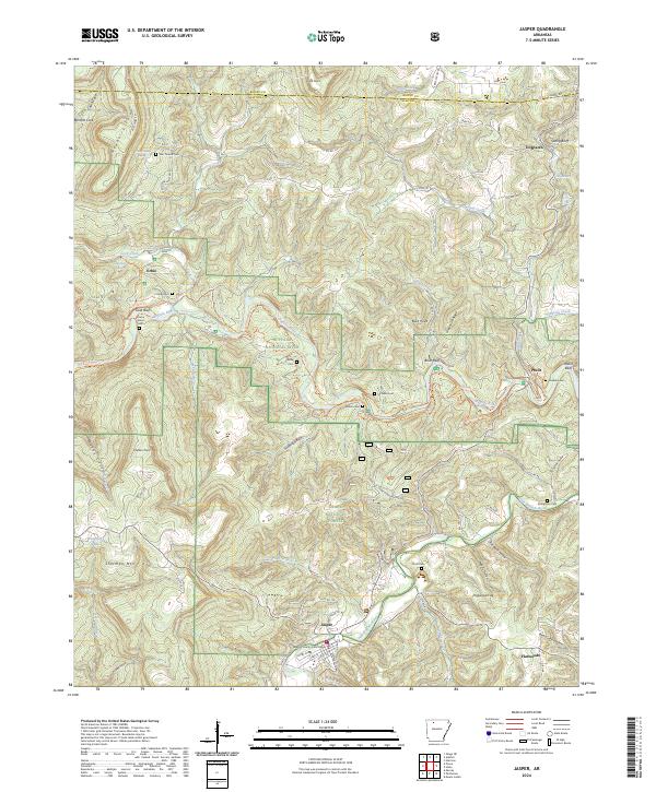 2024 Jasper2024 Print · USGSNewton County in the 2020s remains defined by the rugged bends of the Buffalo River and its deep-rooted Ozark settlements. Researchers can trace ancestral locations through numerous family burial sites like Shaddox Cem or visit the Newton County Courthouse in Jasper.
End of results
Showing maps 1-15 of 15
Top cities near Jasper
- Harrison historical maps
- Bellefonte historical maps
- Western Grove historical maps
- Valley Springs historical maps
Frequently asked questions
- What are the different types of historical maps available for Jasper?
- What is the oldest map of Jasper?
- Where can I purchase historical maps of Jasper for my home or office?
- Where can I download high-res historical maps of Jasper?
- Are there historical topographic maps available for Jasper?
- Is there historical aerial imagery available for Jasper?
- Where are historical maps of Jasper sourced from?