Old Maps of Pope County, Arkansas
Explore 70 old maps of Pope County, spanning from 1879 to today. These high-resolution historic maps reveal how streets, neighborhoods, landmarks, and natural features evolved over time — perfect for genealogy, metal detecting, research, and local history exploration.
What you can do with these maps:
- See how Pope County changed over time: Compare historical maps to modern-day views to trace roads, homesites, rail lines & more.
- View detailed metadata: Each map includes creators, publishers, year, scale, and archive source.
- Overlay maps with satellite & LiDAR: Visualize the past alongside modern tools to explore terrain & human change.
- Trusted historical sources: Maps sourced from the USGS, Library of Congress, and other archives.
- Access maps your way: View online, download high-res files, or order prints for personal or research use.
Start exploring old maps of Pope County to uncover forgotten places, hidden landmarks, and the deep history beneath your feet.
Pope County, AR maps
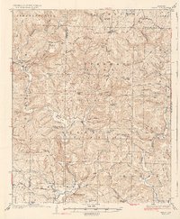
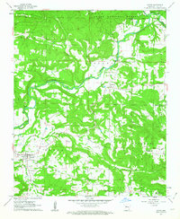
(70)- 1879 Map of Washington
 1879 Washington1879 Print · USGSCovers Pope County, including Lost Corner, Raspberry, and other nearby areas
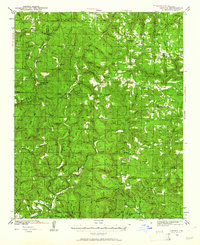
 - 1887 Map of Smyrna
 1887 Smyrna1887 Print · USGSCovers Pope County, including Lost Corner, Raspberry, and other nearby areas
 - 1888 Map of Dardanelle #4
 1888 Dardanelle #41888 Print · USGSCovers Pope County, including Russellville, Dardanelle, and other nearby areas
 - 1888 Map of Dardanelle #2
 1888 Dardanelle #21888 Print · USGSCovers Pope County, including Clarksville, Lamar, and other nearby areas
 - 1888 Map of Dardanelle #1
 1888 Dardanelle #11888 Print · USGSCovers Pope County, including Russellville, Dardanelle, and other nearby areas
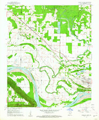
 - 1889 Map of Morrilton No. 3
 1889 Morrilton No. 31889 Print · USGSCovers Pope County, including Morrilton, Atkins, and other nearby areas
 - 1889 Map of Treat
 1889 Treat1889 Print · USGSCovers Pope County, including Bertha, Fort Douglas, and other nearby areas
 - 1889 Map of Marshall #3
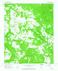
 1889 Marshall #31889 Print · USGSCovers Pope County, including Lost Corner, Raspberry, and other nearby areas
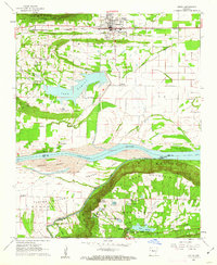
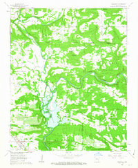
 - 1890 Map of Dardanelle
 1890 Dardanelle1890 Print · USGSCovers Pope County, including Russellville, Clarksville, and other nearby areas7 unique versions available
 - 1892 Map of Marshall
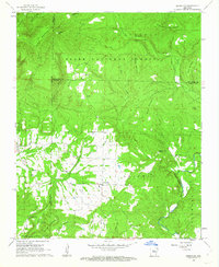
 1892 Marshall1892 Print · USGSCovers Pope County, including Marshall, Leslie, and other nearby areas
 - 1892 Map of Morrillton
 1892 Morrillton1892 Print · USGSCovers Pope County, including Conway, Morrilton, and other nearby areas
 - 1894 Map of Morrillton
 1894 Morrillton1894 Print · USGSCovers Pope County, including Conway, Morrilton, and other nearby areas5 unique versions available
 - 1894 Map of Marshall
 1894 Marshall1894 Print · USGSCovers Pope County, including Marshall, Leslie, and other nearby areas
 - 1901 Map of Marshall
 1901 Marshall1901 Print · USGSCovers Pope County, including Marshall, Leslie, and other nearby areas4 unique versions available
 - 1932 Map of Treat, 1972 Print
 1932 Treat1972 Print · USGSCovers Pope County, including Bertha, Fort Douglas, and other nearby areas
 - 1934 Map of Treat
 1934 Treat1934 Print · USGSCovers Pope County, including Bertha, Fort Douglas, and other nearby areas3 unique versions available
 - 1940 Map of Smyrna, 1961 Print
 1940 Smyrna1961 Print · USGSCovers Pope County, including Lost Corner, Raspberry, and other nearby areas2 unique versions available
 - 1943 Map of Smyrna
 1943 Smyrna1943 Print · USGSCovers Pope County, including Lost Corner, Raspberry, and other nearby areas
 - 1956 Map of Russellville
 1956 Russellville1956 Print · USGSCovers Pope County, including Conway, Russellville, and other nearby areas2 unique versions available
 - 1961 Map of Morrilton West, 1962 Print
 1961 Morrilton West1962 Print · USGSCovers Pope County, including Morrilton, Blackwell, and other nearby areas3 unique versions available
 - 1961 Map of Atkins, 1962 Print
 1961 Atkins1962 Print · USGSCovers Pope County, including Atkins, Whitehall, and other nearby areas3 unique versions available
 - 1961 Map of Dover, 1963 Print
 1961 Dover1963 Print · USGSCovers Pope County, including Dover, Scottsville, and other nearby areas3 unique versions available
 - 1962 Map of Hector, 1963 Print
 1962 Hector1963 Print · USGSCovers Pope County, including Hector, Caglesville, and other nearby areas2 unique versions available
 - 1962 Map of Knoxville, 1963 Print
 1962 Knoxville1963 Print · USGSCovers Pope County, including Lamar, Knoxville, and other nearby areas2 unique versions available
 - 1962 Map of Jerusalem, 1963 Print
 1962 Jerusalem1963 Print · USGSCovers Pope County, including Appleton, Jerusalem, and other nearby areas4 unique versions available
Showing maps 1-25 of 70
Top cities of Pope County
- Russellville historical maps
- Atkins historical maps
- Pottsville historical maps
- Dover historical maps
- London historical maps
- Hector historical maps
Frequently asked questions
- What are the different types of historical maps available for Pope County?
- What is the oldest map of Pope County?
- Where can I purchase historical maps of Pope County for my home or office?
- Where can I download high-res historical maps of Pope County?
- Are there historical topographic maps available for Pope County?
- Is there historical aerial imagery available for Pope County?
- Where are historical maps of Pope County sourced from?