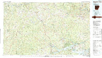
1980s Maps of Pope County, Arkansas
Explore 16 historic maps of Pope County from the 1980s. These maps offer a rare glimpse into what life looked like during the 1980s — showing old roads, neighborhoods, homes, and landmarks that have changed or disappeared over time.
Whether you're researching your family's past, planning a metal detecting trip, or studying how Pope County's landscape evolved across the 1980s, these high-resolution maps are a powerful tool for exploring the history of this region.
- Focus on a specific era: All maps on this page are from the 1980s, giving you a focused view of this time period.
- See what’s changed: Compare century-old streets, trails, and buildings to today's modern landscape using overlays and satellite layers.
- Research with precision: Use these maps for genealogy, historical research, land use analysis, or educational projects.
- View, download, or print: Maps are fully viewable online in high resolution, and can be downloaded or printed for your own records.
Start exploring Pope County's history through authentic maps from the 1980s. This is your window into the past.
Pope County, AR maps
(16)- 1980 Map of Smyrna
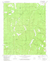 1980 Smyrna1980 Print · USGSPope County and the surrounding Ozark highlands are captured here in the late seventies as a landscape of isolated mountain communities and deep hollows. Researchers can locate remote landmarks like Ben Hur, the Old Smyrna Cem, and the Smyrna Ch near the banks of the Illinois Bayou.2 unique versions available
 - 1980 Map of Simpson
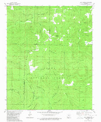
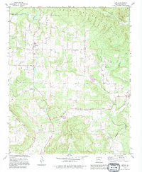
 1980 Simpson1980 Print · USGSThe Ozark highlands of Pope County appear here in the late seventies, showing a landscape of deep timber and winding bayous. Researchers can locate remote family burials at Oak Grove Cem and Sherman Cem or trace old tracks through Moccasin Gap.2 unique versions available
 - 1980 Map of Sand Gap
 1980 Sand Gap1980 Print · USGSThe Ozark highlands on the Newton and Pope county line are captured here in the late seventies. Researchers can trace rural life through secluded sites like Freeman Springs Cemetery and remote settlements such as Sand Gap.2 unique versions available
 - 1980 Map of Lost Corner
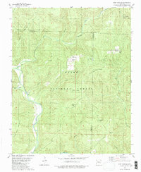
 1980 Lost Corner1980 Print · USGSThe high ridges of the Ozarks are documented here in the early eighties, where the Pope and Van Buren county lines meet. Researchers can trace rural settlement patterns through family-named landmarks like Snowlick Mountain and sites such as New Hope Cem and Lost Corner.
 - 1980 Map of Treat
 1980 Treat1980 Print · USGSThe Ozark National Forest's deep valleys and high ridges are documented here in the late seventies. Researchers can trace rural life through the Treat settlement, several family cemeteries like Shannon Cem, and local landmarks such as Bullfrog Valley.2 unique versions available
 - 1980 Map of Solo
 1980 Solo1980 Print · USGSPope County’s high country is captured here in the 1980s as a landscape of deep hollows and isolated mountain settlements. Genealogists can trace family landmarks like Barkers Cem and Tripp Cem near the quiet communities of Solo and Retta.
 - 1980 Map of Fort Douglas
 1980 Fort Douglas1980 Print · USGSThe Ozark highlands near the border of Johnson and Newton counties were characterized by isolated settlements and rugged peaks in the 1970s. Researchers can locate family sites such as Fort Douglas, trace the Hurricane Trail, and find remote burial grounds like Wheeler Cem and Self Cem.2 unique versions available
 - 1980 Map of Tilly, 1981 Print
 1980 Tilly1981 Print · USGSThe rugged boundary between Searcy, Pope, and Van Buren counties comes to life in the early 1980s. Researchers can trace rural life through scattered landmarks like Union Hill Ch, Parks Cem, and the high ridges of Walker Mountain and Shields Knob.2 unique versions available
 - 1983 Map of Fly Gap Mountain
 1983 Fly Gap Mountain1983 Print · USGSThe high Ozarks in the early eighties were a landscape of deep river valleys and isolated mountain gaps. Researchers can locate remote settlements like Venus and Cass, or trace family sites at Oark Cem, White Rock Cem, and the Pelsor Post Office.
 - 1983 Map of Mountain View
 1983 Mountain View1983 Print · USGSNorth-central Arkansas comes into sharp focus during the early eighties, showing the transition from traditional Ozark mountain settlements to a landscape shaped by major reservoirs. Genealogists and historians can trace family roots through mountain hamlets like Snowball, Witts Springs, and Timbo, or locate landmarks such as Zion Hill Church and the Missouri Pacific Railroad.
 - 1983 Map of Conway, 1984 Print
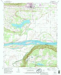
 1983 Conway1984 Print · USGSThe Arkansas River valley in the early eighties shows a landscape of river-bend settlements and expanding wildlife areas. Genealogists and historians can trace the Missouri Pacific RR through old river towns like Toad Suck, Morrilton, and Menifee.
 - 1984 Map of Russellville
 1984 Russellville1984 Print · USGSThe Arkansas River valley in the mid-eighties shows a landscape defined by the rise of Lake Dardanelle and the enduring presence of the Ozark National Forest. Researchers can find historical institutions like Arkansas Tech Univ and Sacred Heart Church or trace the routes of the Missouri Pacific RR.2 unique versions available
 - 1984 Map of Russellville
 1984 Russellville1984 Print · USGSThe Arkansas River valley was undergoing significant change in the 1950s as transportation and water management reshaped the region from Russellville to Conway. Researchers can trace the era's rail networks like the Missouri Pacific RR and explore landmarks like Magazine Mountain and Petit Jean State Park.
 - 1989 Map of Hector, 1995 Print
 1989 Hector1995 Print · USGSThe southern Ozark foothills near Hector and Appleton are documented here in the late twentieth century. Researchers can trace family sites at Walnut Grove Ch, Kinslow Cem, and the small community of Caglesville.
 - 1989 Map of Moreland, 1995 Print
 1989 Moreland1995 Print · USGSThe foothills of Pope County come alive in this map from the late twentieth century, showing a transition from mountain ridges to lowland creek valleys. Genealogists can locate family landmarks like Sugg Cem, Shady Grove Ch, and the rural community of Moreland.
 - 1989 Map of Atkins, 1995 Print
 1989 Atkins1995 Print · USGSThe Arkansas River valley near Atkins is shown in the late eighties as it transitions from the fertile Carden Bottom to the heights of Petit Jean Mountain. Genealogists and historians can trace local landmarks like Bells Chapel Cem, Gold Hill Sch, and the riverside community of Winrock.
End of results
Showing maps 1-16 of 16
Top cities of Pope County
- Russellville historical maps
- Atkins historical maps
- Pottsville historical maps
- Dover historical maps
- London historical maps
- Hector historical maps
Frequently asked questions
- What are the different types of historical maps available for Pope County?
- What is the oldest map of Pope County?
- Where can I purchase historical maps of Pope County for my home or office?
- Where can I download high-res historical maps of Pope County?
- Are there historical topographic maps available for Pope County?
- Is there historical aerial imagery available for Pope County?
- Where are historical maps of Pope County sourced from?