1900s (20th Century) Maps of Saline County, Arkansas
Explore 59 historic maps of Saline County from the 1900s (20th Century). These maps offer a rare glimpse into what life looked like during the 1900s — showing old roads, neighborhoods, homes, and landmarks that have changed or disappeared over time.
Whether you're researching your family's past, planning a metal detecting trip, or studying how Saline County's landscape evolved across the 1900s, these high-resolution maps are a powerful tool for exploring the history of this region.
- Focus on a specific era: All maps on this page are from the 1900s, giving you a focused view of this time period.
- See what’s changed: Compare century-old streets, trails, and buildings to today's modern landscape using overlays and satellite layers.
- Research with precision: Use these maps for genealogy, historical research, land use analysis, or educational projects.
- View, download, or print: Maps are fully viewable online in high resolution, and can be downloaded or printed for your own records.
Start exploring Saline County's history through authentic maps from the 1900s. This is your window into the past.
Saline County, AR maps
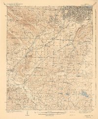
(59)- 1932 Map of Pastoria, 1965 Print
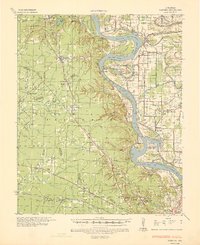
 1932 Pastoria1965 Print · USGSThe Arkansas River valley comes alive in the mid-1930s, showing a landscape defined by deep river bends and rural institutional life. Genealogists can trace family roots through numerous sites like Haywood College, Pastoria Ch & Cem, and the State Penal Farm.2 unique versions available
 - 1935 Map of Little Rock
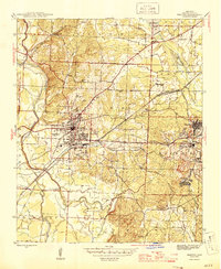
 1935 Little Rock1935 Print · USGSLittle Rock and its southern outskirts are captured in the mid-thirties, showcasing a city defined by its railroads and quarrying industry. Genealogists can trace family footprints near Oakland Cem or the rural community of Geyer Springs, while identifying landmarks like the Old Penitentiary Site and Biddle Shops.
 - 1935 Map of Alexander
 1935 Alexander1935 Print · USGSSaline and Pulaski counties come alive in this mid-1930s survey as the rail-and-creek network shaped local life. Researchers can trace family roots through numerous country landmarks including Sardis Sch, Salem Cem, and the State Girls Indust Home.2 unique versions available
 - 1935 Map of Pastoria, 1937 Print
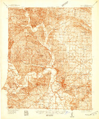
 1935 Pastoria1937 Print · USGSJefferson County's riverfront landscape in the mid-1930s shows a complex network of bayous, schools, and small post offices. Researchers can trace family history at Haywood College, locate the State Penal Farm, or find long-standing community landmarks like Morris Chapel Sch & Ch.2 unique versions available
 - 1938 Map of Benton
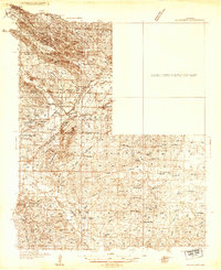
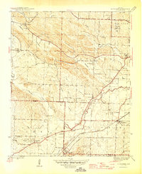
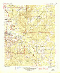
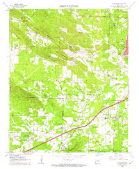
 1938 Benton1938 Print · USGSSaline County industry and rural life are captured here in the late 1930s, just as the Bauxite Mines were fueling the local economy. Researchers can trace family roots through numerous country churches like Grape Chapel or locate old river crossings such as Wray Ford and Daniels Ford.4 unique versions available
 - 1940 Map of Woodson, 1945 Print
 1940 Woodson1945 Print · USGSPulaski County at the start of the 1940s reveals a riverside landscape of bayous and railroad towns. Researchers can trace rural life through landmarks like Gospel Temple Ch, the State Industrial School, and Campbell Cem.2 unique versions available
 - 1941 Map of Alexander
 1941 Alexander1941 Print · USGSIn the 1930s, the corridor between Pulaski and Saline County was a bustling landscape of rail lines and rural townships. Genealogists and historians can trace family roots through numerous local landmarks, including the Dawson Sch, Vimy Ridge, and the Industrial Home.2 unique versions available
 - 1944 Map of Benton
 1944 Benton1944 Print · USGSSaline County in the mid-1940s centers on the industrial hub of Benton and the neighboring Bauxite Mines. Genealogists and historians can trace family roots through numerous rural landmarks like Grape Chapel, Pitkin Cem, and the State Hospital.
 - 1944 Map of Alexander, 1946 Print
 1944 Alexander1946 Print · USGSSouthwest of Little Rock during the mid-forties, this area reveals a landscape of institutional history and rural community life along the Missouri Pacific Road. Researchers can trace old property and family lines near Alexander Cem, Mabelvale, and the Salasco Sanitarium.2 unique versions available
 - 1944 Map of Spring Lake, 1946 Print
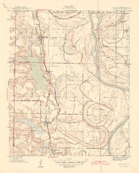
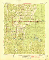 1944 Spring Lake1946 Print · USGSSaline and Pulaski counties meet in this mid-century survey of the Arkansas countryside south of Little Rock. Genealogists and local historians can trace the foundations of these communities through landmarks like Landmark Sch, Ivy Chapel, and Jay Cem.
 - 1944 Map of Little Rock, 1946 Print
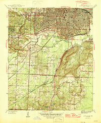 1944 Little Rock1946 Print · USGSMid-century Little Rock and its southern rural outskirts are captured here during a period of industrial and residential expansion. Researchers can trace the legacy of local families through landmarks like Feltons Store, Longley Sch, and rural congregations at Primrose Ch.2 unique versions available
 - 1944 Map of Bryant, 1946 Print
 1944 Bryant1946 Print · USGSSaline County at the end of the war shows a landscape of timber, mining rails, and small crossroads communities. Genealogists and researchers can trace the locations of the Thomas Mcrae Tuberculosis Home, Mt Olive Sch, and the railroad stop at Brooks.2 unique versions available
 - 1944 Map of Benton, 1946 Print
 1944 Benton1946 Print · USGSBenton and the surrounding aluminum mining districts come to life in the years following the war. Genealogists and historians can trace rail lines like the Rock Island, locate rural schools like Bennett Sch, and find family names at Lee Cem or Liberty Cem.4 unique versions available
 - 1954 Map of Woodson, 1957 Print
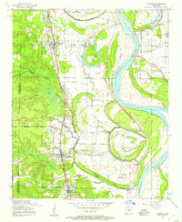 1954 Woodson1957 Print · USGSIn the mid-fifties, the riverfront communities south of Little Rock were shaped by the winding Arkansas River and the busy Missouri Pacific railroad. Genealogists and local historians can locate several family burial grounds and country parishes, such as Kuykendall Cemetery, Virginia Church, and Nelson School.3 unique versions available
 - 1954 Map of Bryant, 1957 Print
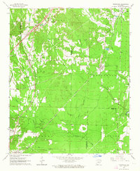
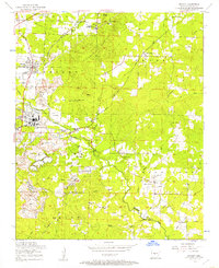 1954 Bryant1957 Print · USGSSaline County in the mid-fifties is captured here as a landscape of heavy mining operations and tight-knit rural communities. Researchers can trace the industrial footprint of Lignite and Pine Haven or locate family sites like China Grove Cemeteries and Sardis School.3 unique versions available
 - 1954 Map of Little Rock, 1957 Print
 1954 Little Rock1957 Print · USGSLittle Rock and its southern outskirts are captured here during a decade of postwar growth and industrial activity. Genealogists can locate family sites among several country churches like Life Line Church and historic burial grounds including Mt Holly Cemetery.
 - 1954 Map of Alexander, 1957 Print
 1954 Alexander1957 Print · USGSThe borderlands of Pulaski and Saline counties are captured here in the mid-fifties, showing a landscape of small communities and institutional landmarks. Genealogists can locate family sites like the McDonald Cemetery or the Salasco Sanatorium near Collegeville.
 - 1954 Map of Spring Lake, 1957 Print
 1954 Spring Lake1957 Print · USGSThe Saline and Pulaski County line comes to life in the mid-1950s as rural communities began to expand along the ARCH STREET PIKE. Genealogists and historians can locate old family landmarks like the Salem Cemetery, East Union Church, and the Landmark School.4 unique versions available
 - 1955 Map of Little Rock, 1978 Print
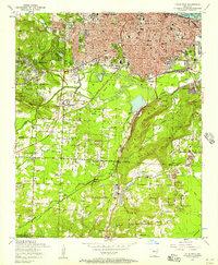
 1955 Little Rock1978 Print · USGSCentral Arkansas in the mid-fifties exhibits a landscape of growing cities, massive military installations, and mountain reservoirs. Genealogists and historians can trace the industrial Bauxite Mines, regional rail lines, and local landmarks like Antioch Church.
 - 1956 Map of Little Rock
 1956 Little Rock1956 Print · USGSCentral Arkansas in the mid-fifties shows a landscape defined by burgeoning military bases and the timber-and-mineral wealth of the Ouachitas. Genealogists and researchers can trace old rail lines like the Missouri Pacific and find established communities such as Bauxite, Sheridan, and Mabelvale.
 - 1960 Map of Little Rock
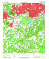
 1960 Little Rock1960 Print · USGSCentral Arkansas in the late fifties shows a landscape of growing military bases and massive new reservoirs. Local historians can trace the mid-century expansion of Little Rock and Hot Springs alongside the industrial works at Bauxite and the Pine Bluff Arsenal.
 - 1961 Map of Little Rock, 1962 Print
 1961 Little Rock1962 Print · USGSLittle Rock and its southern suburbs are captured in the early sixties during a transformative era of growth and industrial activity. Genealogists and researchers can locate historic institutions like Central High Sch, trace the Missouri Pacific rail lines, or find family plots in Oakland Cemetery and Calvary Cemetery.3 unique versions available
 - 1961 Map of Alexander, 1962 Print
 1961 Alexander1962 Print · USGSThe transition from rural Saline and Pulaski counties to suburban reach is evident here in the early 1960s. Genealogists can trace family names at Forest Hills Memorial Park, Mabelvale, and the Ida Mission Cem.4 unique versions available
 - 1963 Map of Traskwood, 1964 Print
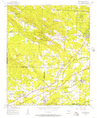
 1963 Traskwood1964 Print · USGSSaline and Hot Spring counties are captured here in the early sixties as new highway construction began to reshape the rural landscape. Genealogists and local historians can trace the foundations of Glen Rose, Francois, and Traskwood, alongside landmarks like Holy Ridge Ch and the Fairplay Cem.4 unique versions available
 - 1963 Map of Paron SW, 1964 Print
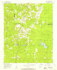
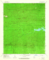 1963 Paron SW1964 Print · USGSThe interior of the Ouachita National Forest comes into sharp focus during the early sixties, showing a landscape defined by the Alum Fork and North Fork Saline River. Researchers can trace the rugged drainage patterns of Stillhouse Creek and find landmarks like Flatside Pinnacle and Walnut Bottom.5 unique versions available
Showing maps 1-25 of 59
Top cities of Saline County
- Benton historical maps
- Bryant historical maps
- Haskell historical maps
- Alexander historical maps
- Shannon Hills historical maps
- Salem historical maps
See more
Frequently asked questions
- What are the different types of historical maps available for Saline County?
- What is the oldest map of Saline County?
- Where can I purchase historical maps of Saline County for my home or office?
- Where can I download high-res historical maps of Saline County?
- Are there historical topographic maps available for Saline County?
- Is there historical aerial imagery available for Saline County?
- Where are historical maps of Saline County sourced from?